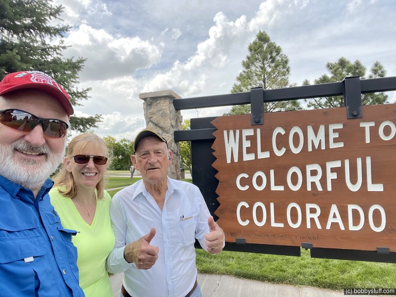
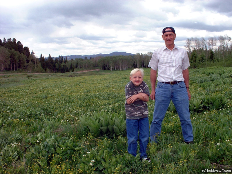
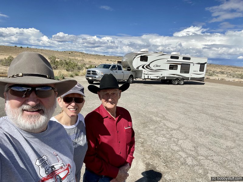
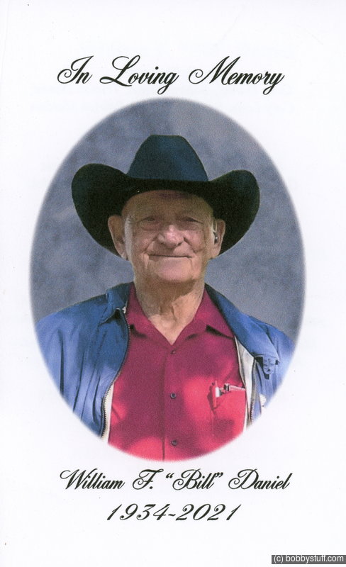
Laurie and I Took My Dad to Colorado
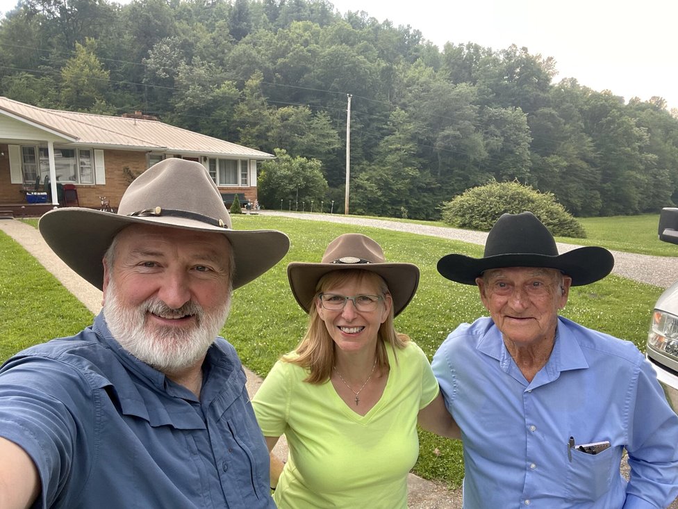
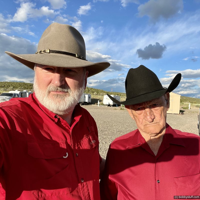
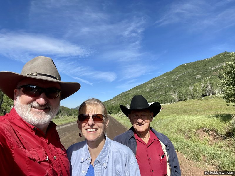
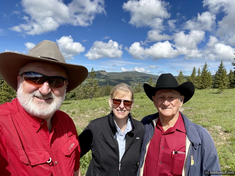
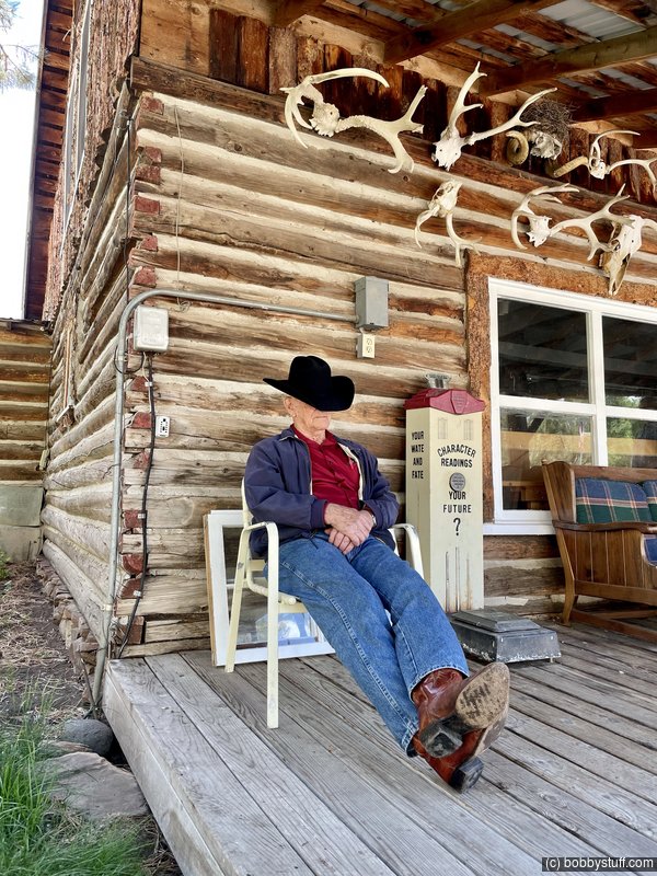
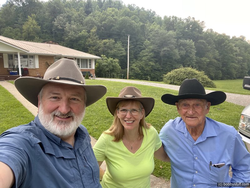
The photo above is the last photo I have of my Dad. We had just arrived home after being on the road for a couple of weeks taking as he said "A trip of a lifetime."
His wife and our mother died in Sep 2020. Dad loved traveling and had been to Colorado many times. He loved the Rocky Mountains.
Way back around 1999, we were talking about the mountains and he said he guessed he would never see them again. I made up my mind then to take him and Mom out west again. So my boys and I took them to Colorado in 2000 and to the North West in 2001. Mom dropped out for the next three years when he, myself and the boys traveled all over the American west during the summers.
Skip forward to year end 2020. Mom died after a very long illness. Dad was a full time care giver and I knew it took a toll on him but he did it with love. He was adjusting very well to being alone again without his wife of 61 years.
I told him we were going to Colorado again. He did not say no, but I knew he had mixed emotions. He wanted to go but was not sure he could do it. As the time got closer, the family kept encouraging him.
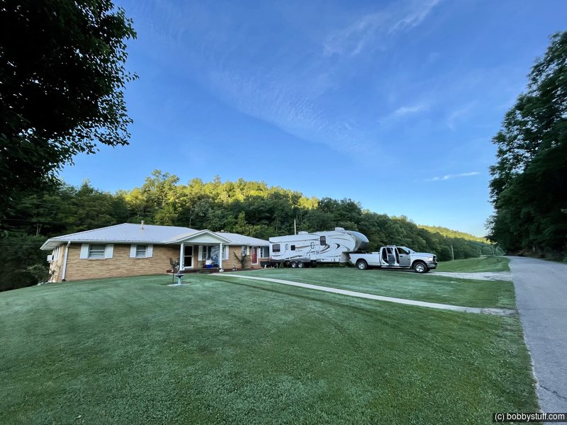
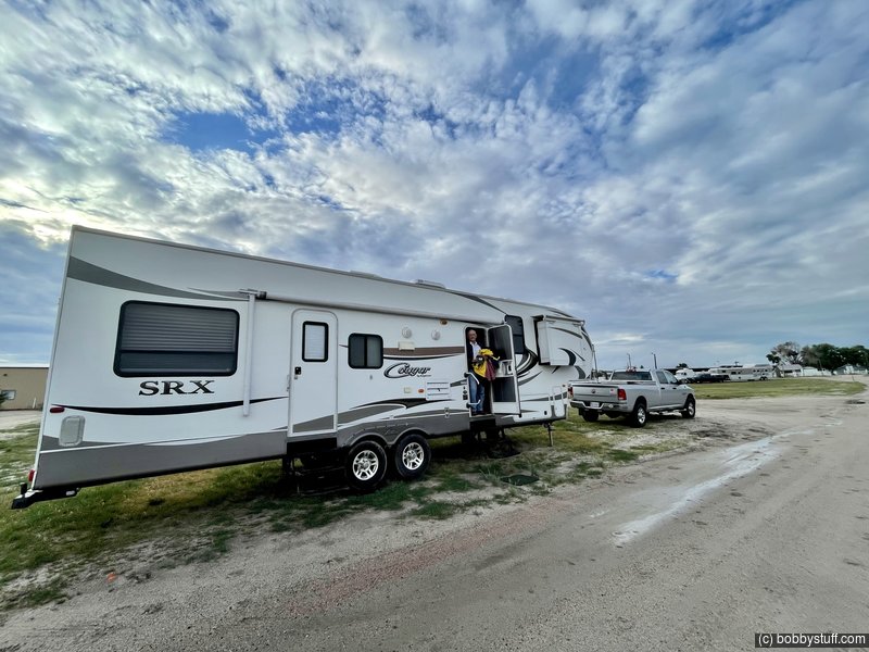
We have a 38 foot 5th wheel toy hauler RV. In the back is the "garage" where we normally haul our Honda Gold Wing motorcycle. This time we replaced the Gold Wing with a bed. Laurie added a large rug to make it cozy. Dad loved it and called it his apartment. Laurie did everything she could to make sure Dad enjoyed the trip. Dad enjoyed bantering with her. He said the only reason our selfies on Facebook got any comments was because she was always in them.
We have a family cemetery in eastern Ky. There is a tradition in the hills where there is often a memorial church meeting in a family cemetery once a year and there is one for our family cemetery. It usually turns into a family reunion where family members who have moved out of state return to their childhood home this one time each year. All my siblings were there and it was a good time. We honored our Mother who died a few months before.
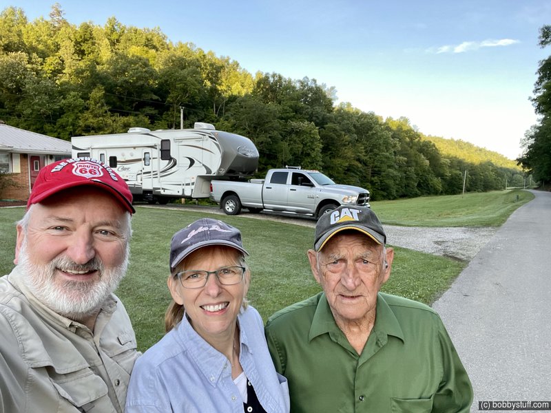
We kept encouraging Dad and Susie helped him pack for the trip. He was excited and we took off a few days after the cemetery memorial service.
This blog is about our trip.
We are off. Leaving the home place to head west.
Bobby, Laurie, William F.
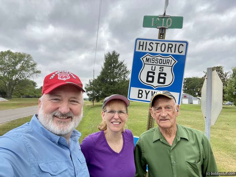
Some of our first stops after putting some miles behind us were some Route 66 places in Missouri. He was already beginning to enjoy himself.
Bobby, Laurie, William F.
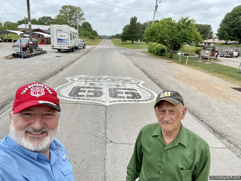
Bobby, William F.
This was a little hole in the wall place Laurie and I found last year when we did an October Route 66 trip.
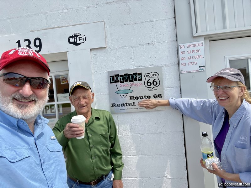
Bobby, William F., Laurie
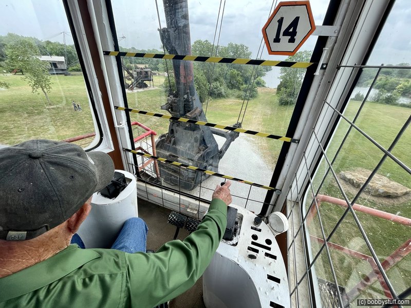
As an eastern Ky coal miner, I knew he would enjoy seeing Big Brutus in Mineral KS. He loved it and pointed out some things I had missed when Laurie and I were there last fall.
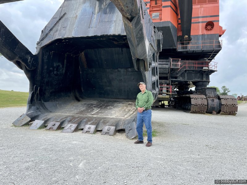
William F.
William F.
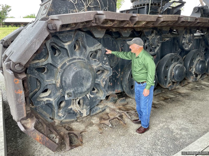
Big Brutus, West Mineral KS
William F.
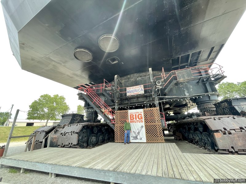
Big Brutus, West Mineral KS
William F.
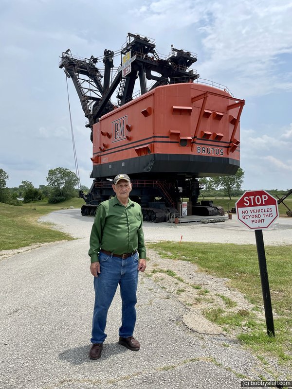
Big Brutus, West Mineral KS
William F.
We had a couple of mechanical problems on this trip. Let me start from the beginning.
Going to Ky we noticed a faint smell of antifreeze sometimes when pulling a mountain. I had decided to ignore it. In Ky, Laurie and I drove to the local Ram dealer and got a gallon of antifreeze. My plan was to just keep adding antifreeze as needed. Then the next day after an extended period of the truck idling we smelled antifreeze again. Dad was with me and we soon found the problem. My Diesel Ram has two radiators. There is a plastic Y in the water return hose to the radiators and that Y was cracked. I called the local Ram parts department with 2 minutes left before closing. They had one in stock and could leave it with the Sales department which would be open for another hour. I paid by credit card, we got the Y and installed it before we left. We joked about that the entire trip.
William F.
In Ky Laurie kept saying that the water pump in the RV was not right. This is important later in this story.
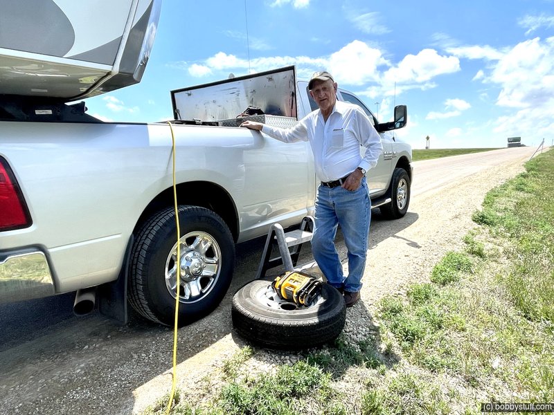
The left propane tank access door has a problem and does not stay latched. Sometimes I tape it shut. This day I noticed the door flapping so I stopped on an on ramp to tape it shut. As I was walking past the RV door I heard hissing. The valve stem on the curb side front tire was leaking air. I am really glad I stopped at that time. I am prepared for these situations and in a short amount of time I had the spare tire on. The next town had a tire shop where I got a new valve stem and all was good.
I had a jack, blocks, 120v impact wrench, sockets, a generator for power, etc so this break down was not big deal.
But it gets better. Later that night the water pump was dimming the lights when we turned it on. I thought the pump was bad and drawing excess current. So that night I was looking for a Camping World along our route where I could get a new water pump, however that was not the problem.
The next morning the refrigerator starting flipping out. That was a big deal as Laurie had packed enough food in the fridge to last us 3+ weeks. Then the furnace starting acting up. I was getting a little concerned as I did not want Dad freaking out about our problems.
The lights in the RV were not dim so I did not suspect a battery problem. However I had changed the bulbs to LED which don't need much current or voltage to work. They tricked me.
I eventually got my multimeter out and checked the output of the RV converter. This converts 120 volts AC to 12 volts DC to charge the battery. It showed a good voltage so I was confused. Then I turned on the range hood light which used a standard incandescent bulb (not LED) and the voltage from the converter dropped to under 10 volts. I had found the problem.
The converter was not charging the battery. We had this problem in Ky and Laurie had tried to tell me. The battery would get charged by the truck during the day but the first time we stayed in one place for two days with the truck disconnected the problem came to a head.
A trip to the local Walmart solved the problem. I purchased a battery charger and every night from that point onward, I would hook up the battery charter to our RV battery. Problem solved.
My standard saying during the trip became "It's all good." Dad understood that these things happen sometimes. I really wanted him to have a good time and not worry about any problems.
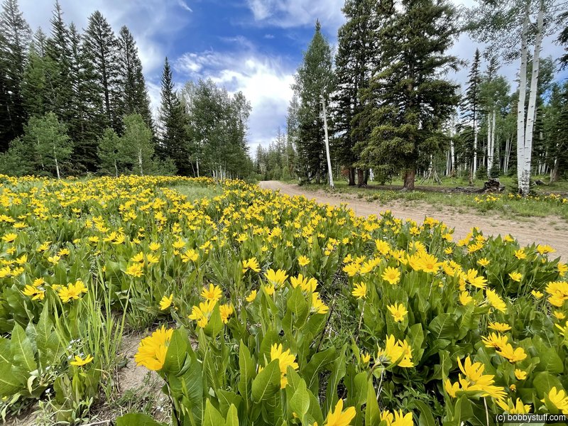
We made it to Colorado and things were looking up.
Bobby, Laurie, William F.
I could not find a campground near Denver with any free spots. We wanted to stay a couple of days near Denver and visit some places Dad had been to in previous years. The only place I could find was the fairgrounds in Kiowa, CO southeast of Denver. It was perfect for us.
Kiowa CO
William F.
Kiowa CO
Laurie, William F.
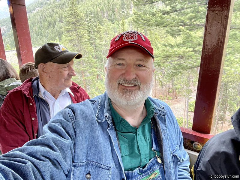
In 2000 with him and Mom we rode the George Town Loop Railroad so we did it again. He seemed to really enjoy it.
 Video
Video
Bobby, William F.
Georgetown Loop Rail Road
William F., Bobby
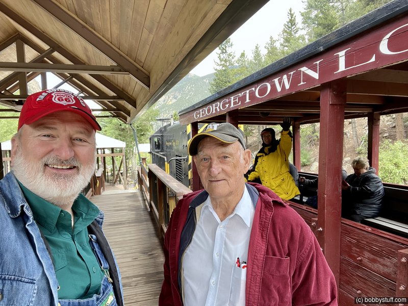
Georgetown Loop Rail Road
Bobby, William F., Laurie
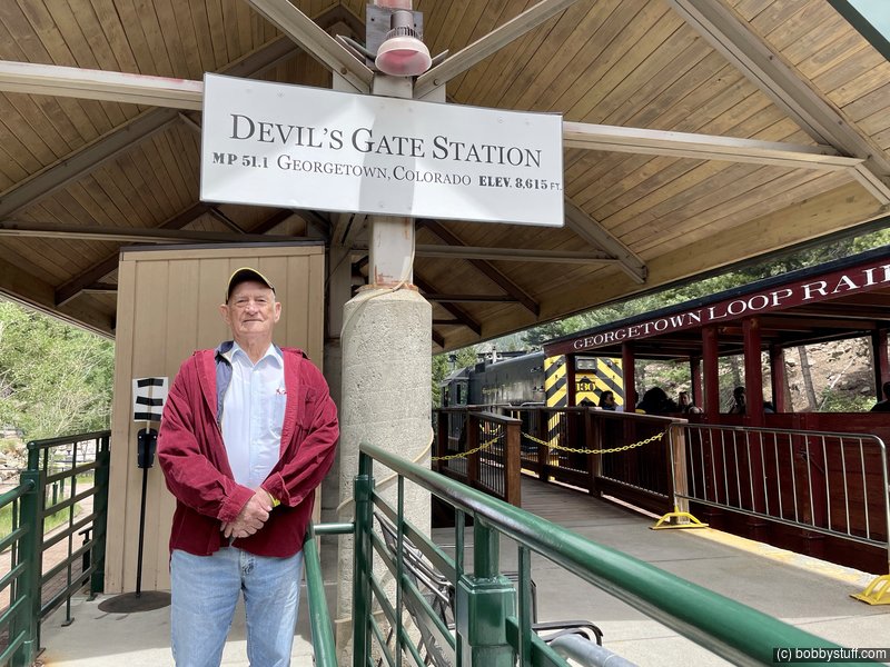
Georgetown Loop Rail Road
William F.
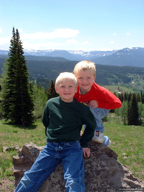
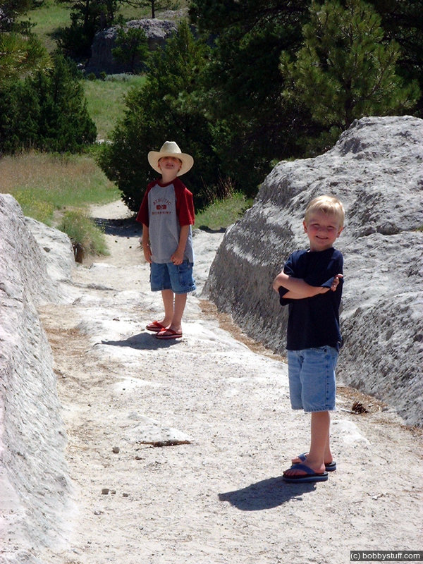
This one of my favorite photos of Dad and my sons, taken at the George Town Loop in 2000.
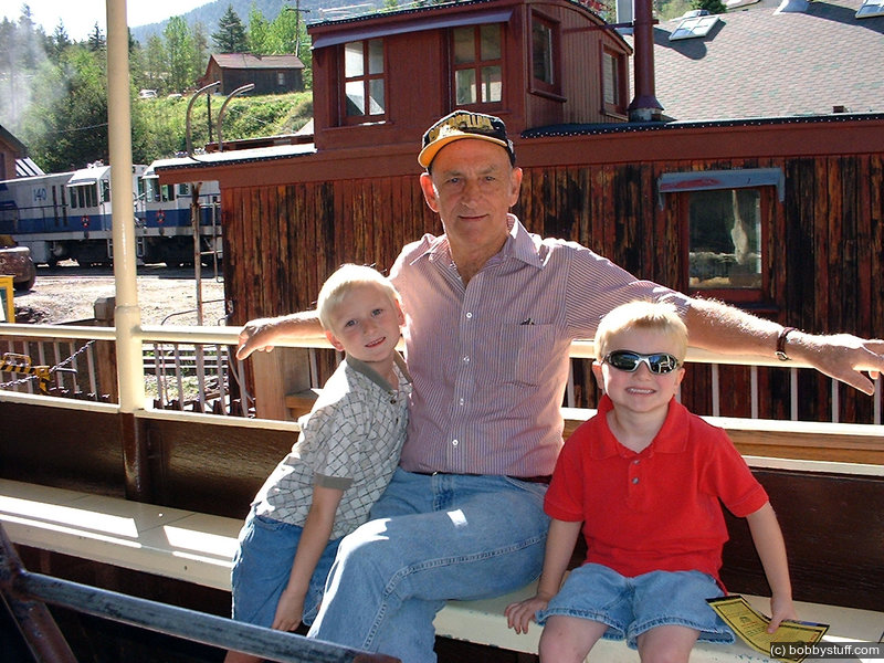
The Georgetown Loop Railroad near Idaho Springs, CO.
Bradley Taylor, William F., Tucker Riley
Here is video from our 2000 trip.
Video
The Georgetown Loop Railroad near Idaho Springs, CO.
William F., Wanda, Bradley Taylor, Tucker Riley
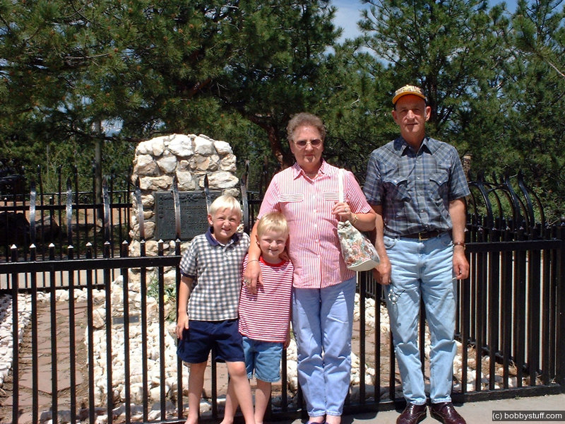
Next was a visit to Buffalo Bill's grave overlooking Denver.
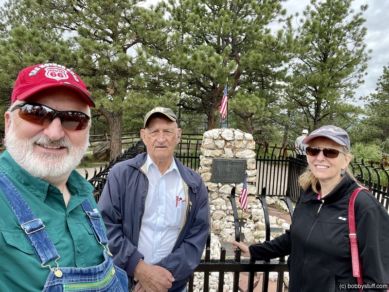
Buffalo Bills Grave
Bobby, William F., Laurie
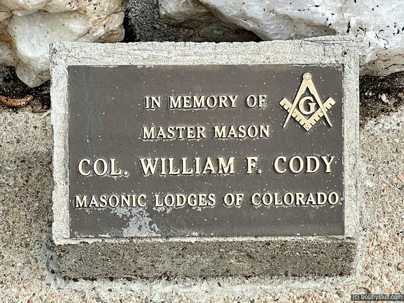
Buffalo Bills Grave
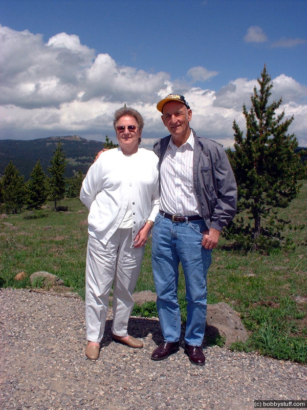
Here is a photo of Mom, Dad and my boys at the same place during our 2000 trip.
Bradley Taylor, Tucker Riley, Wanda, William F.
And again from 1969
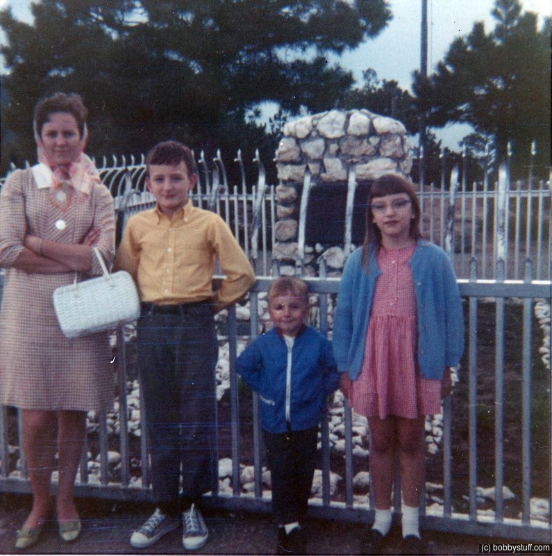
Buffaloe Bills grave, Denver CO
Wanda, Bobby, Greg, Susie
Just before boarding the George Town Loop Train we checked out Silver Plume. This was the Main Street. Yes it was gravel.
Silver Plume CO
Bobby, Laurie, William F.
Silver Plume CO
Bobby, Laurie, William F.
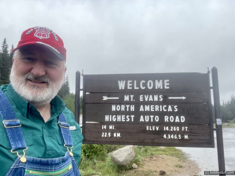
Mt Evans CO
Bobby
Video
Bobby, William F., Laurie
Bobby, William F.
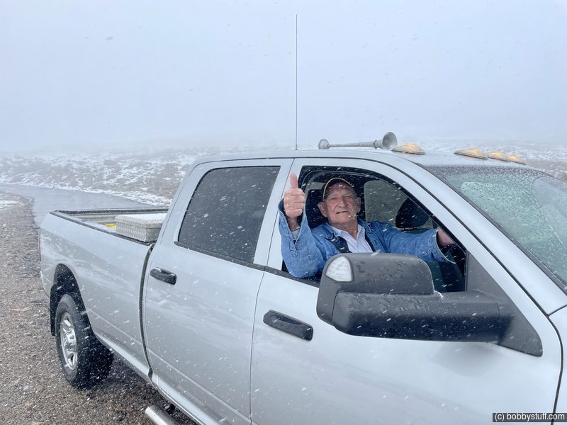
Mt Evans CO
William F.
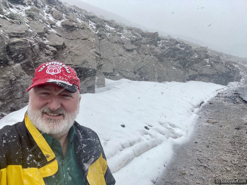
Mt Evans CO
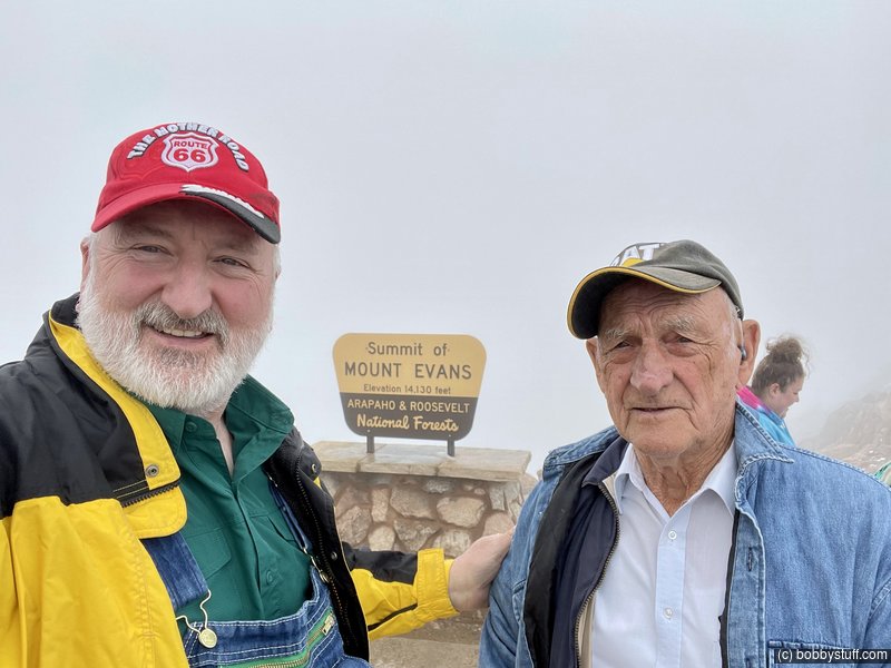
Bobby
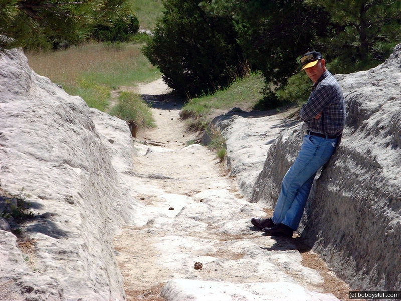
Here he is in 2000.
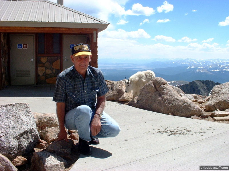
On top of Mt Evans, CO. 14,260 feet
William F.
Here is some camcorder footage of Mt Evans from 2000. Bradley threw up because he ran around too much at the high elevation so I washed him off in a mountain lake and wrapped a blanket around him in place of pants.
Video
On top of Mt Evans, CO.
William F., Bradley Taylor, Tucker Riley
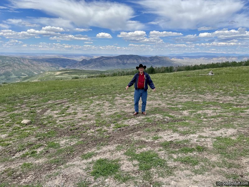
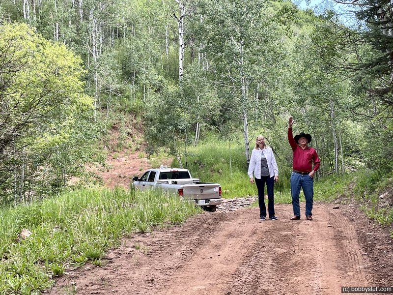
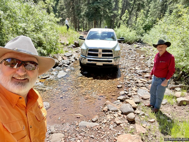
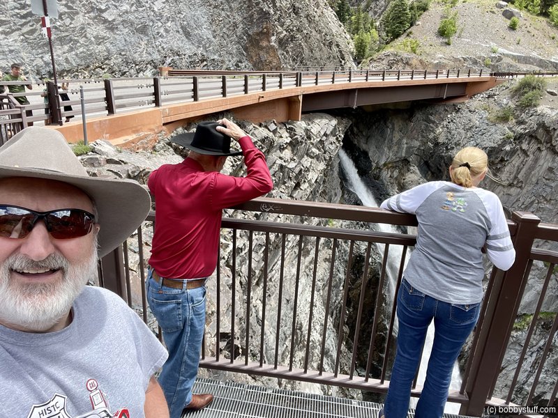
After a day checking out Buffalo Bills grave, Mt Evans, the George Town Loop RR and other sites, we grabbed the 5th wheel and headed to Rifle and Meeker, CO.
Video
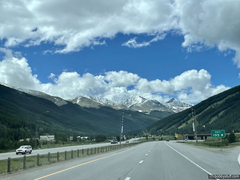
Colorado I70
Colorado I70
Bobby, Laurie
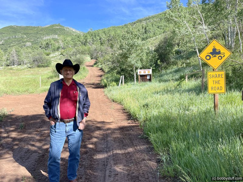
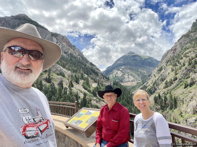
We stopped in Glenwood Springs at a Boot Barn to do some shopping. Dad and I got hats. He had a hat from the 60's or 70's he always wore on camping trips but he could not find it before the trip. So he replaced it. We were trying to look tough in the photo below. This photo was taken at a campground just outside of Meeker, CO.
I have to explain about Meeker. In the 60's my grand father was introduced to elk hunting in the White River National Forest east of Meeker. It became a passion. He returned many times with his friends and members of his family. My Dad went several times and fell in love with the Rocky Mountains. These trips were not vacations. You needed a vacation after a hunting trip but stories from the hunting trips were retold often and became part of the family lore.
Bobby, William F.
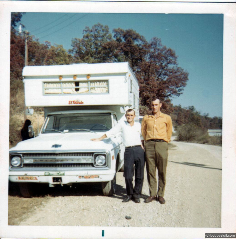
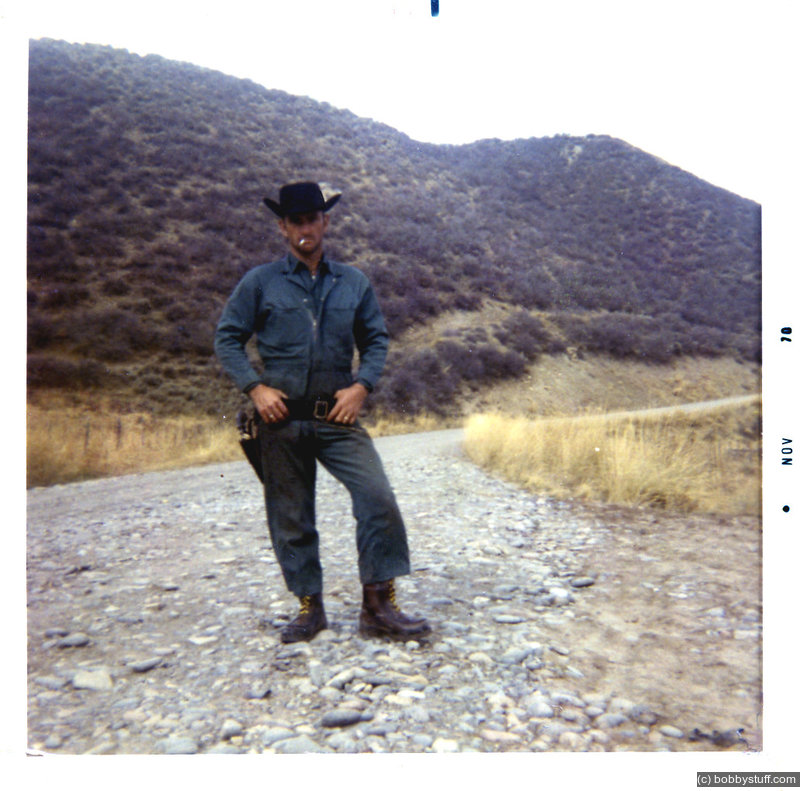
Dad camped beside this road in 1969 with a Chevrolet 3/4 ton pick truck with a slide in camper. He remembered exactly where he had camped all those years ago. The photo below became is obituary photo.
He had an excellent memory and he tripped me up several times during the trip.
Camping location on Dead Horse Loop when Bill and Thirel had to rescue Walter and Mintie because they were snowed in up on the mountain near Maple Springs and Sleepy Cat Peak.
William F.
Camping location on Dead Horse Loop when Bill and Thirel had to rescue Walter and Mintie because they were snowed in up on the mountain near Maple Springs and Sleepy Cat Peak.
Camping location on Dead Horse Loop when Bill and Thirel had to rescue Walter and Mintie because they were snowed in up on the mountain near Maple Springs and Sleepy Cat Peak.
William F.
Camping location on Dead Horse Loop when Bill and Thirel had to rescue Walter and Mintie because they were snowed in up on the mountain near Maple Springs and Sleepy Cat Peak.
Bobby, Laurie, William F.
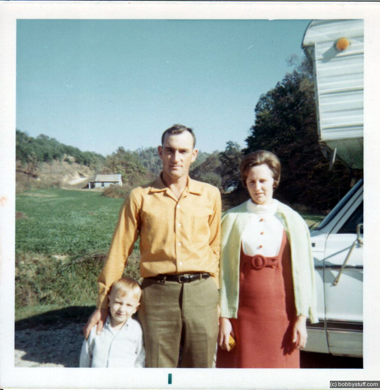
Below are two photos taken the day he and his brother Thirel left Kentucky to rescue their parents from a surprise October snow storm in Colorado. Their parents were not in danger. Their truck and slide in camper were stuck in the snow. He still had a Jeep to get to the local town and make a phone call home. I always wondered why they could not have gotten help from someone locally. But actually, I don't think it took much of an excuse to take a trip to the Rocky Mountains.
They left on a Sunday after church. In the first photo, look at the front bumper of the truck. Dad had added a winch to the truck.
October 1969, the third Sunday of the month. To rescue Walter and Mintie Daniel
Thirel, William F.
Greg, William F., Wanda
A couple of photos from the following year.
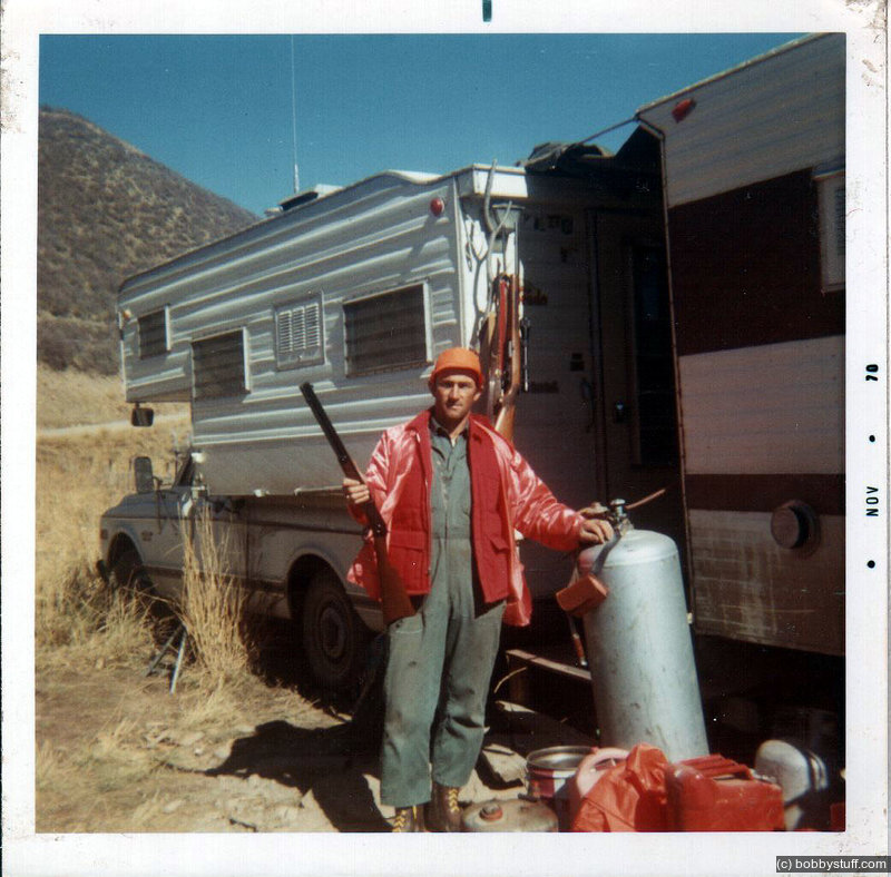
Elk hunting in Colorado.
William F.
Elk hunting in Colorado.
William F.
East of Meeker, it seemed to be the season for moving sheep.
Video
The next photos are from an overlook we visited in 2000. I was lost but he knew exactly where we were
Ripple Creek Overlook
Bobby, Laurie
Ripple Creek Overlook. I have a photo of Bradley and Tucker sitting on this same rock in 2000.
Laurie
Look at the rock above Laurie is sitting on. In 2000 I took the photo below of my boys sitting on the same rock.
East of Meeker, CO
Bradley Taylor, Tucker Riley
Ripple Creek Overlook
Bobby, Laurie, William F.
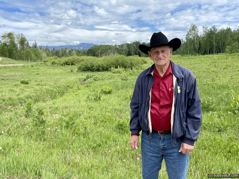
Dad is pointing at Sand Peak.
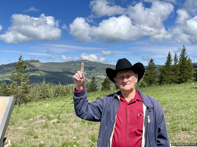
Ripple Creek Overlook. Sand Peak.
William F.
360 Photo !!!
Click and drag on the photo below to see a 360 view. Pinch to zoom in or out on your mobile device or use your mouse scroll wheel on your desktop. Click the box in the top left of the image to view in full screen.
Overlook on CO 8 with view of Sand Peak, east of Meeker CO
Here is Mom and Dad at the same place in 2000. If you look close you can see the same mountain in both photos, Sand Peak.
East of Meeker, CO
Wanda, William F.
Here is video from 2000
Video
William F., Tucker Riley, Bradley Taylor, Wanda
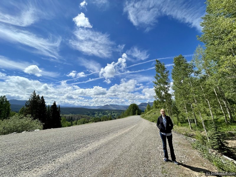
Laurie
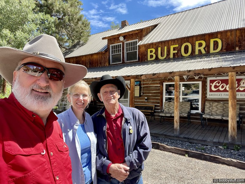
During hunting season, the closest place with a pay phone was in Buford, which seems to only have a general store. He has told me there would be a line at the pay phone and everyone left the dime in the phone for the next person. Everyone called "collect" in those days.
Buford CO
William F.
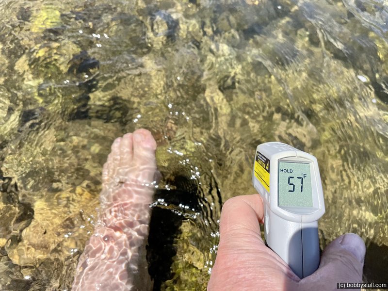
Bobby, Laurie, William F.
The water looked so clear and clean I had to stick my feet into it.
The peak in the background is Sleepy Cat. Later, looking at photos from 2000, I realized I have a photo of Dad and my son Bradley at this exact same spot. See the next photo.
Sleepy Cat Peak in the background.
William F.
Bradley Taylor, William F.
Here is more video from 2000.
Video
This the location where Dad and his brother Raymond, stopped to pull a fellow and his brand new Ford station wagon (I think I got that right) out of the mud. People had been passing the fellow and his buddy all day on the road. Dad and Raymond stopped to lend a hand. Dad told him to hook the winch cable to his car as Dad did not want to be responsible for any damage.
He hooked it to a shiny chrome bumper and said pull it. Dad asked if he was sure and he again repeated pull it. Dad did and pulled him out of the mud but the bumper had a new curved style when finished.
The fellow's buddy started griping and saying Dad should pay for the damage. The fellow cussed him out and said if he had known his buddy had that kind of character he would have never been invited on the trip. The Ford owner was just grateful that someone stopped to help them out of a jam after watching people drive by all day long.
Where Bill and Raymond pulled a guy in a Ford station wagon out of the mud after they had sat there all day long watching people drive by.
William F.
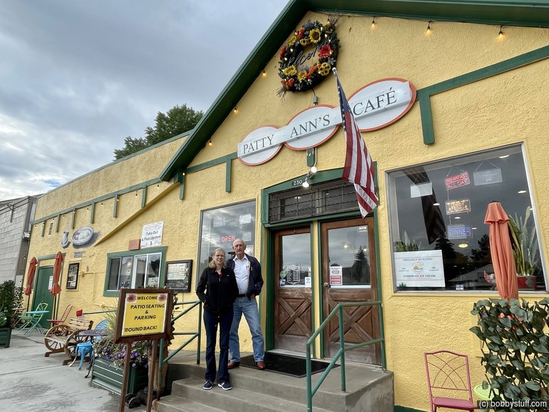
Laurie and I explored downtown Meeker CO.
Meeker CO
Laurie
This cafe has been around forever so we had to get breakfast. The next photo is from 2000.
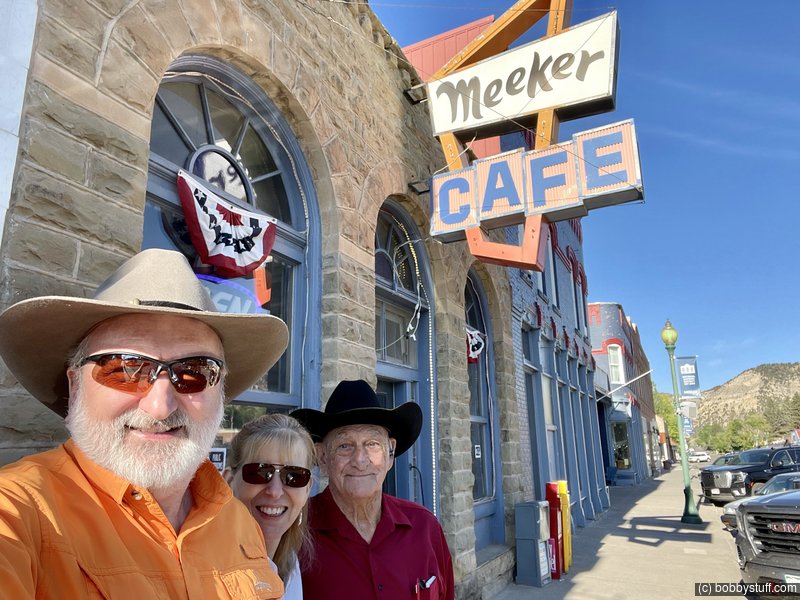
Bobby, Laurie, William F.
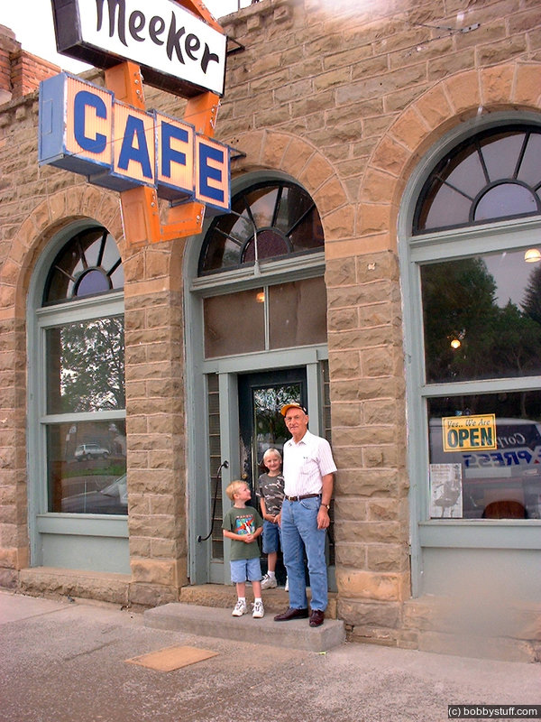
Ate breakfast while Mom had a tooth repaired. Meeker, CO. Coordinates are general area from a map, not GPS unit
Tucker Riley, Bradley Taylor, William F.
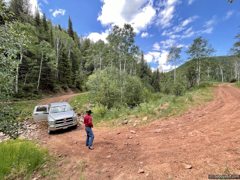
A trip up Fawn Creek which they traveled often when elk hunting.
Video
William F., Laurie
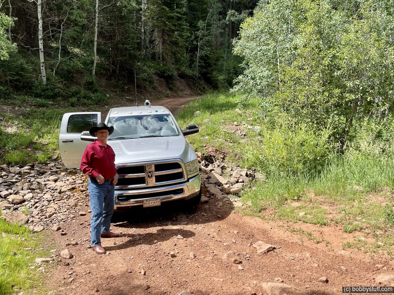
Fawn Creek, White River National Forest, Meeker CO
William F.
Fawn Creek, White River National Forest, Meeker CO
William F.
Fawn Creek, White River National Forest, Meeker CO
Laurie, William F.
Left fork of Fawn Creek, White River National Forest, Meeker CO
Bobby, William F.
Laurie
Bobby, Laurie, William F.
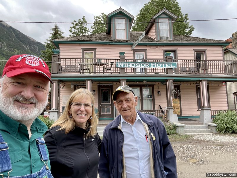
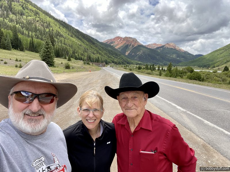
Dad and I always loved Silverton, CO so we headed south after Meeker. We had been on the Million Dollar highway before but it is always amazing. Laurie called it the Butt Puckering Highway. Dad really liked that and started using the phrase.
Video
William F., Laurie
Million Dollar Highway
Bobby, William F., Laurie
Million Dollar Highway
Bobby, William F., Laurie
Million Dollar Highway
Bobby, Laurie, William F.
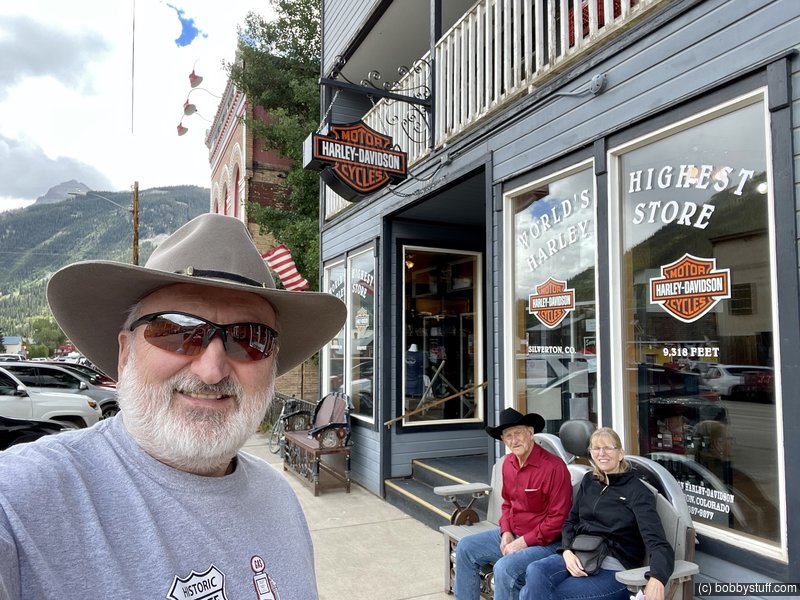
Handlebars in Silverton CO
Laurie, William F.
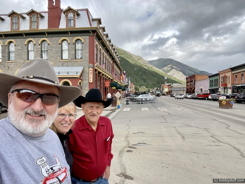
Silverton CO
Bobby, Laurie, William F.
Silverton CO
Bobby, William F., Laurie
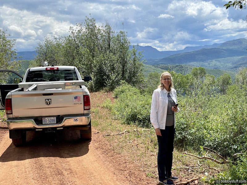
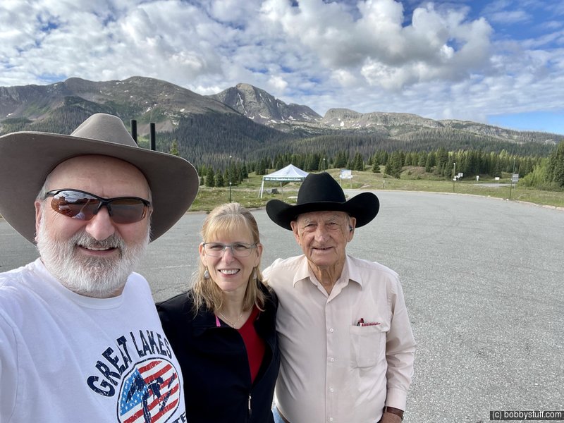
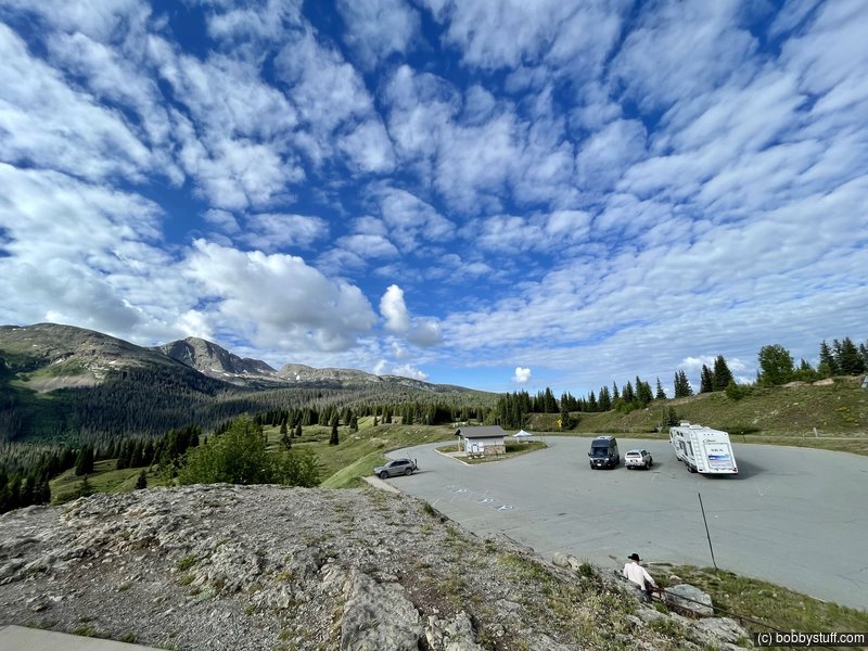
From Silverton, we head south to Durango and then east. We eventually made a complete loop of the state. At the eastern side of the state we headed north toward Denver again and on into Wyoming.
Molas Pass Silverton CO
Bobby, Laurie, William F.
Molas Pass Silverton CO
360 Photo !!!
Click and drag on the photo below to see a 360 view. Pinch to zoom in or out on your mobile device or use your mouse scroll wheel on your desktop. Click the box in the top left of the image to view in full screen.
Molas Overlook, US 550 near Silverton CO
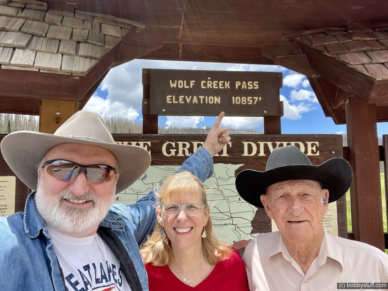
Wolf Creek Pass CO
Bobby, Laurie, William F.
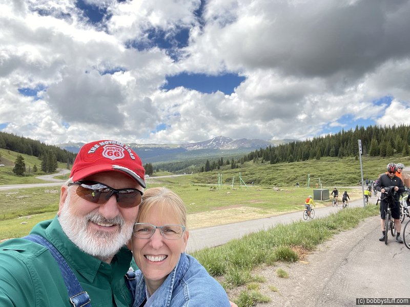
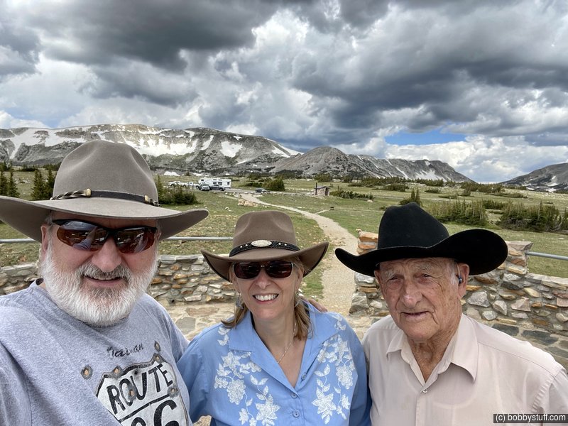
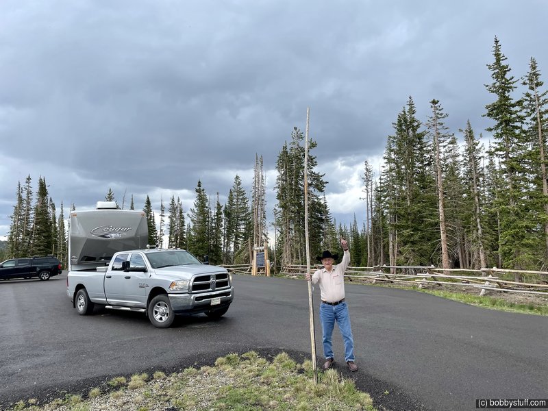
After a night in an over priced campground in Colorado Springs, we decided to skip Pikes Peak because of the holiday crowds and drove north toward Laramie WY and one of my favorite places in the country, the Snowy Range. But first a fun stop on the freeway
Bobby, Laurie, William F.
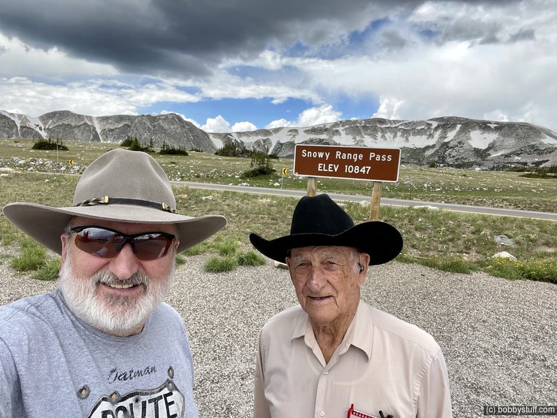
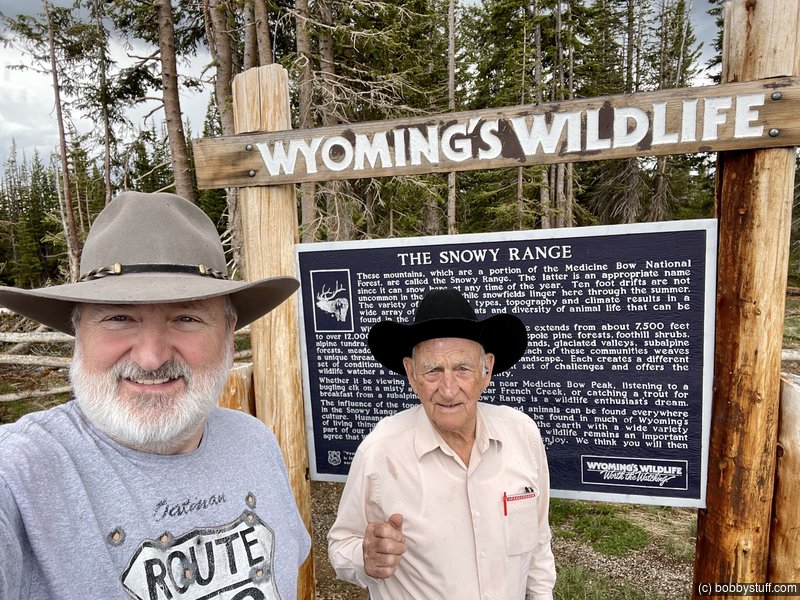
Snowy Range Pass in south easy Wyoming.
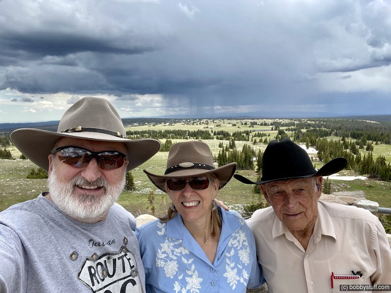
Libby Flats Medicine Bow NF SE Wyoming
Bobby, Laurie, William F.
Video
Libby Flats Medicine Bow NF SE Wyoming
Bobby, Laurie, William F.
Libby Flats Medicine Bow NF SE Wyoming
Bobby, William F.
360 Photo !!!
Click and drag on the photo below to see a 360 view. Pinch to zoom in or out on your mobile device or use your mouse scroll wheel on your desktop. Click the box in the top left of the image to view in full screen.
Libby Flats Observation Area, Snowy Range Pass, Centennial WY
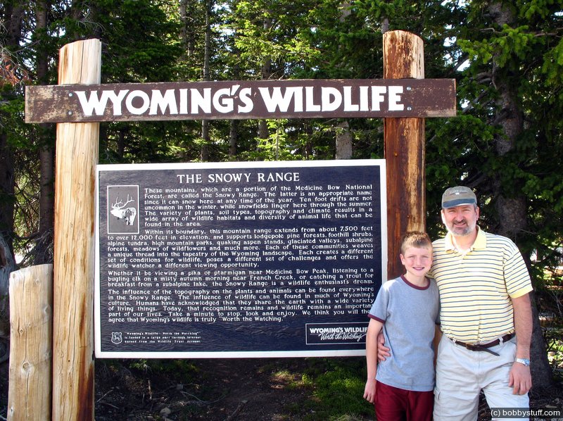
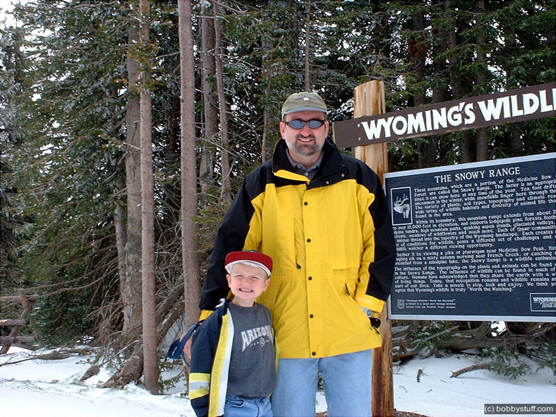
We first got a photo of this sign in 2000. Since then every time through this area, I stop and get another photo. Check out the following photos.
Bobby, William F.
I have photos of me and Tucker at this same spot in 2001 and 2007.
Tucker Riley, Bobby
Snowy Range Pass, south east Wyoming.
Tucker Riley, Bobby
Medicine Bow National Forest, south east Wyoming.
Tucker Riley, Bobby
William F.
The Desert Rose campground had a courtesy vehicle. I have never stayed in a campground with one of those. So we took it downtown to get some wine. It was a hoot.
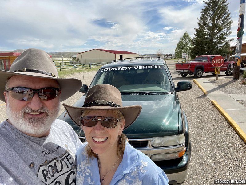
Red Desert Rose Campground, Rawlins WY Courtesy Vehicle
Bobby, Laurie
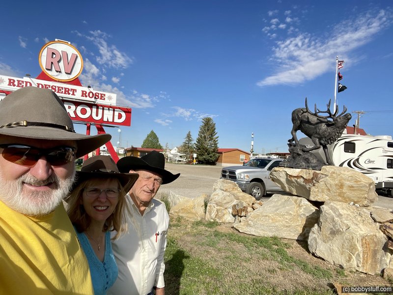
Red Desert Rose Campground, Rawlins WY
Bobby, Laurie, William F.
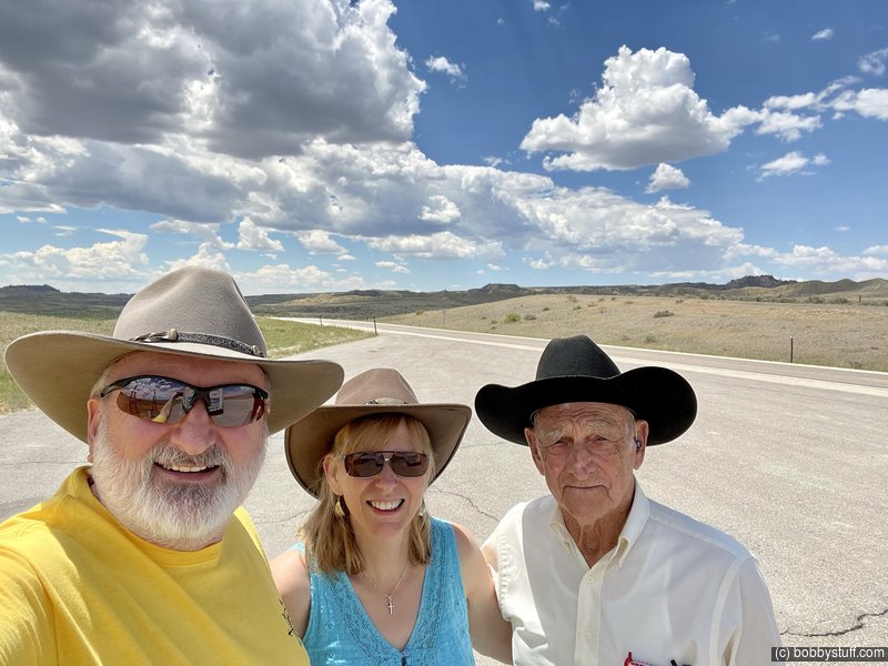
Someplace in Wyoming.
Bobby, Laurie, Bobby
Laurie and I finally stopped watching MASH 4077 in the evenings after watching the the whole series multiple times. So we got hooked on YouTube. One our favorite channels is Our Wyoming Life. It is about a small ranch of 5000+ acres just south of Gillette WY. We were in the neighborhood so we dropped in. I really enjoyed this stop. Mike was just as friendly as he appears in his videos. He opened their farm store and we bought some tee shirts and hamburger.
Video
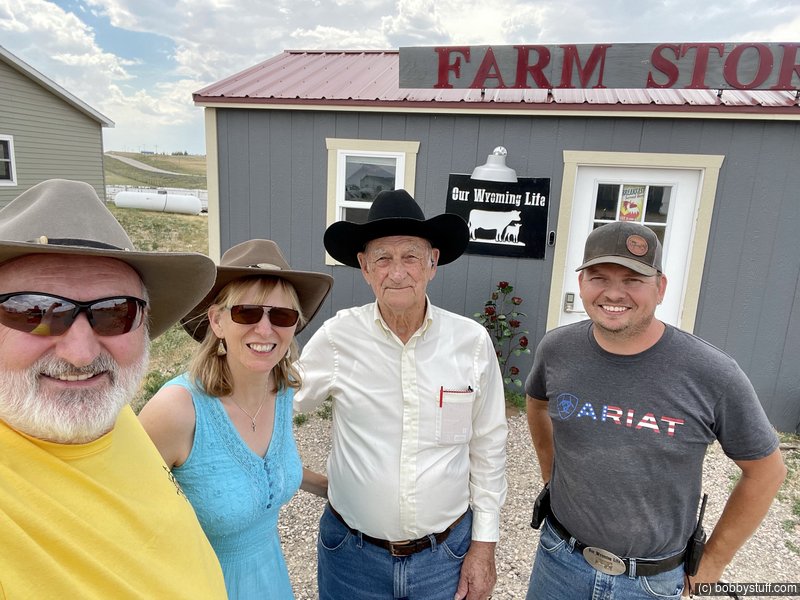
Our Wyoming Life YouTuber we enjoy watching south of Gillette WY. We enjoyed this visit.
Bobby, Laurie, Bobby
We had to pull off and check out this load. It was huge and very interesting.
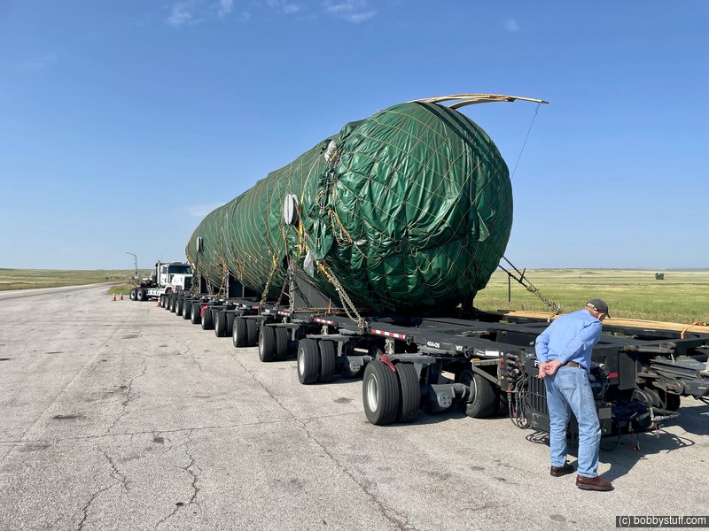
William F.
The Oregon Trail Ruts. We were here in 2000 also.
Bobby, Laurie, William F.
Oregon Trail Ruts
Bradley Taylor, Tucker Riley
Oregon Trail Ruts
William F.
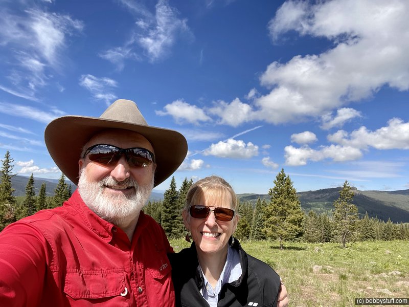
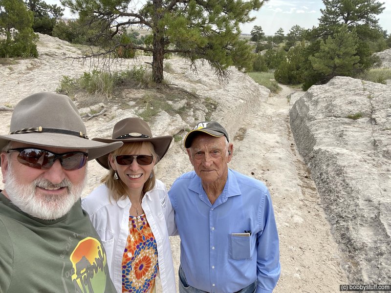
My last photo of Dad. We had just returned to his home and I wanted a final selfie. He really got to enjoy taking selfies and always rushed to get into the photo.
Home again
Bobby, Laurie, William F.
Dad had a blast on our trip to Colorado. When RV camping, in close quarters, everyone has to be on their best behavior as one butt hole can spoil the trip for everyone. Late in the trip he confided that he was afraid he was going to be the butt hole but was happy to find out he was not. He would step aside and have a quiet moment thinking of past trips with Mom but he never let that impact the fun he was having or drag him down.
Our Dad had a positive outlook on life. He was a joy to be around and always had something positive to say or a quick comeback line. His personality was the same from my earliest memories. You could count on Dad always being the same person.
A couple of decades ago I made a new year's resolution that I would say "I love you" to the people I cared about, as often as I could. For some reason it is hard for eastern Ky hill people to say those words, even though everyone feels that way. I had been saying that to my folks at the end of every phone call for years.
I spoke to my Dad 2 days after we returned to NC. We talked about the weather, politics and the recent trip. He repeated again that it was a "trip of a lifetime". I ended with "I love you Dad." He replied "I love you too son." Those were the last words I heard my Dad speak.
At that point he had already cut the grass, done the weed eating and gone to town to pay his bills. On Sunday he cooked and had a couple of his brothers over for lunch. No doubt they heard all about the recent trip.
Wednesday morning he had a cardiac event. Susie was there with him in the hospital and had all of us conferenced in and talking with the doctor. There was nothing the doctors could do and after he coded several times we, as a family, told the doctor to let him go.
Our father left us too soon. I thought I had a few more years with him. His death has left a huge hole in my life. I will be fine eventually. Time has a way of rounding off the rough edges of life.
I am really thankful we took him to Colorado one last time and did not put it off. My wife, Laurie, made the trip very special for him. I am thankful we did not have to watch him wither away and become disabled, unable to drive or to have the ability to just do what ever he wanted to do in life. That would have been harder to handle than losing him too soon. He went out at the top of his game.
One last thing. Dad worked with motorized equipment all his life. He always fueled up his equipment and serviced it at the end of the day. The next morning he just had to climb on and go.
Just before we returned to NC, after his funeral, I decided to cut his grass. I went to the storage building to get the riding lawn mower. I knew what to expect but I had to check anyway. The lawn mower was full of gas and the engine oil was fine. He left it ready for me to climb on and cut the grass.
"I love you Dad."
William F.
William F.