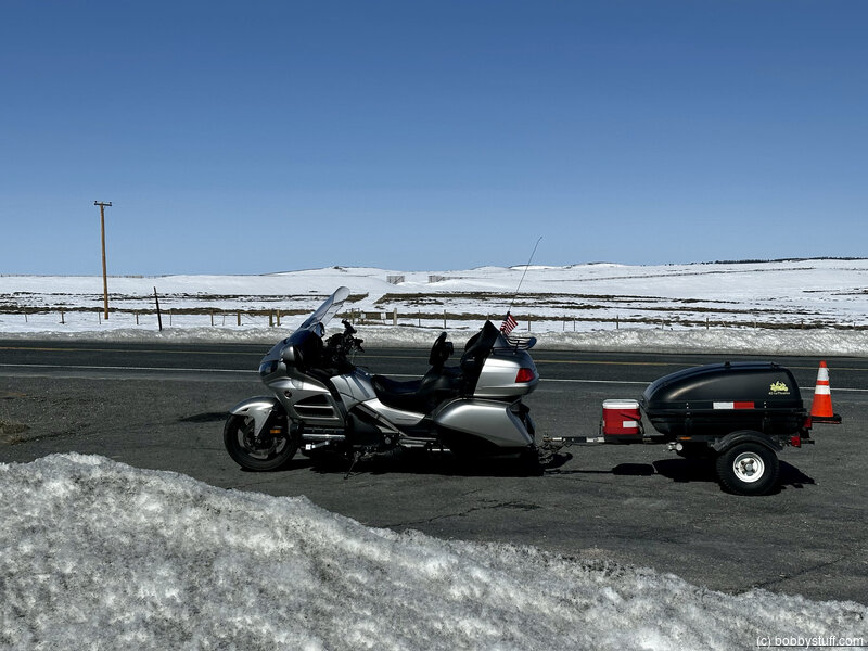
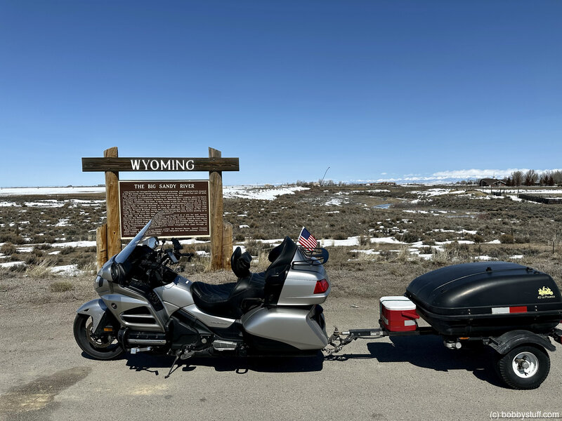
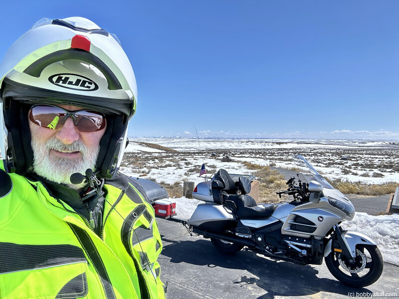
Day 9 - Lander WY to Evanston WY
| Miles for the Day: | 227 |
| Total Trip Miles: | 2622 |
| Start Point: | Lander, WY |
| Sun Rise: | 6:33 AM MDT |
| Start Altitude: | 5354 feet |
| Start Weather: | At 6:00 AM MDT, the temperature was 25.1 degrees with 62 percent humidity. The conditions were clear with a wind speed of 11.4. |
| End Point: | Evanston, WY |
| Sun Set: | 8:04 PM MDT |
| End Altitude: | 6837 feet |
| End Weather: | At 6:00 PM MDT, the temperature was 37.1 degrees with 52 percent humidity. The conditions were clear. |
Table of Contents
 Google Map Track Log
 YouTube Video
360 Photo !!!
Click and drag on the photo below to see a 360 view. Pinch to zoom in or out on your mobile device or use your mouse scroll wheel on your desktop. Click the box in the top left of the image to view in full screen.
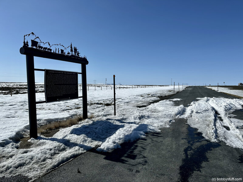
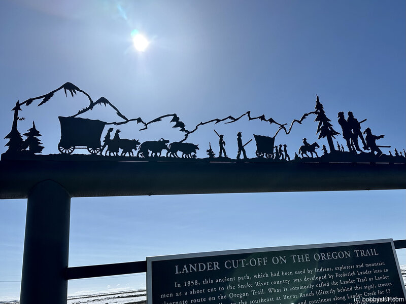
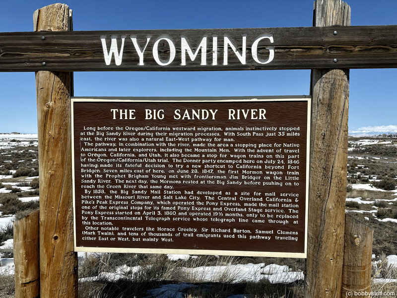
 Lander Cut-Off on the Oregon Trail, near South Pass WY
View a list of places like this or a map.Historical Marker
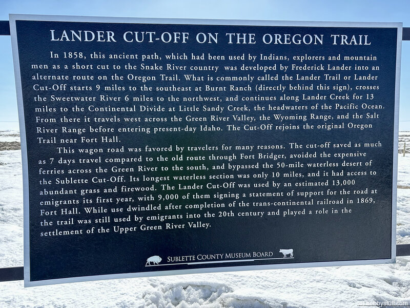
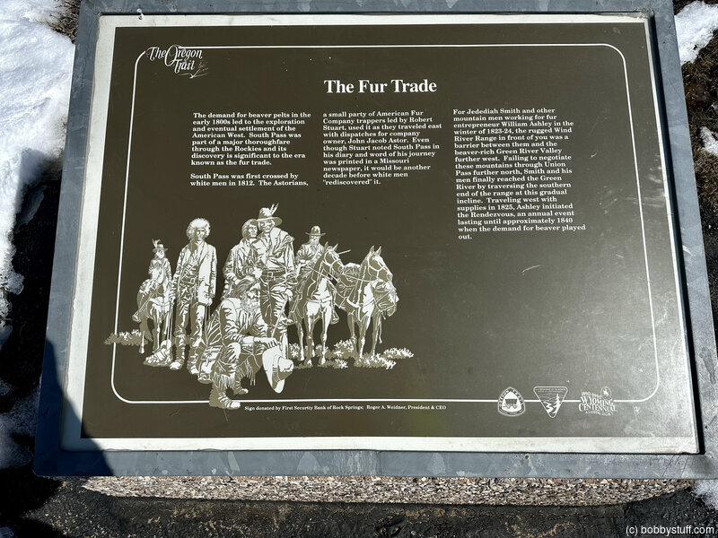
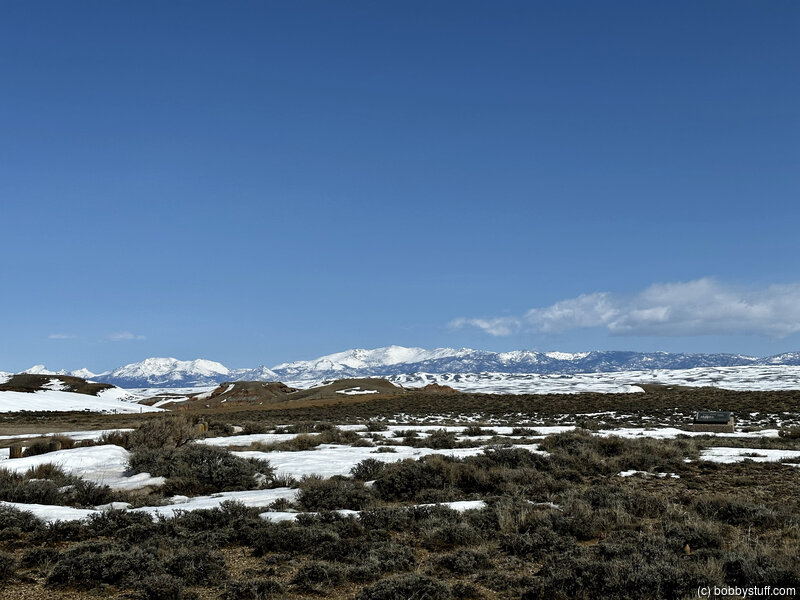
Lander Cut-Off on the Oregon TrailIn 1858, this ancient path, which had been used by Indians, explorers and mountain men as a short cut to the Snake River country was developed by Frederick Lander in to an alternate route on the Oregon Trail. What is commonly called the Lander Trail or Lander Cut-Off starts 9 miles to the southeast at Burnt Ranch (directly behind this sign), crosses the Sweetwater River 6 miles to the northwest, and continued along Lander Creek for 13 miles to the Continental Divide at Little Sandy Creek, the headwaters of the Pacific Ocean. From there it travels west across the Green River Valley, the Wyoming Range, and the Salt River Range before entering present-day Idaho. The Cut-Off rejoins the original Oregon Trail near Fort Hall.
This wagon road was favored by travelers for many reasons. The cut-off save as much as 7 days travel compared to the old route though Fort Bridger. avoided the expensive ferries across the Green River to the south, and bypassed the 50-mile waterless desert of the Sublette Cut-Off. Its longest waterless section was only 10 miles, and it had access to abundant grass and firewood. The Lander Cut-Off was used by an estimated 13,000 emigrants its first year, with 9,000 of them signing statements of support for the road at Fort Hall. While use dwindled after completion of the trans-continental railroad in 1869, the trail was still used by emigrants into the 20th century and played a role in the settlement of the Upper Green River Valley.
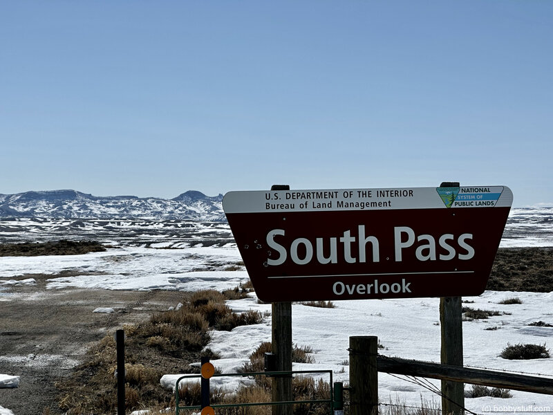
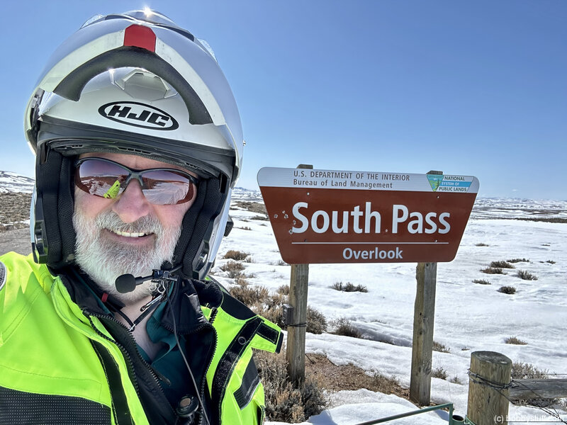
South Pass Historic Monument, Sweetwater Station WY (B-14)
View a list of places like this or a map.Historical Marker
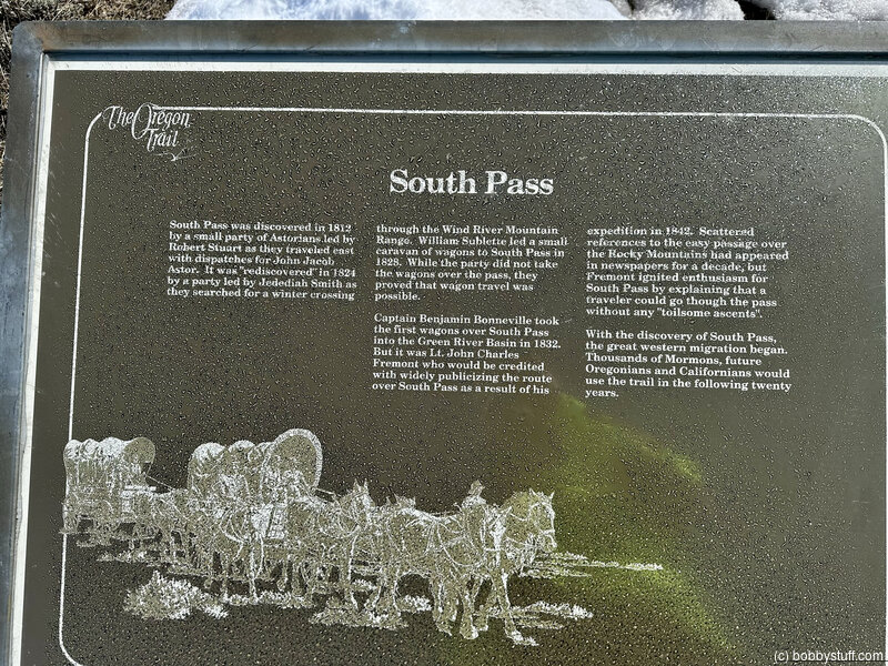
South PassEven after the discovery of South Pass in 1824, it was years before the route was used extensively. Fur trapper/trader William Sublette brought a small caravan of wagons to South Pass in 1828. While his party did not take wagons over the pass, they demonstrated the feasibility of using them.
Captain Benjamin Bonneville took the first wagons over South Pass in 1832. But it was U.S. Government explorer, Lt. John Charles Fremont, who was responsible for publicizing the South Pass route. Scattered references to an easy passage over the Rockies had appeared in newspapers for a decade, but in 1842 Fremont created enthusiasm for South Pass by explaining that a traveler could go through it without any "toilsome ascents".
As knowledge of South Pass became widespread, a great western migration commenced. Thousands of Mormons, and future Oregonians and Californians, would cut a wide swath along the route in the next twenty years.
Bobby
Little Sandy Crossing, Farson WY
View a list of places like this or a map.Historical Marker
Little Sandy CrossingOn Monday evening, June 28, 1847, Brigham Young and the Mormon pioneers met James Bridger and party near this place. Both companies encamped here over night and conferred at length regarding the route and the possibility of establishing and sustaining a large population in the valley of the Great Salt Lake. Bridger tried to discourage the undertaking in this conference he is reported to have said that he would give one thousand dollars for the first bushel of corn grown in the Salt Lake Valley.
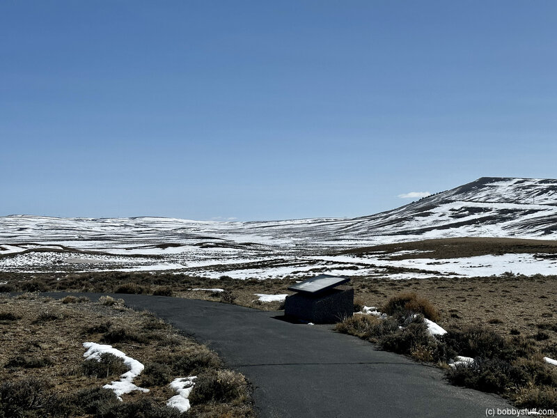
Pilot Butte Pullout, Farson WY (B-19)
View a list of places like this or a map.nps.gov
Pilot Butte Pullout is a BLM interpretive site that tells of tragedy and difficulties on the trail.
There are several monuments/markers here.
Historical Marker
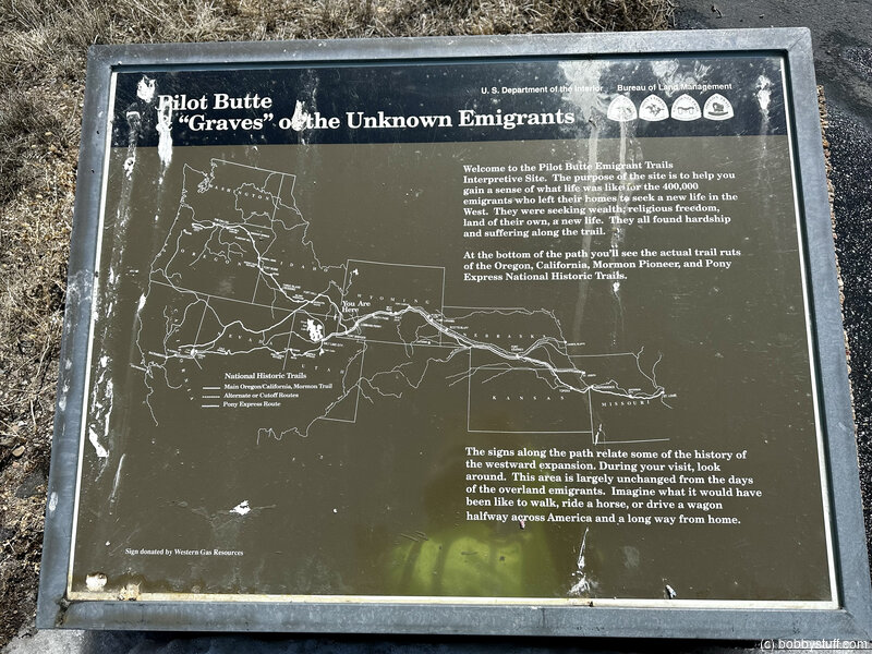
Pilot Butte & "Graves" of the Unknown EmigrantsWelcome to the Pilot Butte Emigrant Trails Interpretive Site. The purpose of the site is to help you gain a sense of what life was like for the 400,000 emigrants who left their homes to seek a new life in the West. They were seeking wealth, religious freedom, land of their own, a new life. They all found hardship and suffering along the trail.
At the bottom of the path you'll see the actual trail ruts of the Oregon, California, Mormon Pioneer, and Pony Express National Historic Trails.
The signs along the path relate some of the history of the westward expansion. During your visit, look around. This area is largely unchanged from the days of overland emigrants. Imagine what it would have been like to walk, ride a horse, or drive a wagon halfway across America and a long way from home
Historical Marker
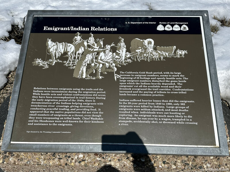
Emigrant/Indian RelationsRelations between emigrants using the trails and the Indians were inconsistent during the migration period. While hostile acts and violent confrontation did occur, they have been overemphasized in trail history. During the early migration period of the 1840s, there is documentation of the Indians helping emigrants with treacherous river crossings, giving directions, conducting peaceful trading, and providing food. It appeared that the native populations did not view the small numbers of emigrants as a threat, even though they were trespassing on tribal lands. Chief Washakie and his Shoshones were well-known for their kindness and (illegible).
The California Gold Rush period, with its large increase in emigrant numbers, seems to mark the beginning of ill feelings and openly hostile acts. The large emigrant numbers disturbed the game herds upon which the Indians heavily depended. The emigrants' cut all the available wood and their livestock overgrazed the trail corridor. Confrontations increased and the paying of a tribute to cross tribal lands became a common practice.
Indians suffered heavier losses than did the emigrants. In the 20-year period from 1840 to 1860, only 362 emigrants were killed by Indians. Large groups of emigrants were seldom attacked, and most deaths resulted when individuals were out hunting or exploring. An emigrant was much more likely to die from disease, be run over by a wagon, trampled in a stampede, accidentally shot, or drowned while crossing a river.
Historical Marker
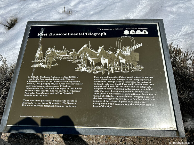
First Transcontinental TelegraphIn 1859, the California legislature offered $6,000 a year for the first overland telegraph. This was followed by an act of the United States Congress on June 16, 1860, pledging $40,000 a year for ten years for carrying government messages. With these inducements, the first work was begun in 1860, but by the end of that year the line ran only to Fort Kearny, Nebraska, from the east and to Fort Churchill, Nevada, from the west.
There was some question of which route should be followed over the Rocky Mountains. The Western Union and Missouri Telegraph Company informed Colorado residents that if they would subscribe $20,000 worth of stock in the enterprise, the company would run the line through Denver, otherwise, the emigrant and mail route over South Pass would be followed. The support in Colorado did not come, and the telegraph was pushed across Wyoming in the summer and fall of 1861. The lack of trees along much of the western route posed a considerable construction problem, but in the fall of 1861, the transcontinental telegraph carried the first message from New York to San Francisco. The remains of the telegraph poles have long since disappeared, but it passed along the emigrant trail in front of this sign.
Historical Marker
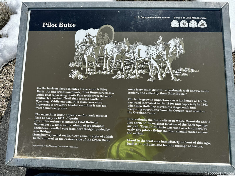
Pilot ButteOn the horizon about 25 miles to the south is Pilot Butte. An important landmark, Pilot Butte served as a guide post separating South Pass trails from the more southerly Overland Trail that crossed southern Wyoming. Oddly enough, Pilot Butte was more important to travelers headed east than it was for west-bound emigrants.
The name Pilot Butte appears on fur trade maps at least as early as 1837. Captain Howard Stansbury mentioned Pilot Butte on September 12, 1850, as his column of topographic engineers traveled east from Fort Bridger guided by Jim Bridger.
Stansbury's journal reads, "... we came in sight of a high butte, situated on the eastern side of the Green River, some forty miles distant: a landmark well known to the traders, and called by them Pilot Butte."
The butte grew in importance as a landmark as traffic eastward increased in the 1850s and especially in 1862 when Ben Holladay moved his stagecoach and freighting operations from the Oregon Trail south to the Overland route.
Interestingly, the butte sits atop White Mountain and is just north of the original location of the Rock Springs airport. Thus, Pilot Butte was used as a landmark by early-day pilots - flying the first airmail routes across the nation.
Stand in the trail ruts immediately in front of this sign, look at Pilot Butte, and feel the passage of history.
Historical Marker
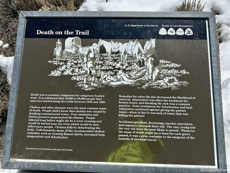
Death on the TrailDeath was a constant companion for emigrants headed west. It is estimated that 10,000 to 30,000 people died and were buried along the trails between 1843 and 1869.
Cholera and other diseases were the most common cause of death. People didn't know that cholera was caused by drinking contaminated water. Poor sanitation and burial practices perpetuated the disease. People infected long before might die by a river crossing and would be buried near the river which would in turn infect more people. Cholera kills by dehydrating the body. Unfortunately, many of the recommended cholera remedies such as wearing flannel shirts, increased body temperature and dehydration.
Remedies for other ills also decreased the likelihood of survival. Amputation was often the treatment for broken bones, and bleeding the sick was a common practice. Some treatments for dehydration and heat exhaustion cautioned against giving the patient water—when in fact it was lack of water that was killing the patient!
Accidental gunshots, drownings, murder, starvation, and exposure also took their toll. The very young and the very old were the most likely to perish. Whatever the cause of death might have been for each grave passed, it was a grim reminder to the emigrant of the hazards of overland travel.
Historical Marker
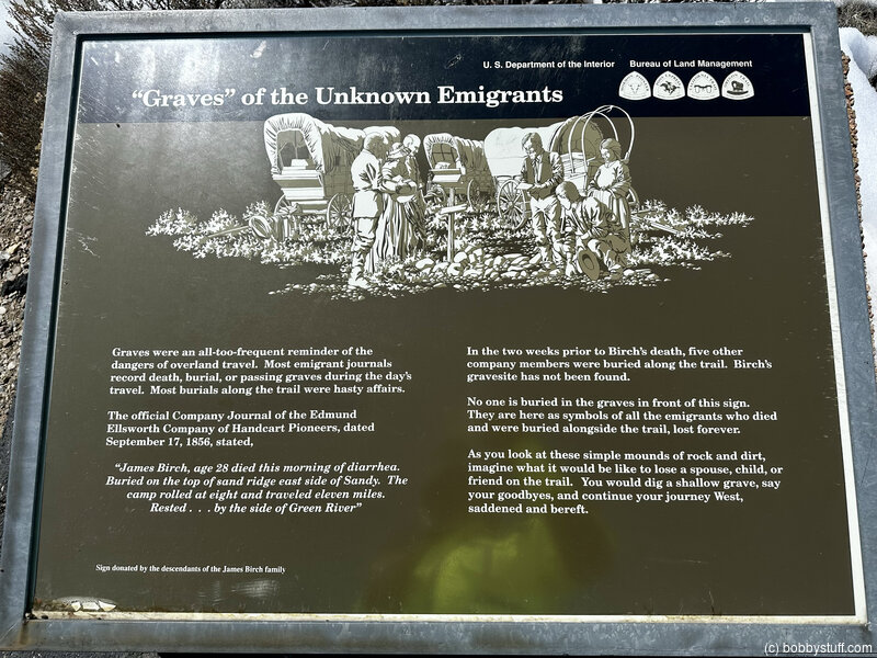
"Graves" of the Unknown EmigrantsGraves were an all-to-frequent reminder of the dangers of overland travel. Most emigrant journals record death, burial, or passing graves during the day's travel. Most burials along the trail were hasty affairs.
The official Company Journal of the Edmund Ellsworth Company of Handcart Pioneers, dated September 17, 1856, stated,
"James Birch, age 28 died this morning of diarrhea. Buried on the top of sand ridge east side of Sandy. The camp rolled at eight and traveled eleven miles. Rested ... by the side of Green River."
In the two weeks prior to Birch's death, five other company members were buried along the trail. Birch's gravesite has not been found.
No one is buried in the graves in front of this sign. They are here as symbols of all the emigrants who died and were buried alongside the trail, lost forever.
As you look at these simple mounds of rock and dirt, imagine what it would be like to lose a spouse, child, or friend on the trail. You would dig a shallow grave, say your goodbyes, and continue your journey West, saddened and bereft.
Historical Marker
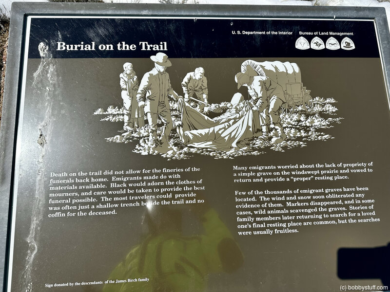
Burial on the TrailDeath on the trail did not allow for the fineries of the funerals back home. Emigrants made do with materials available. Black would adorn the clothes of mourners, and care would be taken to provide the best funeral possible. The most travelers could provide was often just a shallow trench beside the trail and no coffin for the deceased.
Many emigrants worried about the lack of propriety of a simple grave on the windswept prairie and vowed to return and provide a "proper" resting place.
Few of the thousands of emigrant graves have been located. The wind and snow soon obliterated any evidence of them. Markers disappeared, and in some cases, wild animals scavenged the graves. Stories of family members later returning to search for a loved one's final resting place are common, but the searches were usually fruitless.
Historical Marker
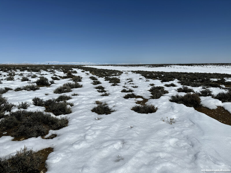
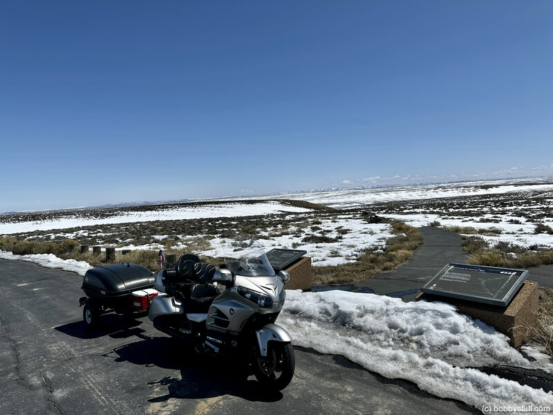
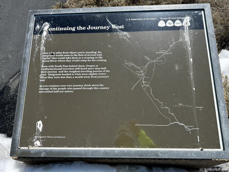
Continuing the Journey WestJust a few miles from where you're standing, the emigrants would come to the first of several trail "splits" that would take them to a crossing on the Green River where they would camp for the evening.
Even with South Pass behind them, Oregon or California-bound travelers still faced more than half their journey and the roughest traveling portion of the trail. Emigrants headed to Utah were slightly better off as they were less than a month away from journey's end.
As you continue your journey, think about the courage of the people who passed through this country and settled half our nation.
Bobby
Bobby
Bobby
360 Photo !!!
Click and drag on the photo below to see a 360 view. Pinch to zoom in or out on your mobile device or use your mouse scroll wheel on your desktop. Click the box in the top left of the image to view in full screen.
Lombard Ferry/Mormon Ferry, Green River WY (B-20)
View a list of places like this or a map.nps.gov
Lombard Ferry/Mormon Ferry was the main crossing of the treacherous Green River (called Seedskadee, or "Prairie Chicken River," by the Shoshone people). Mormons operated a commercial ferry service here but some travelers opted to save the fare and brave the current themselves. Many drowned at the Green River crossings.
BLM interpretive exhibits tell the story. Walk down the short, paved, path from the parking lot to see a replica ferry.
Historical Marker
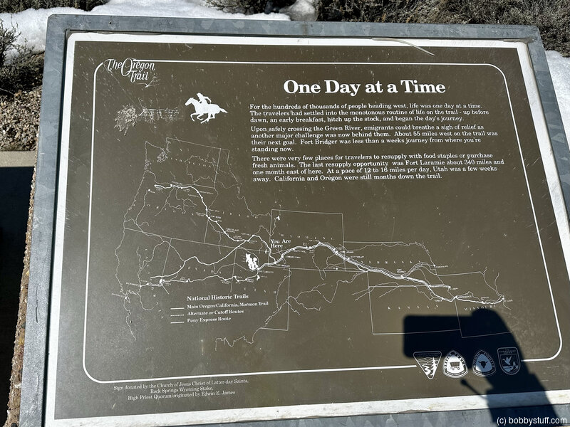
One Day at a TimeFor the hundreds of people heading west, life was one day at a time. The travelers had settled into the monotonous routine of life on the trail - up before dawn, an early breakfast, hitch up the stock, and begin the day's journey.
Upon safely crossing the Green River, emigrants could breath a sigh of relief as another major challenge was now behind them. About 55 miles west on the trail was their next goal. Fort Bridger was less than a weeks journey from where you're standing now.
There were very few places for travelers to resupply with food staples or purchase fresh animals. The last resupply opportunity was Fort Laramie about 340 miles and one month east of here. At a pace of 12 to 16 miles per day, Utah was a few weeks away. California and Oregon were still month down the trail
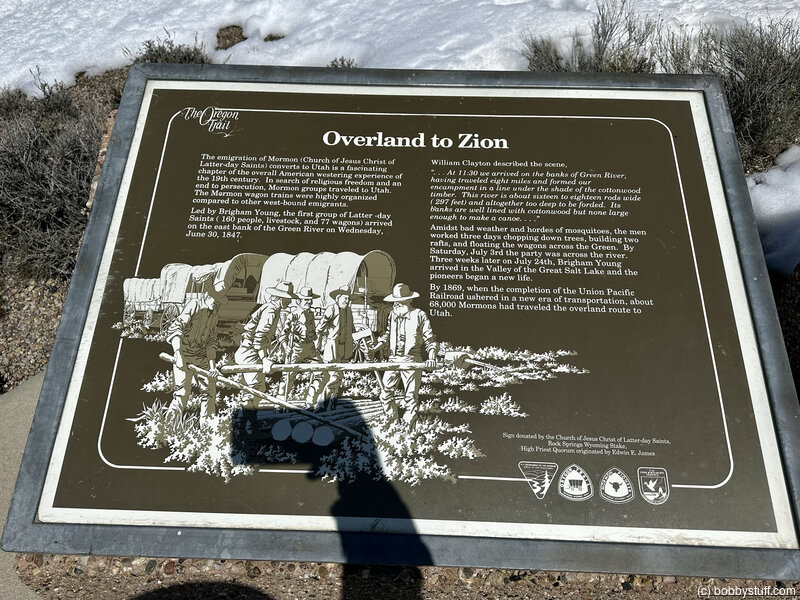
Historical Marker
Overland to ZionThe emigration of Mormon (Church of Jesus Christ of Latter-day Saints) converts to Utah is a fascinating chapter of the overall American westering experience of the 19th century. In search of religious freedom and an end to persecution, Mormon groups traveled to Utah. The Mormon wagon trains were highly organized compared to other west-bound emigrants.
Led by Brigham Young, the first group of Latter-day Saints (160 people, livestock, and 77 wagons_ arrived on the east bank of the Green River on Wednesday, June 30, 1847.
William Clayton described the scene. "... At 11:30 we arrived on the banks of the Green River, having traveled eight miles and formed our encampment in a line under the shade of the cottonwood timber. This river is about sixteen to eighteen rods wide (297 feet) and altogether too deep to be forded. The banks are well lined with cottonwood but none large enough to make a canoe..."
Amidst bad weather and hordes of mosquitoes, the men worked three days chopping down trees, building two rafts, and floating the wagons across the Green. By Saturday, July 3rd the party was across the river. Three weeks later on July 24th, Brigham Young arrived in the Valley of the Great Salt Lake and the pioneers began a new life.
By 1869, when the completion of the Union Pacific Railroad ushered in a new era of transportation, about 68,000 Mormons had traveled the overland route to Utah.
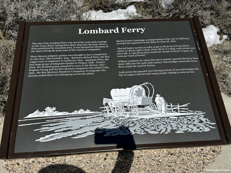
Historical Marker
The Lombard FerryThis site of the Lombard Ferry was one of the most used crossings on the Green River, lasting from about 1843 into the early 1900s. First established by mountain men, it was operated by Mormons in the 1850s during the peak years of the westward emigration.
Many famous emigrant parties were thought to have crossed here. These include: 1841 - Bartleson-Bidwell Party, the first wagon train of emigrants to California; 1843 - Applegate Party, the first large group of emigrants headed to Oregon; 1846 - Donner Party, the ill-fated group stranded by snow in the Sierras; 1847 - Brigham Young and the first Mormon emigrants who settled Utah; 1856 - the first Mormon Handcart Companies of emigrants who literally pulled their own belongings across the plains.
Mariett Foster Cummings, a young woman on her way to California, recorded the experience in her diary for June 28, 1852, "Started before sunrise in order to get to the ferry of Green River, which we did by eight o'clock. Green River is a deep, swift stream 200 feet wide. A rope ferry and a moderate charge of $3 per wagon, 25 cents per head of horses."
William Lombard, for whom this site is named, operated the ferry from about 1880 into the early 20th century when bridges across the Green River ended the need for ferries.
Look across the peaceful river flowing in front of you and imagine the line of wagons and the trail-weary people waiting to come across.
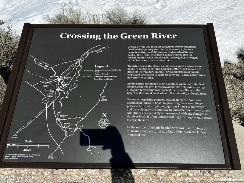
Historical Marker
Crossing the Green RiverCrossing rivers was the most dangerous activity emigrants faced on their journey west. By the time weary pioneers enroute (sic) to Oregon, California, or Utah reached the east bank of the Green River, they had been on the trail for several months. Utah was close, but those going to Oregon or California were only halfway there.
Though crossing the Green had its perils, most emigrants were happy to see the cool water and lush cottonwood groves with grass for their hungry animals, firewood instead of buffalo chips, and the chance to camp under trees - a rare opportunity in western Wyoming.
Before spring runoff and in late summer when the water level of the Green was low, fords provided relatively safe crossings. However, most emigrants reached the Green River at the height of its annual flood when it flowed swift, wide and deep.
Several enterprising pioneers settled along the river and established ferries to float emigrant wagons across. Ferry prices were usually high ranging from $3 to $16 per wagon and were virtually the only way to cross the river. Ferry prices sometimes changed daily to correspond with the changes in the river level. It often took several days for large wagon trains to cross the river.
As the number of people headed west swelled into tens of thousands each year, the number of ferries on the Green increased also. As many as 50 ferries are thought to have operated along the 50-mile corridor of the Green River Valley crossed by emigrant trails.
Historical Marker
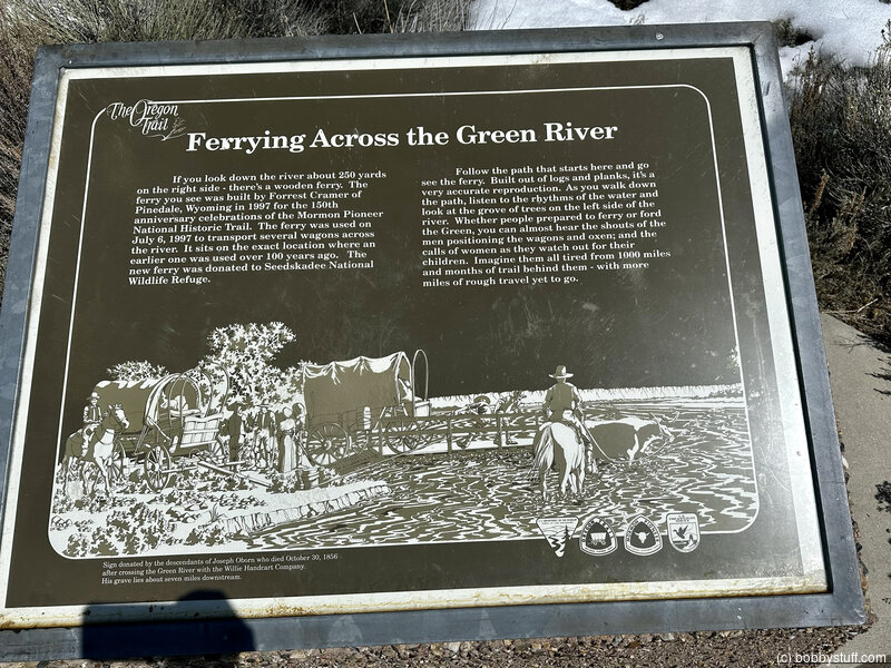
Ferrying Across the Green RiverIf you look down the river about 250 yards on the right side - there's a wooden ferry. The ferry you see was built by Forrest Cramer of Pinedale, Wyoming in 1997 of the 150th anniversary celebrations of the Mormon Pioneer National Historic Trail. The ferry was used on July 6, 1997 to transport several wagons across the river. It sits on the exact location where an earlier one was used over 100 years ago. The new ferry was donated to Seedskadee National Wildlife Refuge.
Follow the path that starts here and go see the ferry. Built out of logs and planks, it's a very accurate reproduction. As you walk down the path, listen to the rhythms of the water and look at the grove of tree on the left side of the river. Whether people prepared to ferry or ford the Green, you can almost hear the shouts of men positioning the wagons and oxen and the calls of women as they watch out for their children. Imagine them all tired from 1000 miles and months of trail behind them - with more miles of rough travel yet to go
 Elevation Changes During the Day
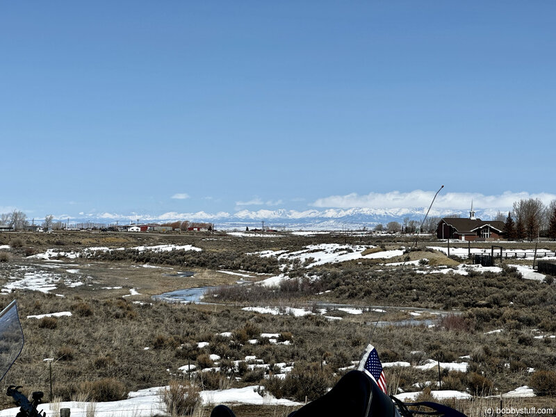
The day started at 5,354 feet and ended at 6,837 feet. The highest altitude was 8,330 feet and the lowest altitude was 5,354 feet.
| Days 7-8 - Casper WY to Lander WY |
Topics
TagsConfederate Statues (32),Motorcycle (97),National Parks (9),Odd (1),Route 66 (33),Unemployment (6),Zombies (1)