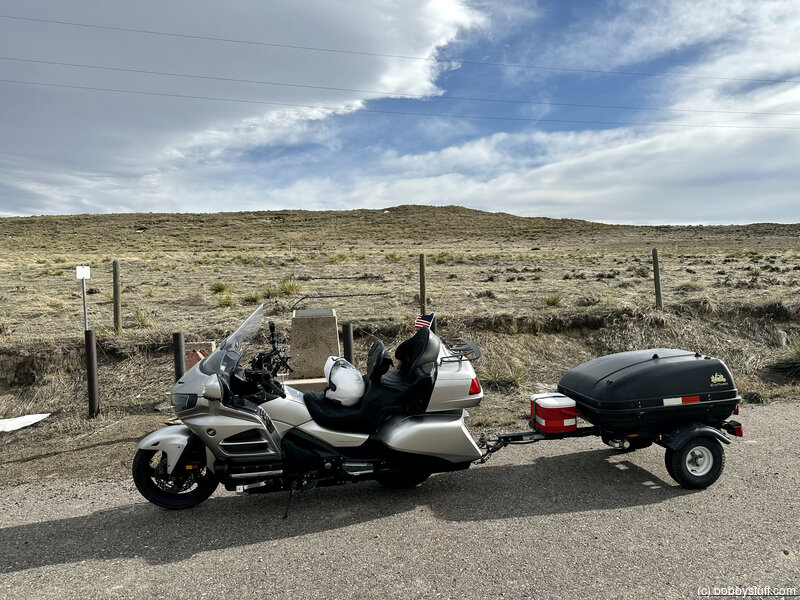
Day 6 - Morrill NE to Casper WY
| Miles for the Day: | 203 |
| Total Trip Miles: | 2198 |
| Start Point: | Morrill, NE |
| Sun Rise: | 6:20 AM MDT |
| Start Altitude: | 3993 feet |
| Start Weather: | At 6:00 AM MDT, the temperature was 48 degrees with 44 percent humidity. The conditions were clear. |
| End Point: | Mills, WY |
| Sun Set: | 7:44 PM MDT |
| End Altitude: | 5185 feet |
| End Weather: | At 6:00 PM MDT, the temperature was 64.1 degrees with 28 percent humidity. The conditions were clear with a wind speed of 20.8. |
Table of Contents
 Google Map Track Log
 YouTube Video
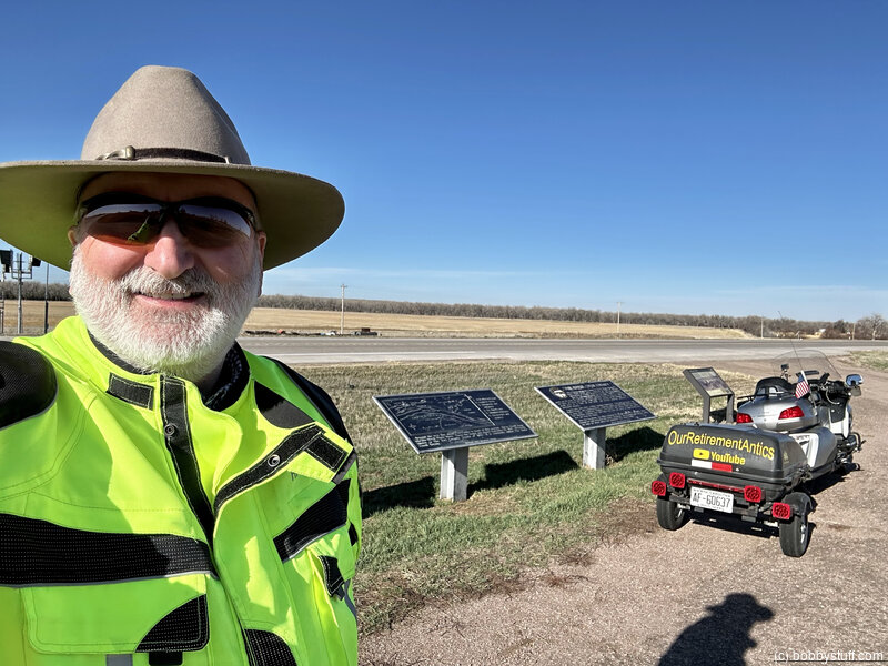
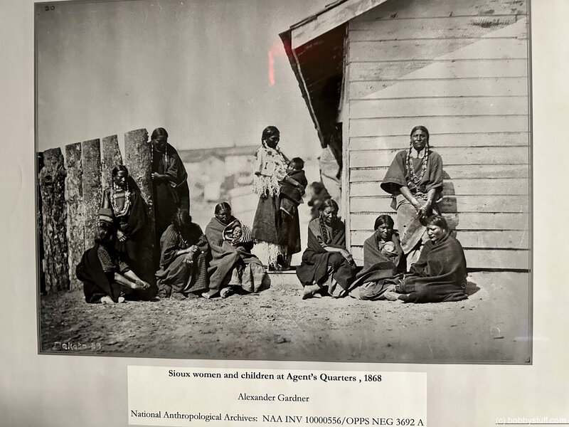
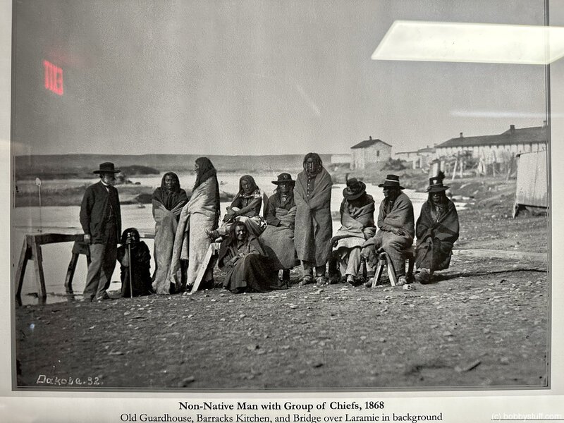
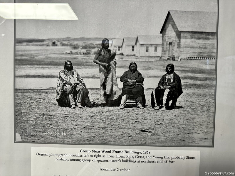
 Horse Creek Treaty Grounds and Battle Site, Morrill NE
View a list of places like this or a map.nps.gov
This spot in September 1851 was the campground of some 12,000 tribal representatives - the largest gathering of Indians ever recorded. They came to work out the terms of a treaty to protect the emigrant trails and compensate the tribes for that use of their lands and resources.
At the same site in 1864 a band of Lakota Sioux resisted efforts of the U.S. Army to move them to Ft. Kearny, resulting in a fight known as the Battle of Horse Creek.
Nebraska State Historical Society interpretive panels tell about the treaty; privately owned treaty grounds can be viewed from the pullout.
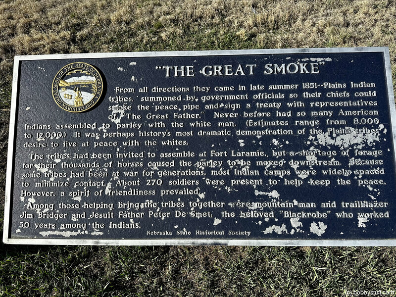
Historical Marker
"The Great Smoke" The Horse Creek TreatyFrom all directions they came in late summer 1851 - Plains Indian tribes, summoned by government officials so their chiefs could smoke the peace pipe and sign a treaty with representatives of "The Great Father." Never before had so many American Indians assembled to parley with the white man. (Estimates range from 8,000 to 12,000.) It was perhaps history's most dramatic demonstration of the Plain's tribes desire to live at peace with the whites.
The tribes had been invited to assemble at Fort Laramie, but a shortage of forage for their thousands of horses caused the parley to be moved downstream. Because some tribes had been at war for generations, most Indian camps widely spaced to minimize contact. About 270 soldiers were present to help keep the peace. However, a spirit of friendliness prevailed. Among those helping bring the tribes together were mountain man and trailblazer Jim Bridger and Jesuit Father Peter De Smet, the beloved "Blackrobe" who worked 50 years among the Indians.
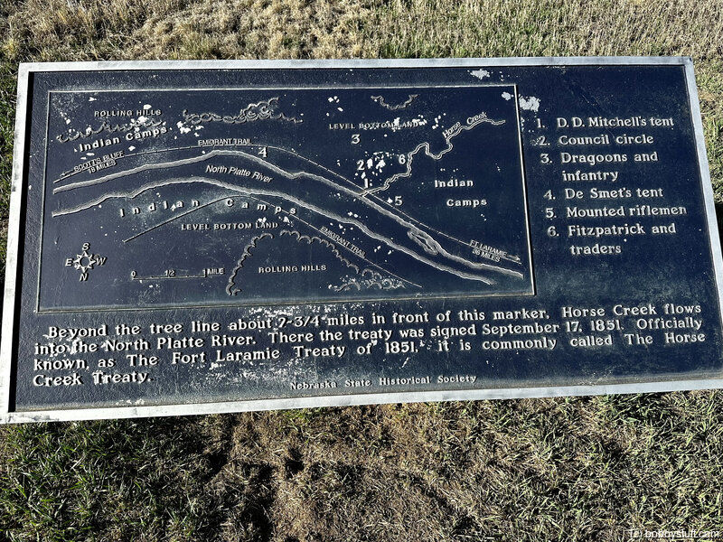
Beyond the tree line about 2 3/4 miles in front of this marker, Horse Creek flows into the North Platte River. There the treaty was signed September 17, 1851. Officially known as The Forty Laramie Treaty of 1851, it is commonly called The Horse Creek Treaty.
Historical Marker
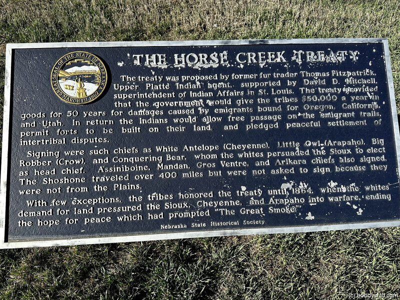
The Horse Creek TreatyThe Treaty was proposed by former fur trader Thomas Fitzpatrick, Upper Platte Indian agent, supported by David D. Mitchell, superintendent of Indian Affairs in St. Louis. The treaty provided that the government would give there tribes $50,000 a year in goods for 50 years for damage caused by emigrants bound for Oregon, California and Utah. In return the Indians would allow free passage on the emigrant trails, permit forts to be built on their land, and pledged peaceful settlement of intertribal disputes. Signing were such chiefs as White Antelope (Cheyenne), Little Owl (Arapaho), Big Robber (Crow), and Conquering Bear, whom the whites persuaded the Sioux to elect as head chief. Assiniboine, Mandan, Gros Ventre, and Arikara chiefs also signed. The Shoshone traveled over 400 miles but were not asked to sign because they were not from the Plains.
With few exceptions, the tribes honored the treaty until 1864, when the whites demand for land pressured the Sioux, Cheyenne, and Arapaho into warfare, ending the hope for peace which had prompted "The Great Smoke."
Bobby
Grattan Fight Monument, Lingle WY (A-2)
View a list of places like this or a map.Historical Marker
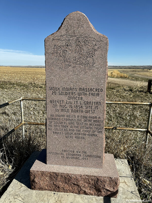
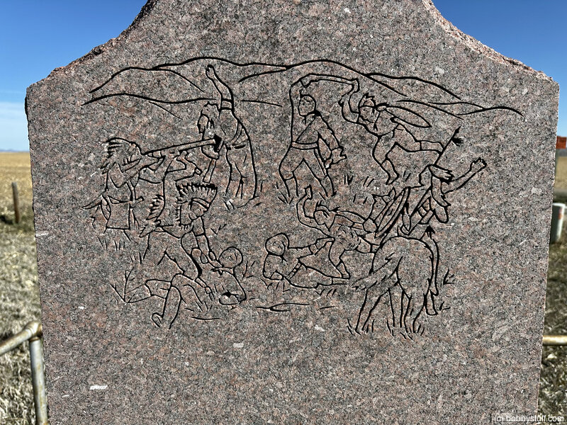
Sioux Indians massacred 29 Soldiers with their Officer Brevet 2nd Lt. L. Grattan, on Aug. 19, 1854. Site is 1/2 mile north-west.
An Indian killed a cow from a Mormon caravan. The detachment of soldiers was sent to receive the offender. In the ensuing fight all soldiers and the chief of the Brule's Sioux, Marton-Ioway, were killed.
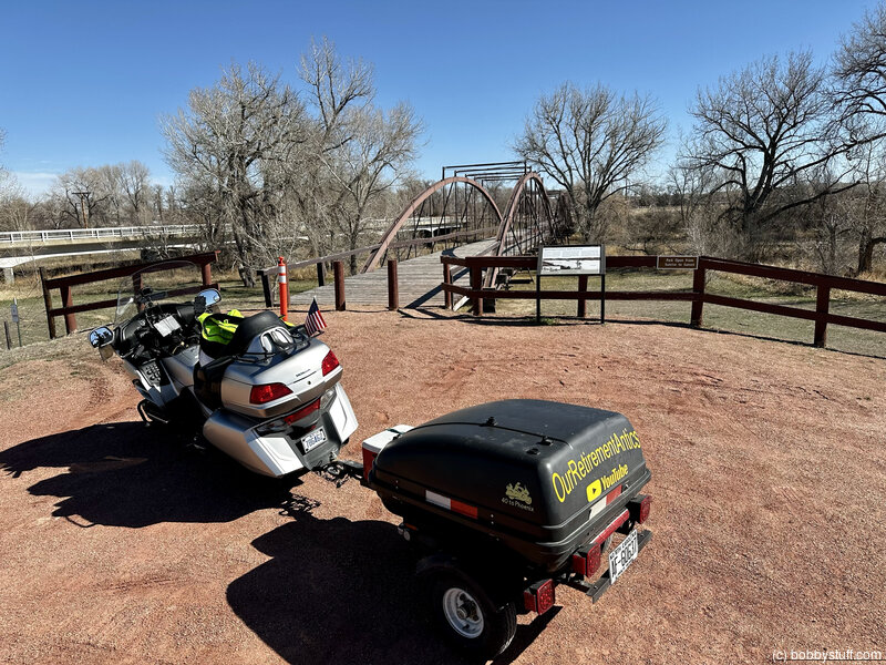
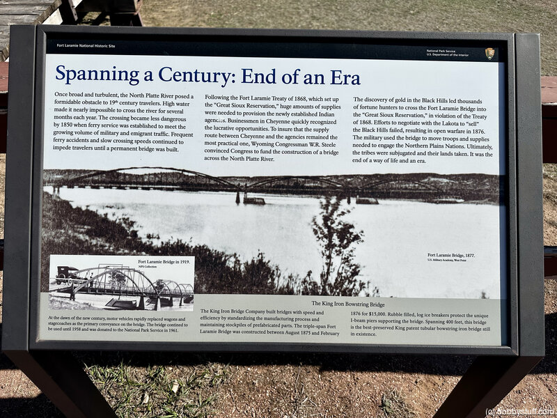
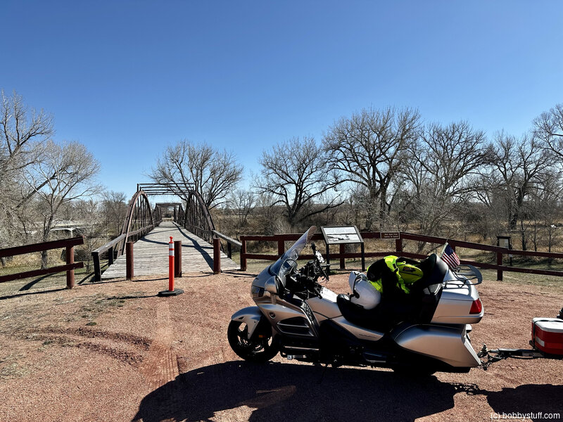
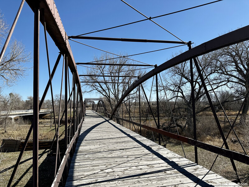
North Platte River Crossing Site and 1875 Military Bridge, Fort Laramie WY (A-4)
View a list of places like this or a map.nps.gov
North Platte River Crossing Site (west of Town of Fort Laramie) is where north-bank emigrants crossed the river to Fort Laramie. An interpretive panel tells the story of the nearby military bridge. The site, which is within the boundary of Fort Laramie National Historic Site, has a 1.5-mile riverside hiking trail.
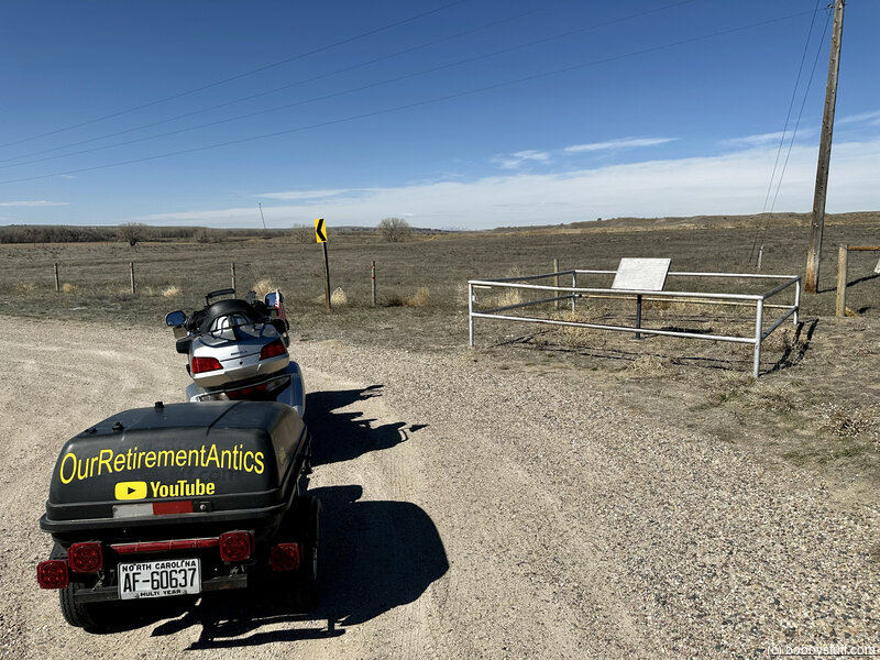
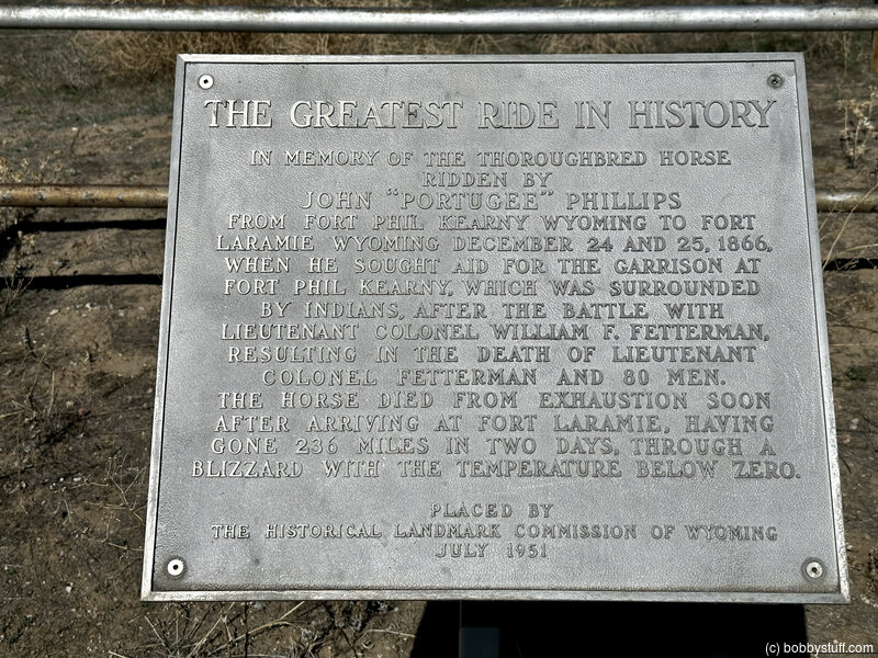
Greatest Ride Monument, Fort Laramie WY (A-6)
View a list of places like this or a map.Historical Marker
The Greatest Ride in HistoryIn memory of the Thoroughbred horse ridden by John "Portugee" Phillips from Fort Phil Kearny Wyoming to Fort Laramie Wyoming December 24, and 25, 1866, when he sought aid for the garrison at Fort Phil Kearny, which was surrounded by Indians, after the battle with Lieutenant Colonel William F. Fetterman resulting in the death of Lieutenant Colonel Fetterman and 80 men.
The horse died from exhaustion soon after arriving at Fort Laramie, having gone 236 miles in two days, through a blizzard with the temperature below zero.
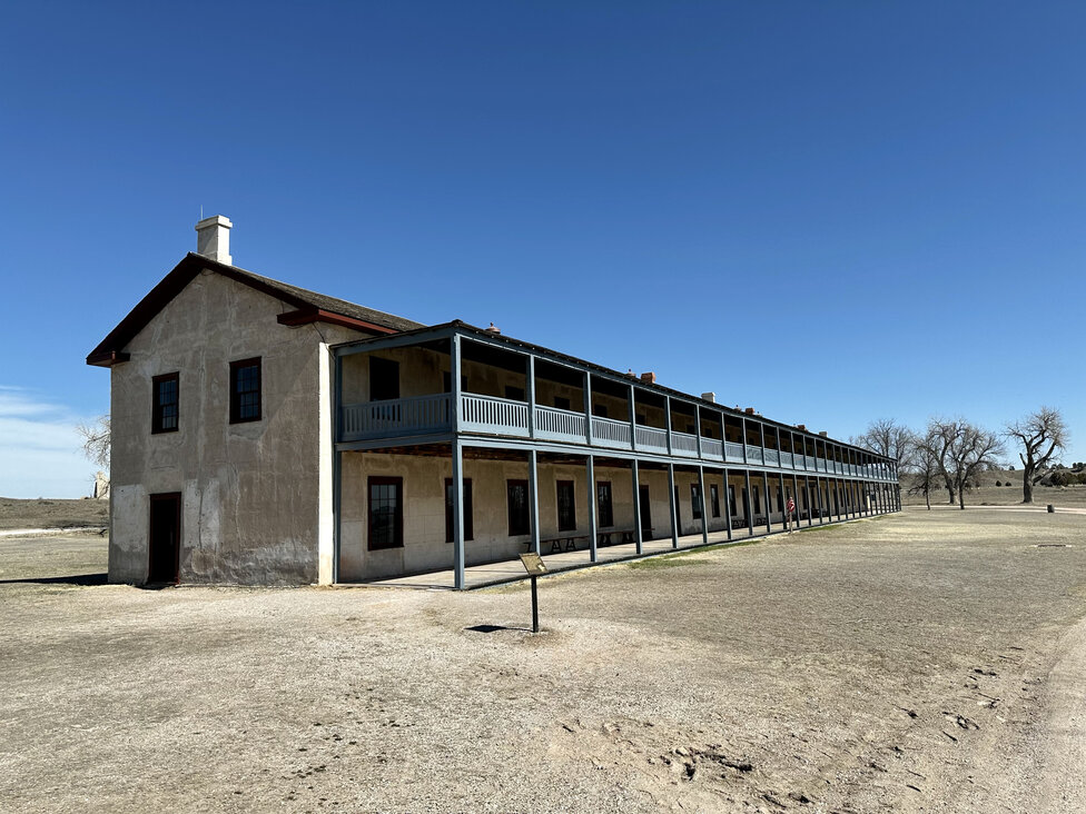
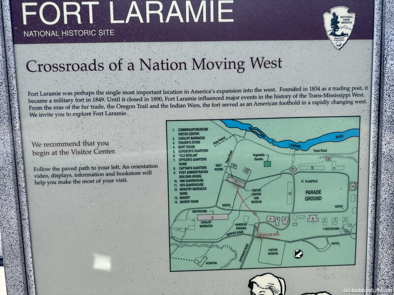
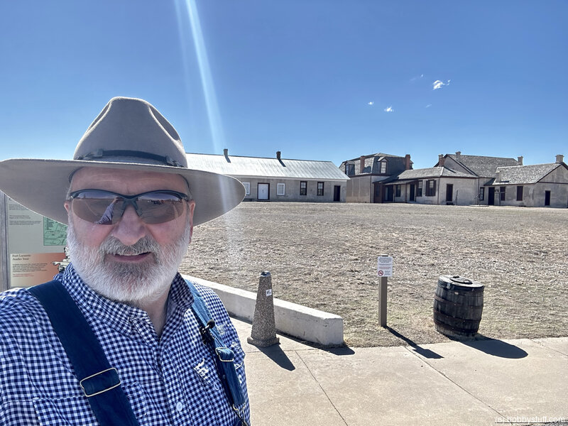
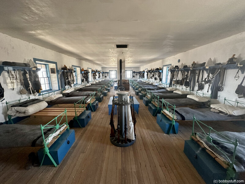
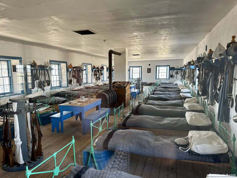
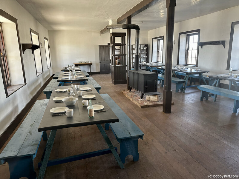
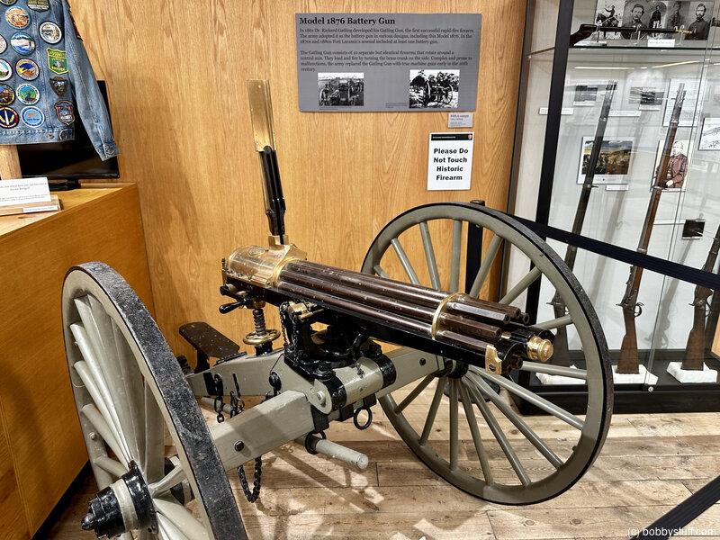
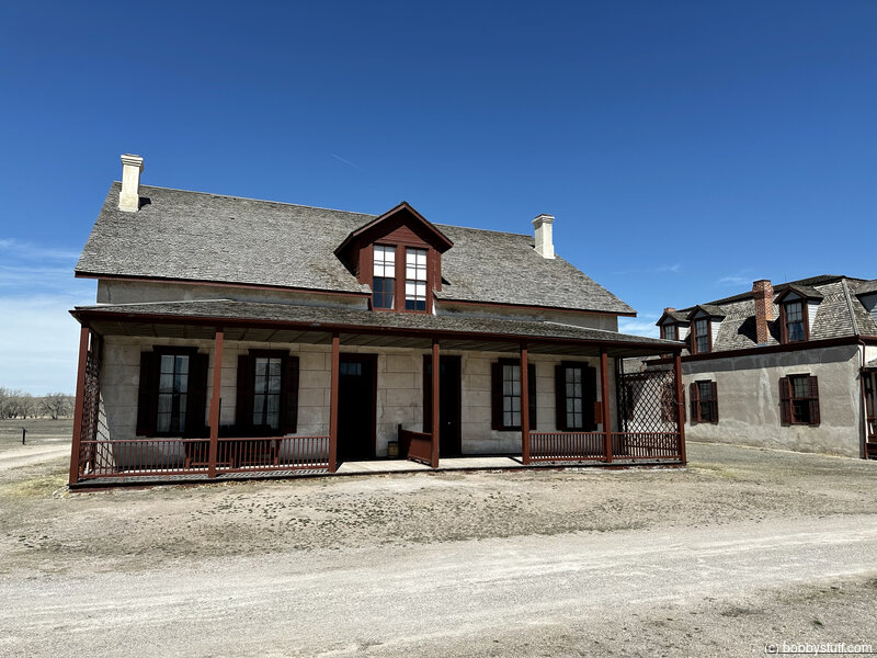
Fort Laramie National Historic Site, Fort Laramie WY (A-7)
View a list of places like this or a map.nps.gov
Fort Laramie National Historic Site once stood sentinel over the Oregon, California, and later Mormon emigration trails, was a stop on the Pony Express route, and served as a staging ground for both peaceful and hostile dealings with Plains Indians.
Its association with important figures (including Sitting Bull and Crazy Horse) and historic events makes Fort Laramie an icon of the American West. The one-time Army post, now managed by the National Park Service, looks much as it did 150 years ago.
A visitor center, museum, and 12 restored buildings help to tell its story. Allow several hours for your visit.

Bobby
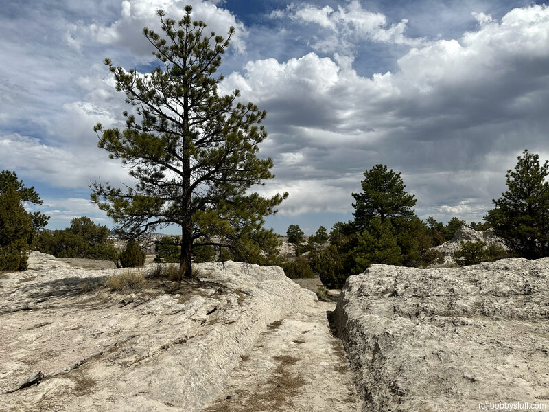
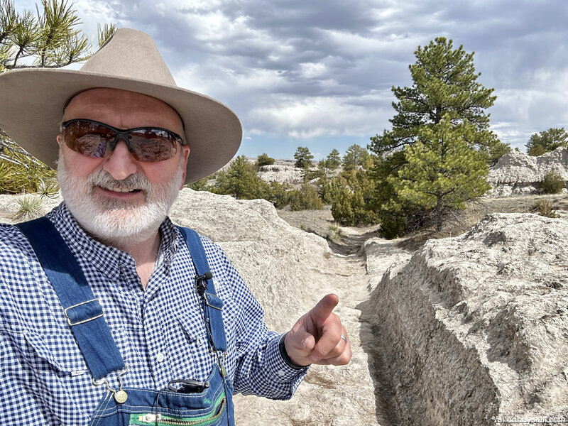
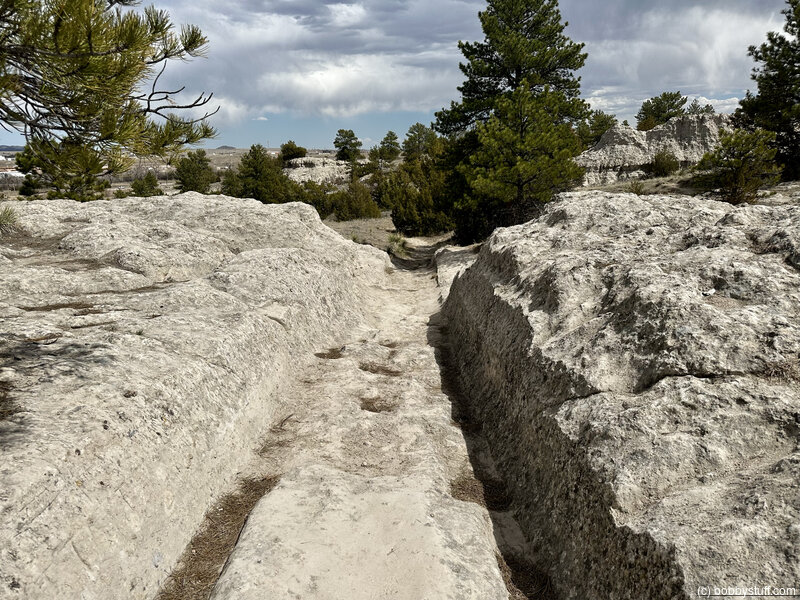
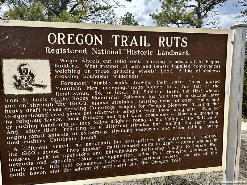
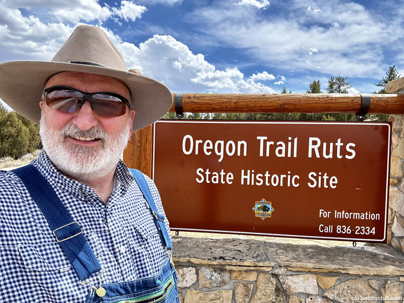
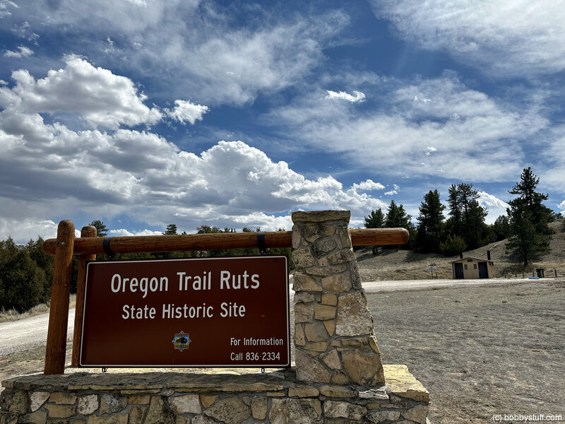
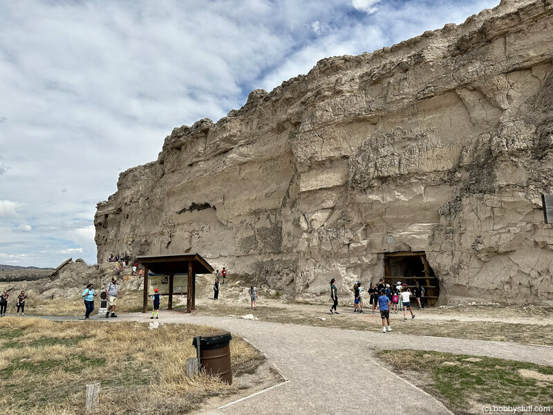
Oregon Trail Ruts State Historic Site and National Historic Landmark, Guernsey WY (A-11)
View a list of places like this or a map.nps.gov
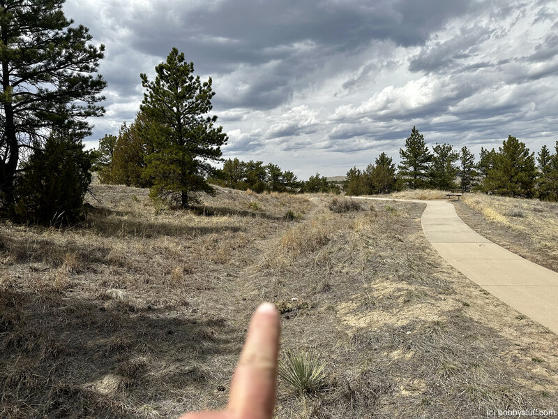
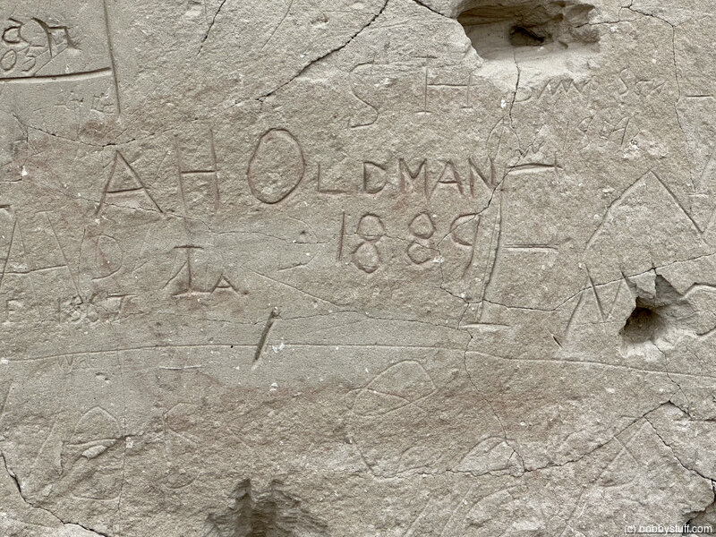
Oregon Trail Ruts State Historic Site and National Historic Landmark, also called the Guernsey Ruts and Deep Rut Hill boasts some of the deepest, most-photographed wagon ruts of the overland trails. Here, thousands of iron-shod wheels and hooves chewed tracks five to six feet deep into solid rock.
Bobby
Bobby
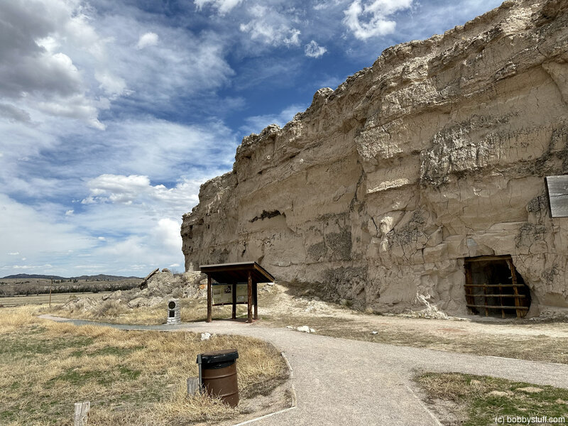
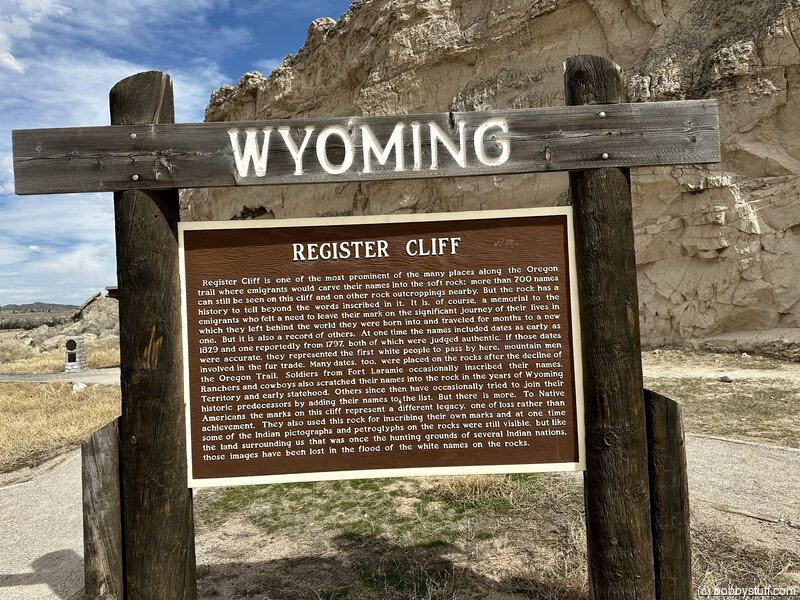
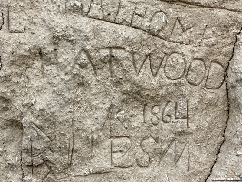
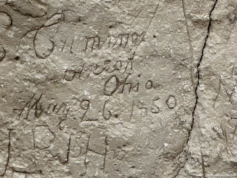
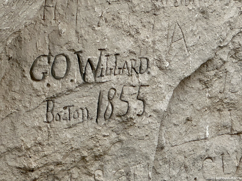
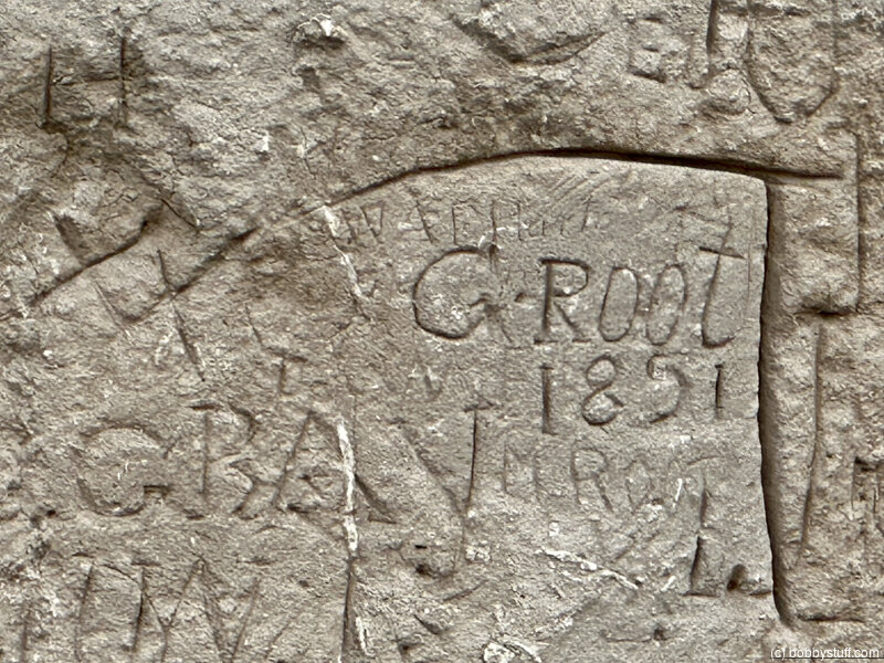
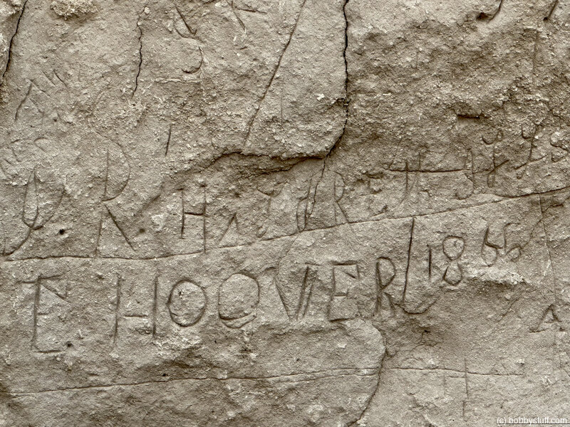
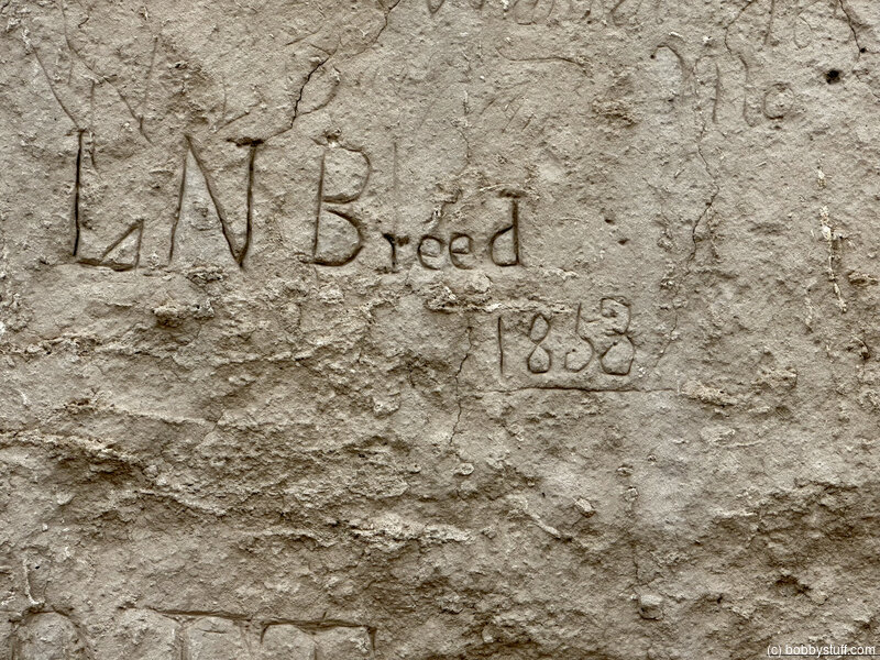
Register Cliff State Historic Site, Guernsey WY (A-13)
View a list of places like this or a map.nps.gov
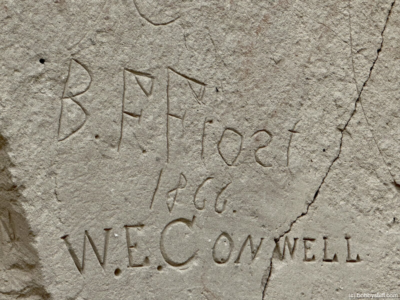
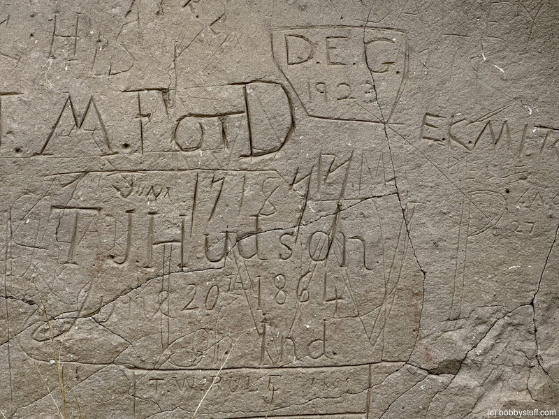
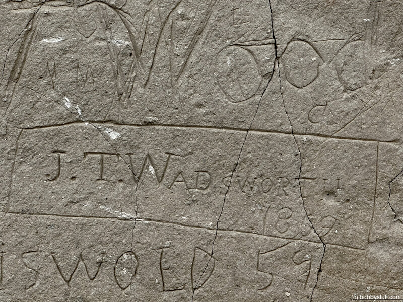
Register Cliff State Historic Site is a soft rock face where many emigrants carved their names. The cliff is defaced with modern graffiti, but the historical inscriptions at the east end (left, as you face the cliff) are protected by a tall wire fence. A pioneer cemetery with at least 3 graves is at the west end.
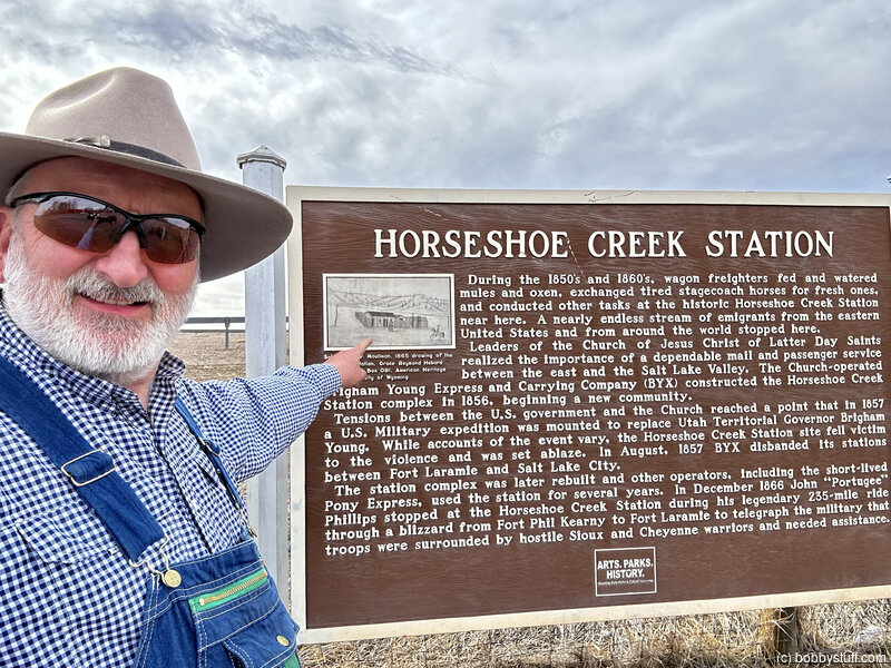
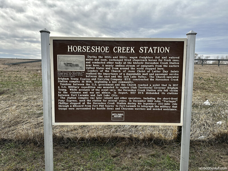
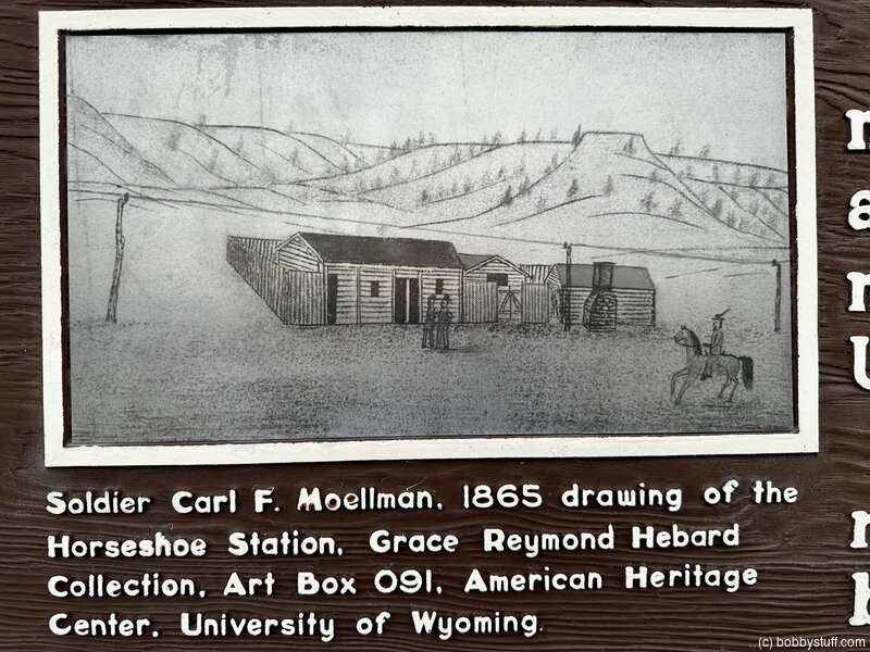
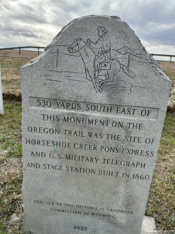
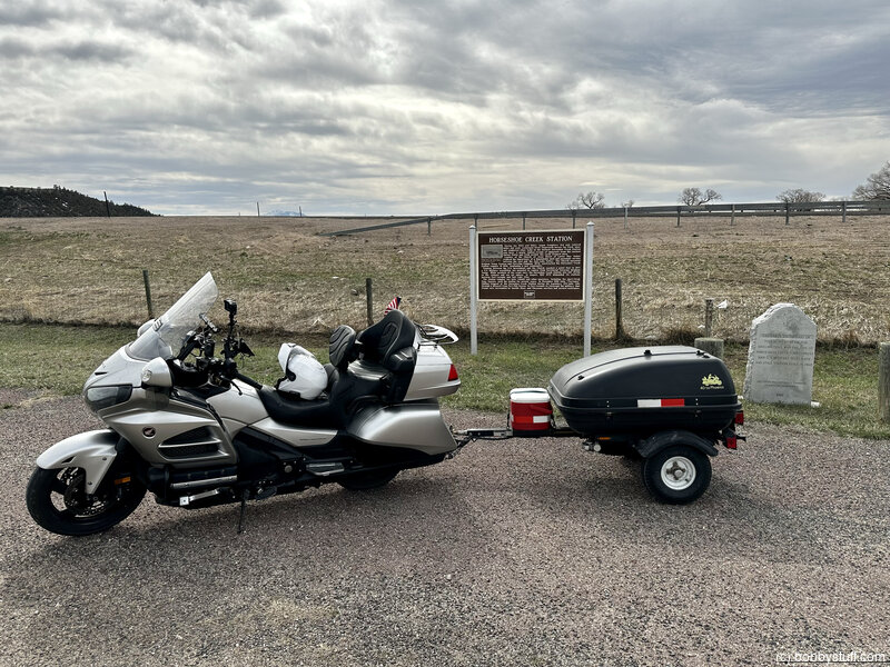
Horseshoe Creek Station, Glendo WY
View a list of places like this or a map.Historical Marker
Horseshoe Creek StationDuring the 1850s and 1860s, wagon freighters fed and watered mules and oxen, exchanged tired stagecoach horses for fresh ones, and conducted other tasks at the historic Horseshoe Creek Station near here. A nearly endless stream of emigrants from the eastern United States and from around the world stopped here.
Leaders of the Church of Jesus Christ of Latter Day Saints realized the importance of a dependable mail and passenger service between the east and the Salt Lake Valley. The Church-operated Brigham Young Express and Carrying Company (BYX) constructed the Horseshoe Creek Station complex in 1856, beginning a new community.
Tensions between the U.S. government and the Church reached a point that in 1857 a U.S. Military expedition was mounted to replace the Utah Territorial Governor Brigham Young. While accounts of the event vary, the Horseshoe Creek Station site fell victim to the violence and was set ablaze. In August. 1857 BYX disbanded its stations between Fort Laramie and Salt Lake City.
The station complex was later rebuilt and other operators, including the short-lived Pony Express, used the station for several years. In December 1866 John "Portugee" Phillips stopped at the Horseshoe Creek Station during his legendary 235-mile ride through a blizzard from Fort Phil Kearny to Fort Laramie to telegraph the military that troops were surrounded by hostile Sioux and Cheyenne warriors and needed assistance.
Bobby
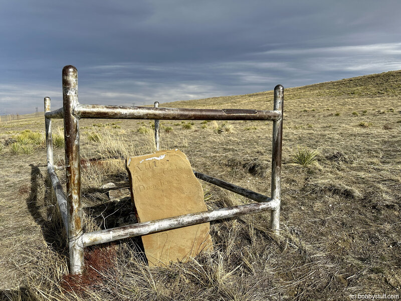
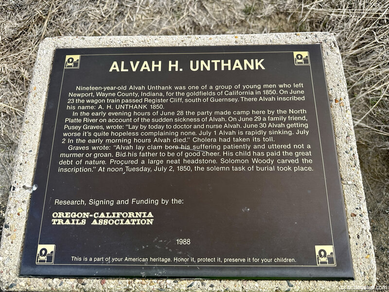
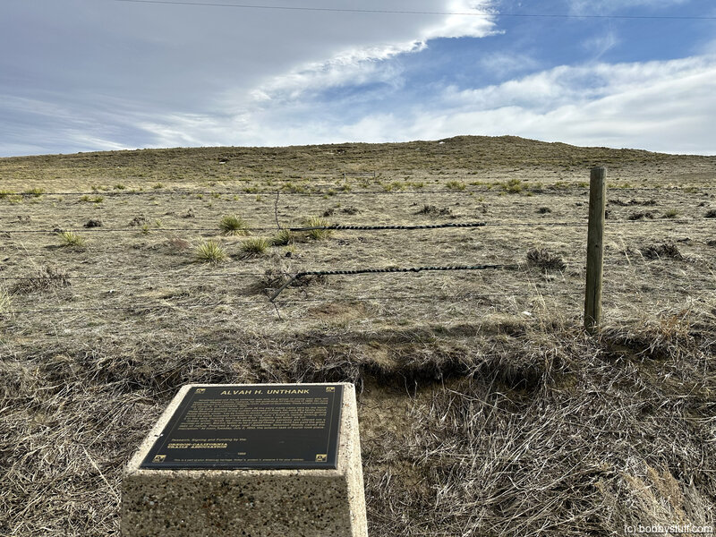
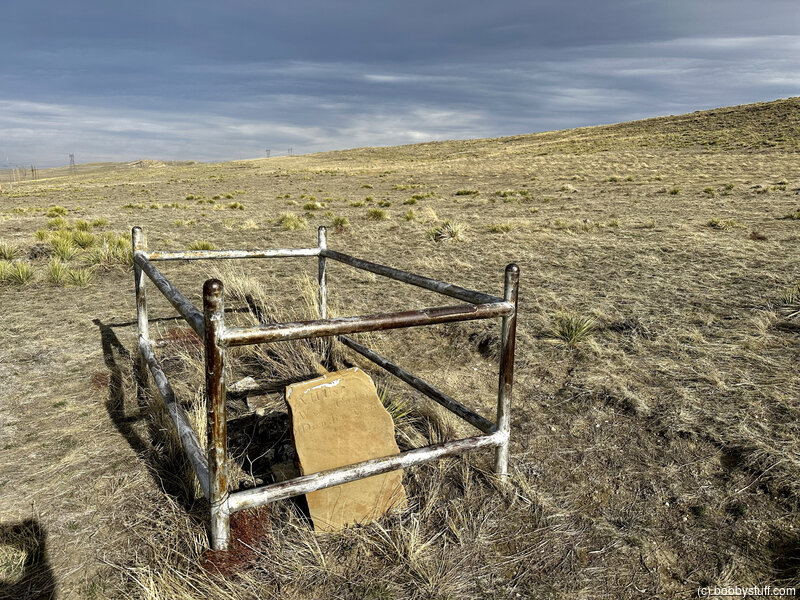
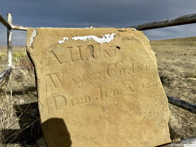
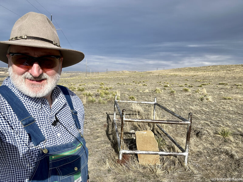
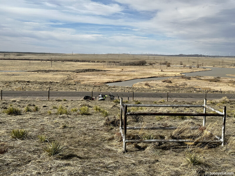
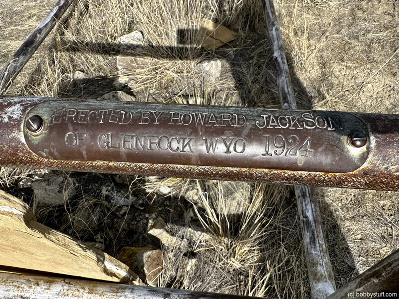
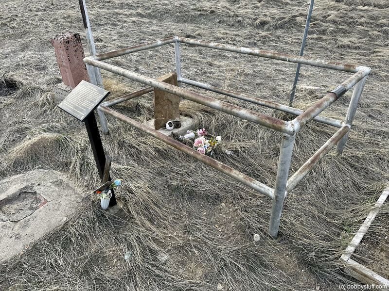
A H Unthank Grave, Glenrock WY
View a list of places like this or a map.Historical Marker
Alvah H. UnthankNineteen-year-old Alvah Unthank was one of a group of young men who left Newport, Wayne County, Indiana, for the goldfields of California in 1850. On June 23 the wagon train passed Register Cliff, south of Guernsey. There Alvah inscribed his name: A.H. UNTHANK 1850.
In the early evening hours on June 28 the party made camp here by the North Platte River on account of the sudden sickness of Alvah. On June 29 a family friend, Pusey Graves, wrote: "Lay by today to doctor and nurse Alvah. June 30 Alvah getting worse it's quite hopeless complaining none. July 1 Alvah rapidly sinking. July 2 in the early morning hours Alvah died." Cholera has taken its toll.
Graves wrote: "Alvah lay clam bore his suffering patiently and uttered not a murmer or groan. Bid his father to be of good cheer. His child has paid the great debt of nature. Procured a large neat headstone. Solomon Woody carved the inscription."
At noon Tuesday, July 2, 1850, the solemn task of burial took place.
Bobby
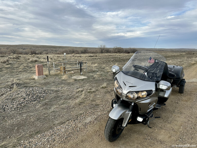
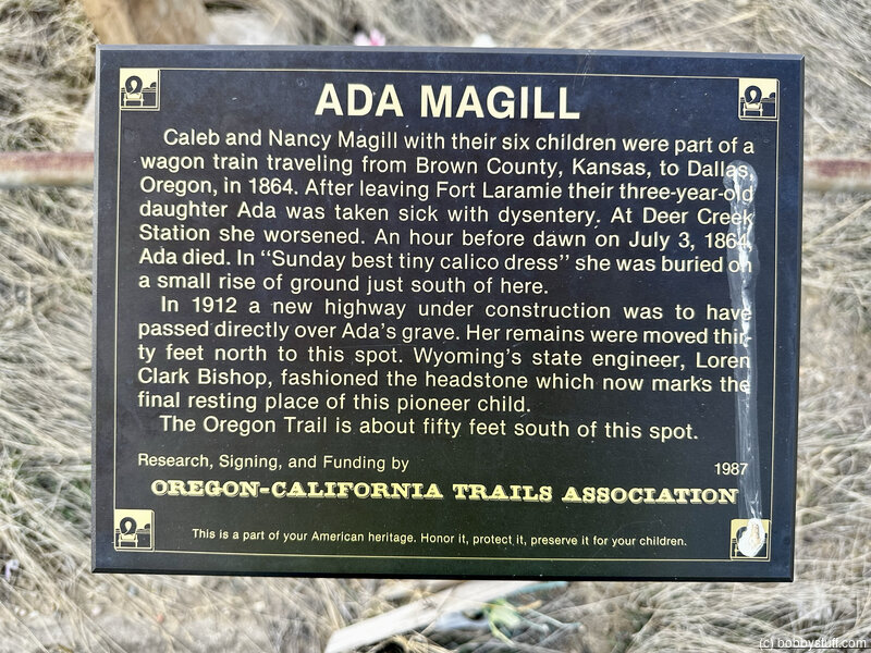
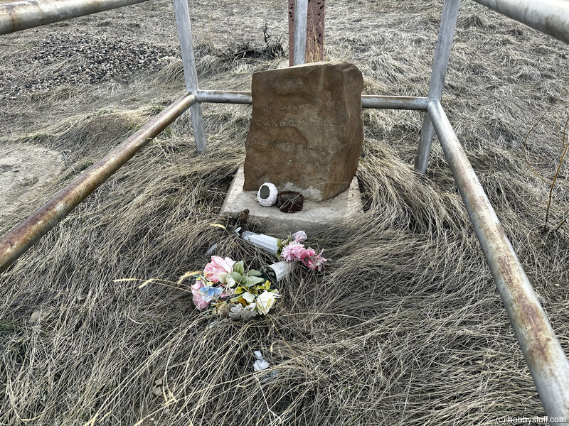
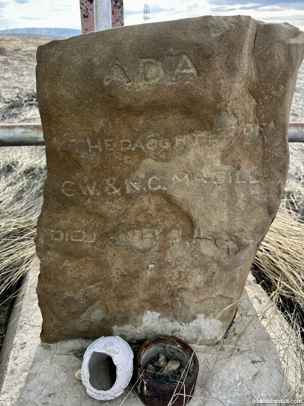
Ada Magill Grave, Parkerton WY (A-24)
View a list of places like this or a map.Historical Marker
Ada MagillCaleb and Nancy Magill with their six children were part of a wagon train traveling fro Brown County, Kansas, to Dallas, Oregon, in 1864. After leaving Fort Laramie their three-year-old daughter Ada was taken sick with dysentery. At Deer Creek Station she worsened. An hour before dawn on July 3, 1864, Ada died. In "Sunday best tiny calico dress" she was buried on a small rise of ground just south of here.
In 1912 a new highway under construction was to have passed directly over Ada's grave. Her remains were moved thirty feet north to this spot. Wyoming's state engineer, Loren Clark Bishop, fashioned the headstone which now marks the final resting place of this pioneer child.
The Oregon Trail is about fifty feet south of this spot
 Elevation Changes During the Day
The day started at 3,993 feet and ended at 5,185 feet. The highest altitude was 5,208 feet and the lowest altitude was 3,985 feet.
| Day 5 - North Platte NE to Morrill NE |
Topics
TagsConfederate Statues (32),Motorcycle (97),National Parks (9),Odd (1),Route 66 (33),Unemployment (6),Zombies (1)