Day 5 - North Platte NE to Morrill NE
| Miles for the Day: | 258 |
| Total Trip Miles: | 1995 |
| Start Point: | North Platte, NE |
| Sun Rise: | 7:10 AM CDT |
| Start Altitude: | 2848 feet |
| Start Weather: | At 6:00 AM CDT, the temperature was 48.8 degrees with 46 percent humidity. The conditions were clear. |
| End Point: | Morrill, NE |
| Sun Set: | 7:32 PM MDT |
| End Altitude: | 3989 feet |
| End Weather: | At 6:00 PM MDT, the temperature was 87.2 degrees with 10 percent humidity. The conditions were clear with a wind speed of 16.8 and wind gusts of 28.9. |
Table of Contents
 Google Map Track Log
 YouTube Video
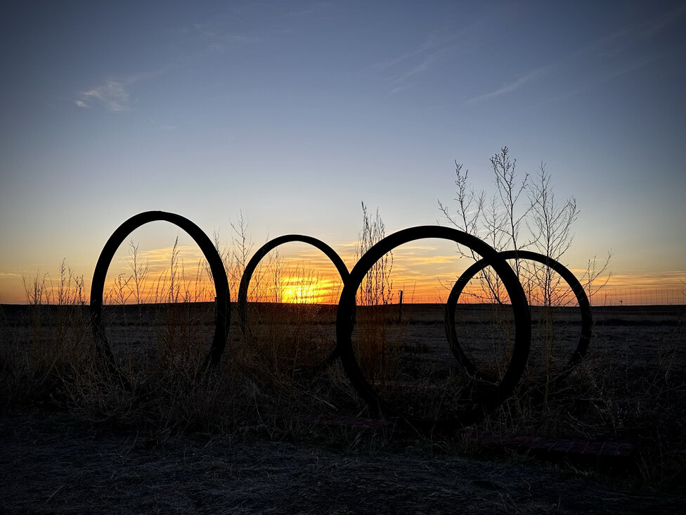
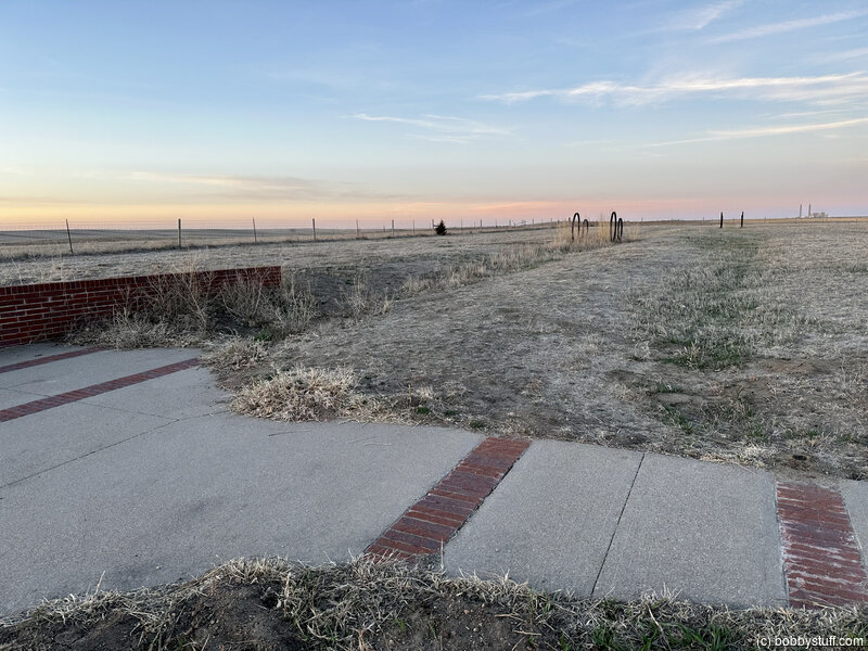
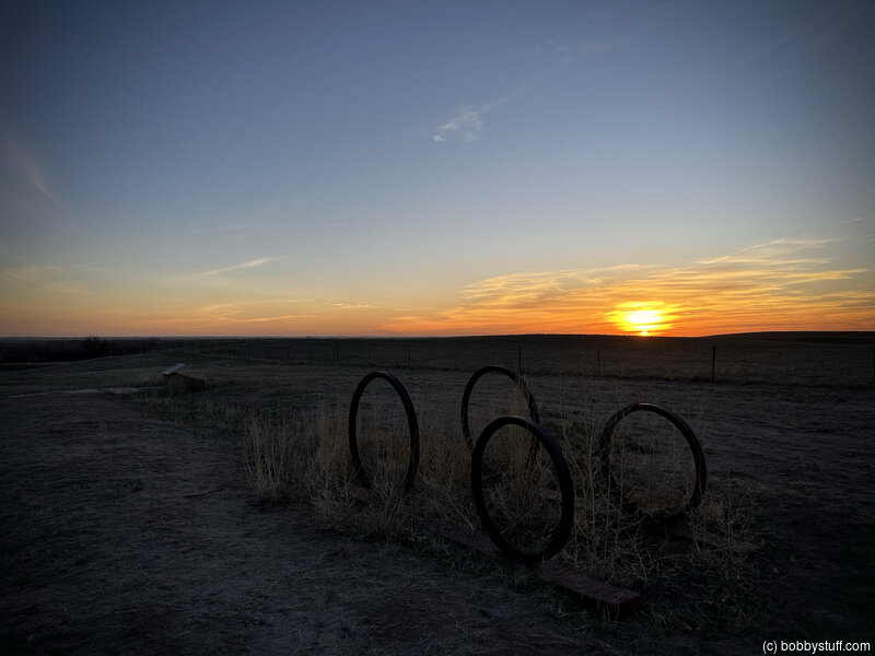
 O'Fallon's Bluff Trail Ruts and Interpretive Area, near Sutherland NE
View a list of places like this or a map.nps.gov
O'Fallon's Bluff is a section of bluffs about 20 miles long that sits next to the south side of the Platte River. The bluffs close proximity to the river forced the emigrant trails onto a narrow path that went up and over the bluffs. Over time, as thousands of wagons, emigrants, and livestock went up the rise, ruts were carved into the dry bluffs. These ruts are still visible today at Sutherland Rest Area, which is only accessible via I-80's eastbound lanes.
At the rest area, the ruts are marked by large iron loops that signify wagon wheels and interpretive panels tell the story of America's westward migration. This is a great place to stretch your legs and walk in the ruts of the Oregon Trail. Other amenities include restrooms, picnic tables, and a children's play area.
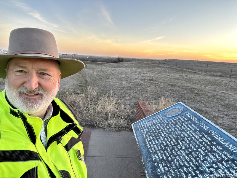
Bobby
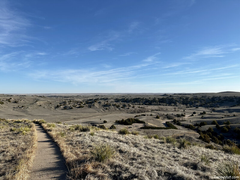
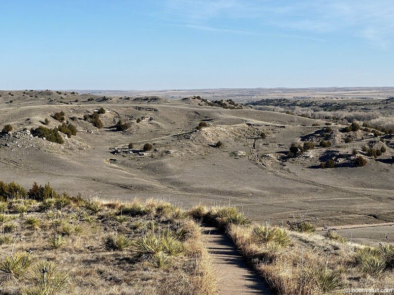
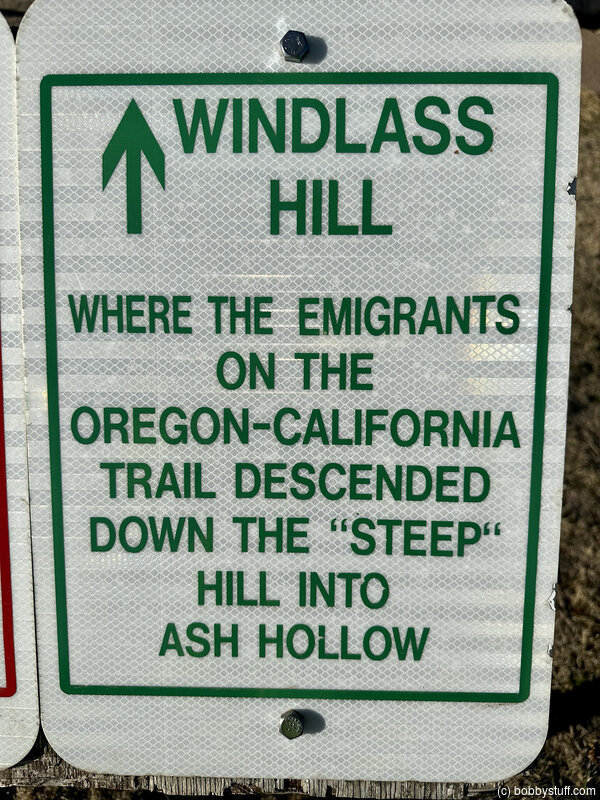
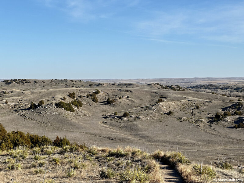
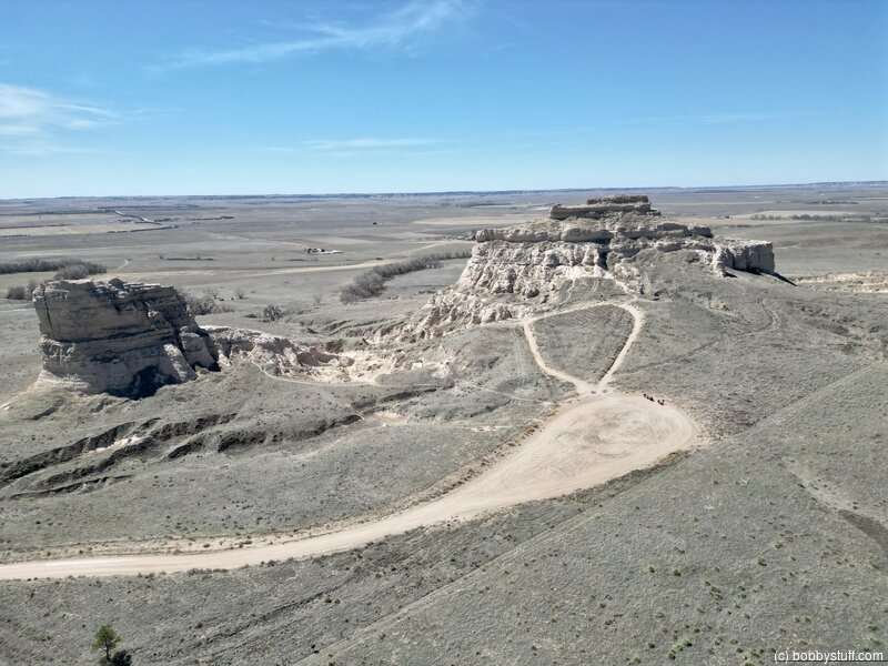
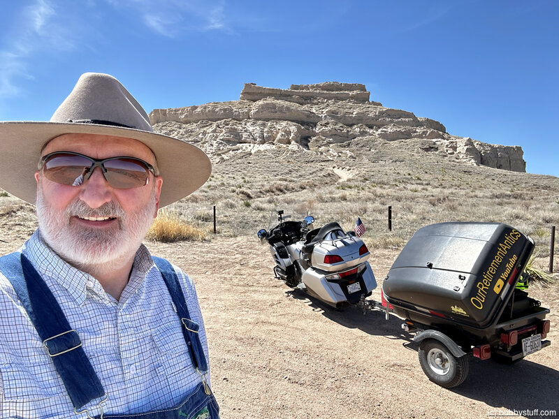
Windlass Hill, Lewellen NE
View a list of places like this or a map.nps.gov
Windlass Hill is scarred by deeply eroded ruts cut by thousands of wagons sliding downhill with their wheels locked. A paved (but steep) walking trail with outdoor exhibits leads visitors along the ruts to the top of the hill, where hikers are rewarded with a vista of Ash Hollow and the Platte River.
360 Photo !!!
Click and drag on the photo below to see a 360 view. Pinch to zoom in or out on your mobile device or use your mouse scroll wheel on your desktop. Click the box in the top left of the image to view in full screen.
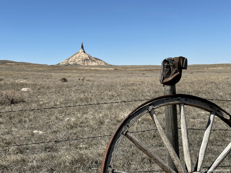
Boots on Fence Posts, Lewellen NE
View a list of places like this or a map.Just a fun place the boys and I visited first in 2007 and then Laurie, Tucker and I visited again in 2012. Why would someone put boots on top of fence posts?
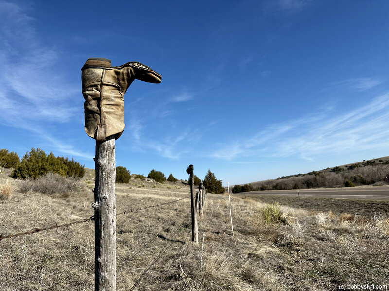
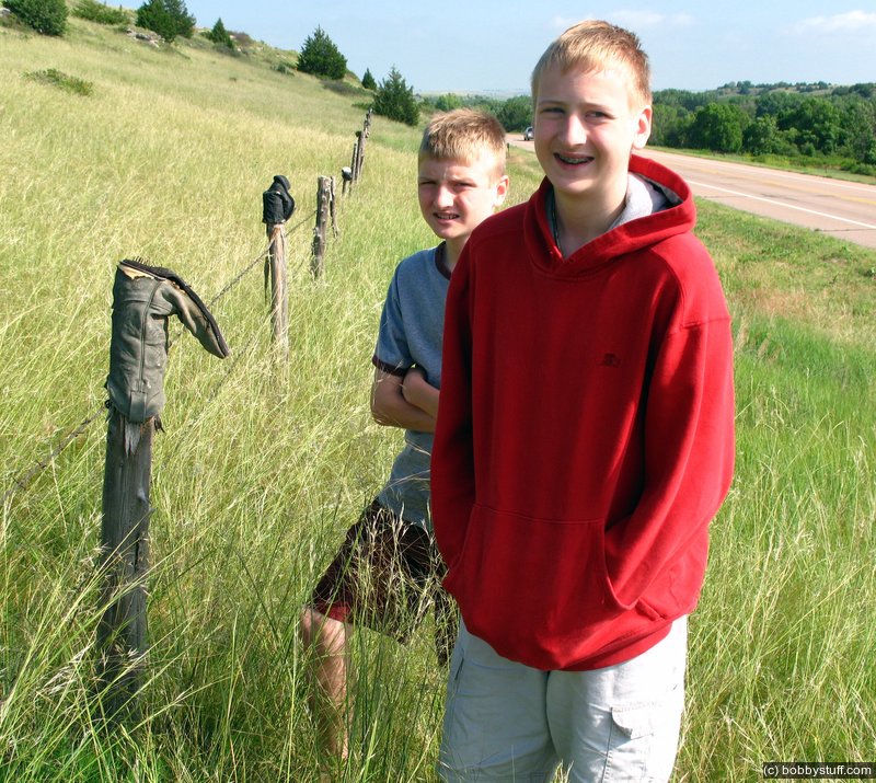
For several miles there was a worn out cowboy boot on the top of every fence post. US 26 on the North Platte River, Nebraska.
Tucker Riley, Bradley Taylor
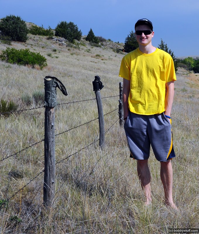
I had photos and GPS coordinates of this place from 2007. There are miles of fence posts with boots on top. We returned to the same boot we had photographed in 2007. It looked like it had not aged at all in 5 years.
Tucker Riley
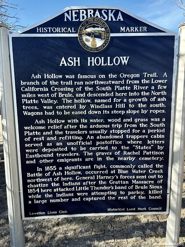
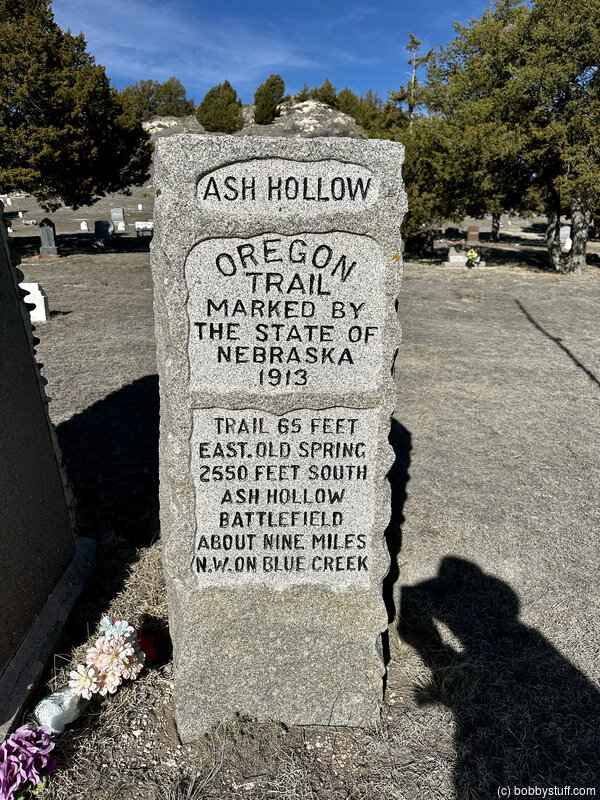
Ash Hollow Complex, Lewellen NE
View a list of places like this or a map.outdoornebraska.gov
Sweet spring water made Ash Hollow State Historical Park near Lewellen a major stopover on the Oregon and California trails and prompted prehistoric Indians to use it, too. Ruts etched by west-bound wagons are still visible on the bluffs. Today, the area's beauty and sweeping vistas continue to make this area a popular destination for vacationers and travelers. The history, archaeology and paleontology of the area are interpreted at the visitor center, Ash Hollow Cave and exhibits and structures.
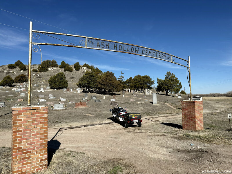
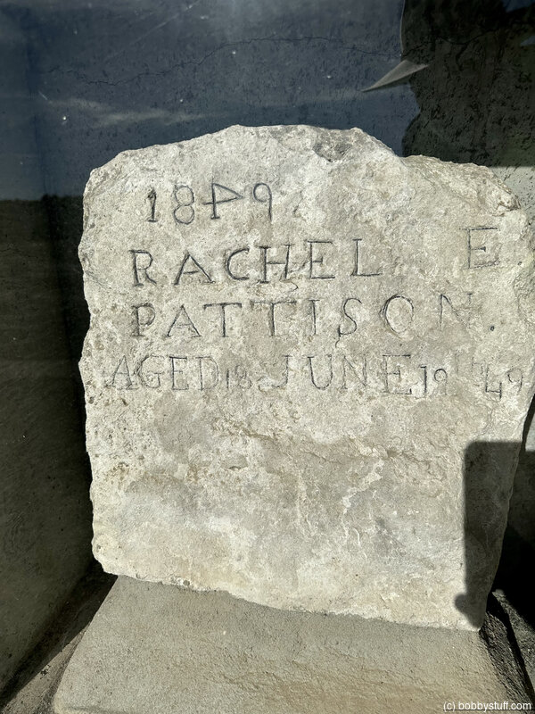
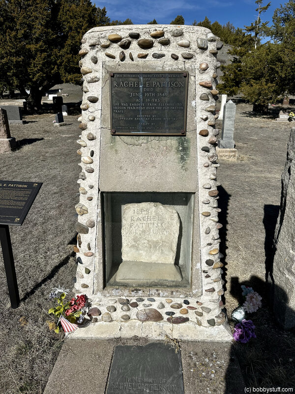
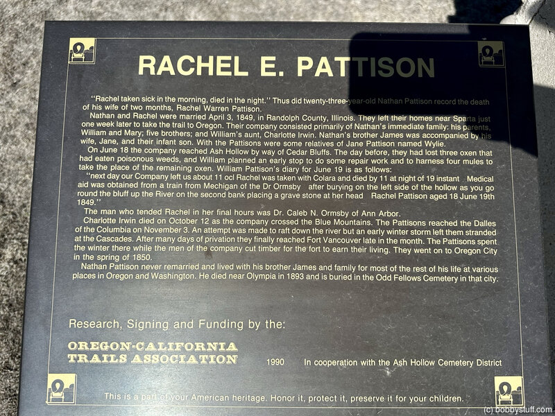
Pioneer Grave at Ash Hollow Cemetery, Lewellen NE
View a list of places like this or a map.nps.gov
Rachel Pattison was an 18-year-old bride of two months and on her way to Oregon when cholera took her life here in 1849. Her trailside grave was the beginning of this pioneer cemetery. To find her burial place, turn right toward the north end of the cemetery. A monument, which preserves her original gravestone, is near the flagpole.
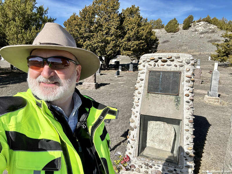
Bobby
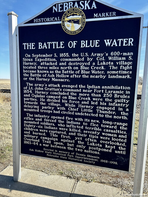
Blue Water Battlefield/Harney Massacre/Battle of Ash Hollow Historic Wayside, Lewellen NE
View a list of places like this or a map.nps.gov
In retaliation for the 1854 killing of 29 U.S. soldiers in Wyoming (the "Grattan Fight"), troops under General William Harney from Fort Kearny destroyed a Lakota Sioux village near here at Blue Creek the following year. Indian strikes against travelers and settlers along the Great Platte River Road in the 1860s were, in part, retribution for the killings at Blue Creek.
A Nebraska State Historical Society sign tells the story; the actual battlefield, not visible from the pullout, is on private land several miles distant from the road.
Historical Marker
On September 3, 1855, the U.S. Army's 600-man Sioux Expedition, commanded by Col William S. Harney, attacked and destroyed a Lakota village located three miles north on Blue Creek. The fight became known as the Battle of Blue Water, sometimes the Battle of Ash Hollow after the nearby landmark or the Harney Massacre.
The army's attack avenged the Indian annihilation of Lt. John Grattan's command near Fort Laramie in 1854. Harney concluded the more than 250 Brules and Ogalalas camped on Blue Creek were the guilty parties. He divided his force and led his infantry towards the village. While Harney engaged in a delaying parley with Chief Little Thunder, the mounted troops had circled undetected to the north.
The infantry opened fire with its new, long-range rifles and forced the Indians to flee towards the mounted soldiers, who inflicted terrible casualties. Eighty-six Indians were killed, seventy women and children captured, and their tipis were looted and burned. This first, yet often overlooked, military campaign against the Lakota kept the Overland Trail open, but only postponed until 1863-64 a war between the two nations.
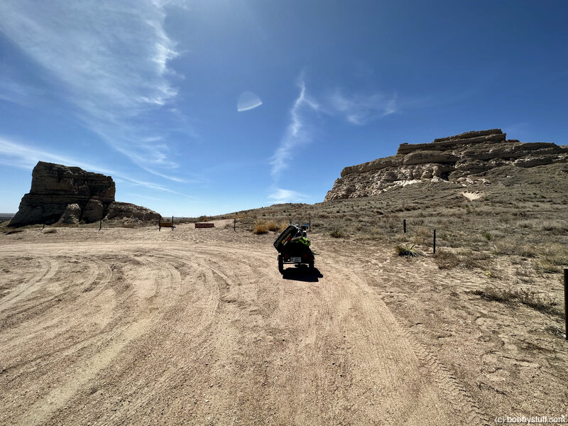
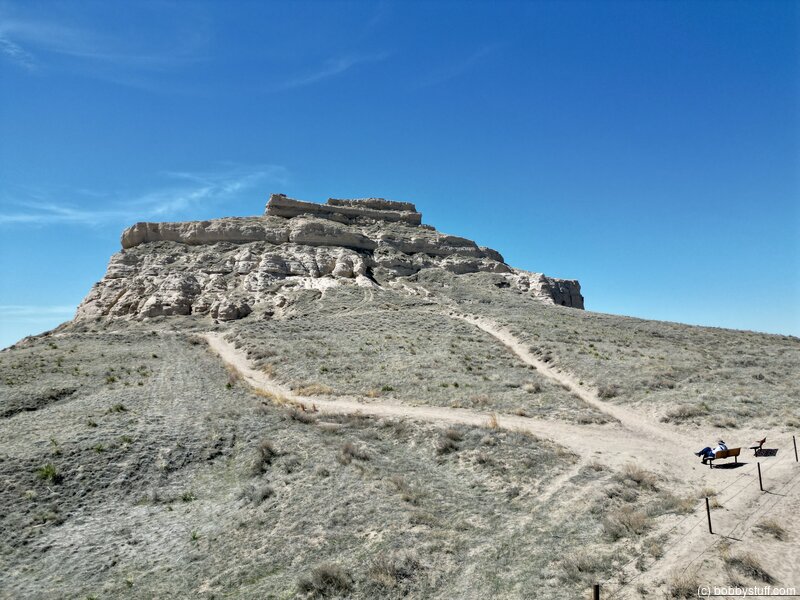
Courthouse and Jail Rocks, Bridgeport NE
View a list of places like this or a map.Historical Marker
from a nearby historical markerCourthouse and Jail Rocks are two rock formations located near Bridgeport in the Nebraska Panhandle.
The Oregon-California Trail, the Mormon Trail, the Pony Express Trail and the Sidney-Deadwood Trail all ran near the rocks. The pair of rock formations served as a landmark along the trails for many pioneers traveling west in the 19th century. Many travelers would stray as much as five miles from the Oregon Trail just to get a glimpse of the rocks.
Hundreds of westward-bound emigrants mentioned Courthouse Rock (originally also McFarlan's Castle) in their travel logs and journals. The name "Courthouse" was first used in 1837. In 1845, one traveler described the rock as "resembling the ruins of an old castle [which] rises abruptly from the plain....It is difficult to look upon it and not believe that art had something to do with its construction. The voyagers have called it the Courthouse; but it looks infinitely more like the Capitol."
Courthouse and Jail Rocks, which rise 400 feet (120 m) above the North Platte Valley, are composed of Brule clay, Gering sandstone and volcanic ash. The rock formations are listed in the National Register of Historic Places and in the Nebraska Natural Areas Register.
Bobby
360 Photo !!!
Click and drag on the photo below to see a 360 view. Pinch to zoom in or out on your mobile device or use your mouse scroll wheel on your desktop. Click the box in the top left of the image to view in full screen.
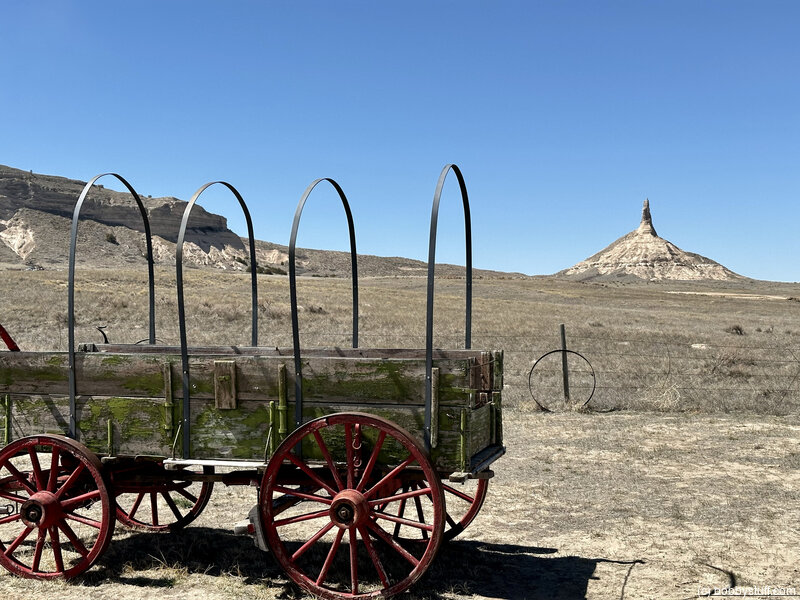
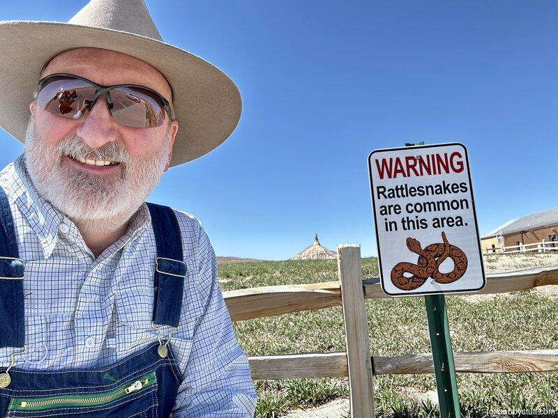
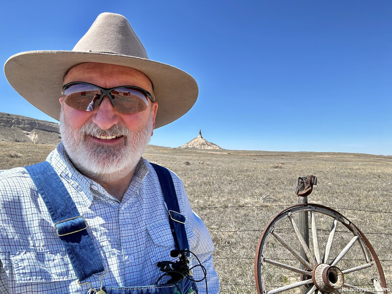
Chimney Rock National Historic Site, Bayard NE
View a list of places like this or a map.nps.gov
Travelers on the Mormon Pioneer Trail viewed this famous landmark from a distance, while those on the Oregon, California, and Pony Express Trails passed much closer. .pa Watch for a roadside pullout with a wayside exhibit (west of U.S. 26 where it turns north from state road 92, near milepost 47) telling of the first Mormons to view the feature.
Bobby
Bobby
Chimney Rock Historical Markers, Bayard NE
View a list of places like this or a map.Historical Marker
The Oregon TrailMarked by the State of Nebraska 1912 Chimney Rock S 56º 56' W. 9041 Ft
Historical Marker
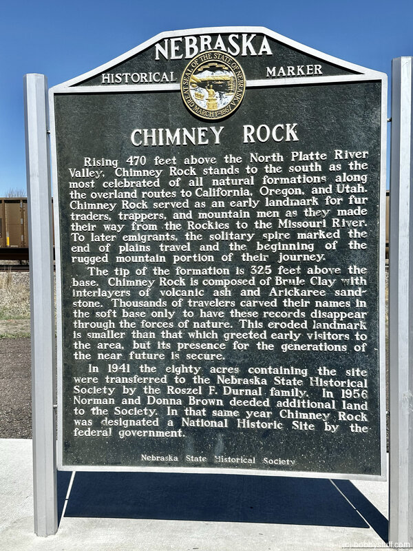
Chimney RockRising 470 feet above the North Platte River Vally, Chimney Rock stands to the south as the most celebrated of all natural formations along the overland routes to California, Oregon, and Utah. Chimney Rock served as an early landmark for fur traders, trappers, and mountain man as they made their way from the Rockies to the Missouri River. To later emigrants, the solitary spire marked the end of plains travel and the beginning of the rugged mountain portion of their journey.
The tip of the formation is 325 feet above the base. Chimney Rock is composed of Brule Clay with interlayers of volcanic ash and Arickaree sand-stone. Thousands of travelers carved their names in the soft base only to have these records disappear through the forces of nature. This eroded landmark is smaller than that which greeted early visitors to the area, but its presence for the generations of the near future is secure.
In 1941 the eighty acres containing the site were transferred to the Nebraska State Historical Society by the Roszel F. Durnal family. In 1956 Norman and Donna Brown deeded additional land to the society. In that same year Chimney Rock was designated a National Historical Site by the federal government
Historical Marker
Chimney Rock StationChimney Rock Station on the route of the Pony Express, was located near here between Chimney Rock and the North Platte River. This was an important Pony Express stop between stations at Court House Rock and Ficklins Springs.
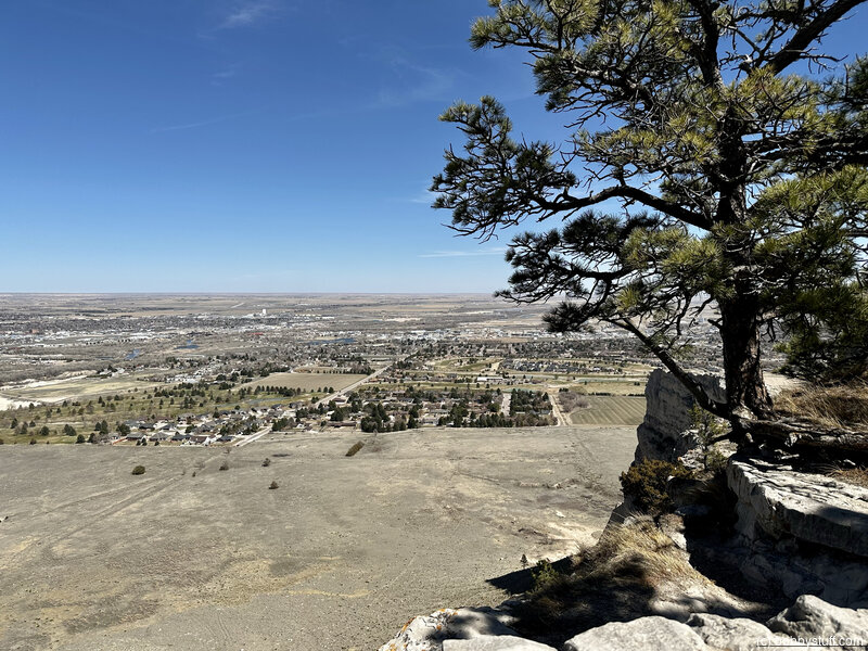
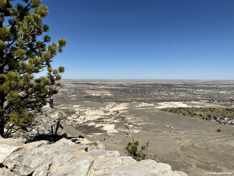
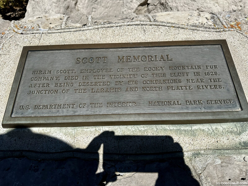
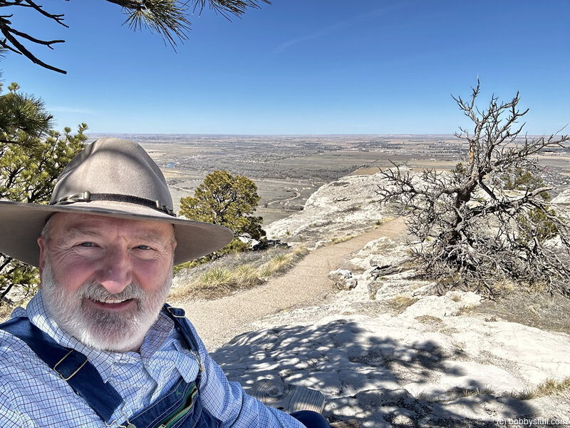
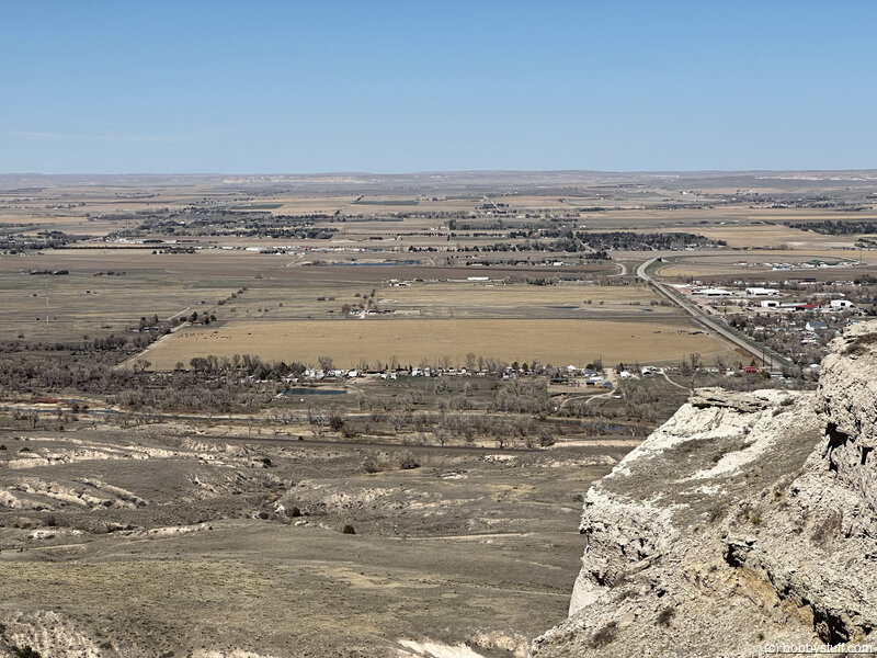
Scotts Bluff National Monument Visitor Center, Gering NE
View a list of places like this or a map.nps.gov
The first wagon trails skirted around this majestic geological formation, but a later route cut through at Mitchell Pass. Attractions include a visitor center with a trail museum and artwork by pioneer photographer and artist William Henry Jackson; a short hiking trail; and a paved driving route. Wagon swales are still visible
Bobby
360 Photo !!!
Click and drag on the photo below to see a 360 view. Pinch to zoom in or out on your mobile device or use your mouse scroll wheel on your desktop. Click the box in the top left of the image to view in full screen.
 Elevation Changes During the Day
The day started at 2,848 feet and ended at 3,989 feet. The highest altitude was 4,621 feet and the lowest altitude was 2,823 feet.
| Day 4 - Fairbury NE to North Platte NE |
Topics
TagsConfederate Statues (32),Motorcycle (98),National Parks (9),Odd (1),Route 66 (33),Unemployment (6),Zombies (1)