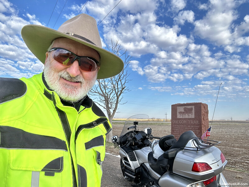
Day 4 - Fairbury NE to North Platte NE
| Miles for the Day: | 307 |
| Total Trip Miles: | 1737 |
| Start Point: | Fairbury, NE |
| Sun Rise: | 6:58 AM CDT |
| Start Altitude: | 1467 feet |
| Start Weather: | At 6:00 AM CDT, the temperature was 46 degrees with 74 percent humidity. The conditions were clear. |
| End Point: | North Platte, NE |
| Sun Set: | 8:17 PM CDT |
| End Altitude: | 2799 feet |
| End Weather: | At 6:00 PM CDT, the temperature was 76.9 degrees with 17 percent humidity. The conditions were clear. |
Table of Contents
 Google Map Track Log
 YouTube Video
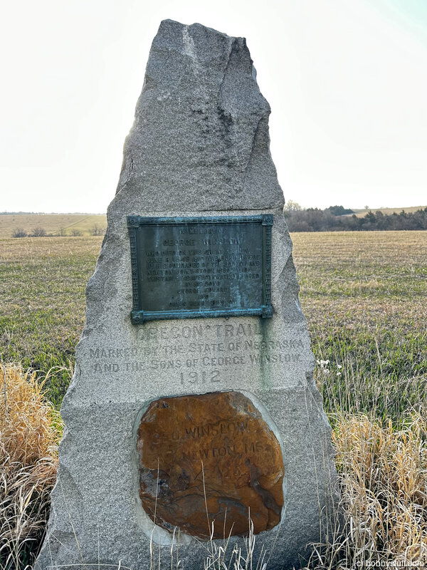
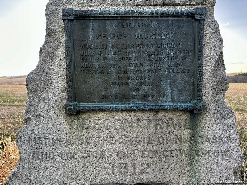
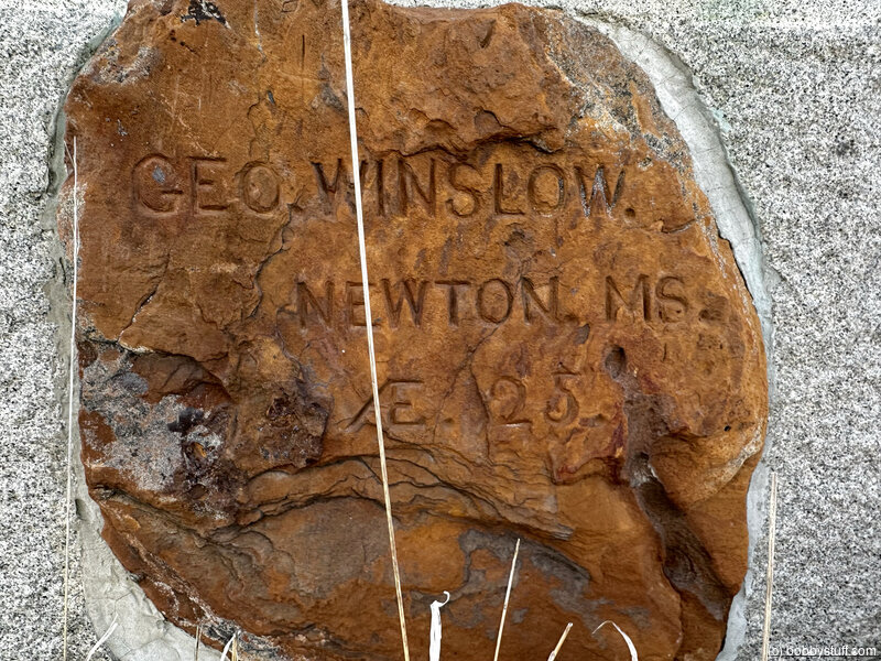
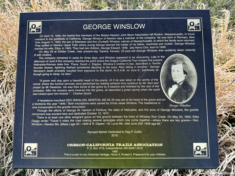
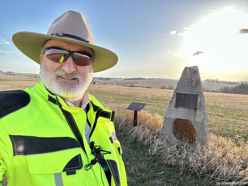
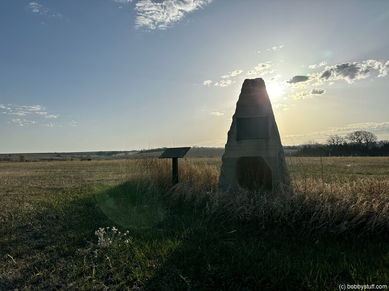
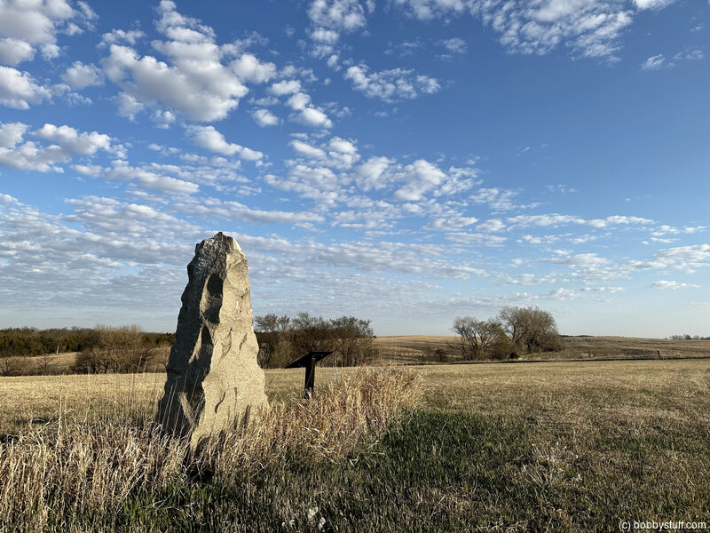
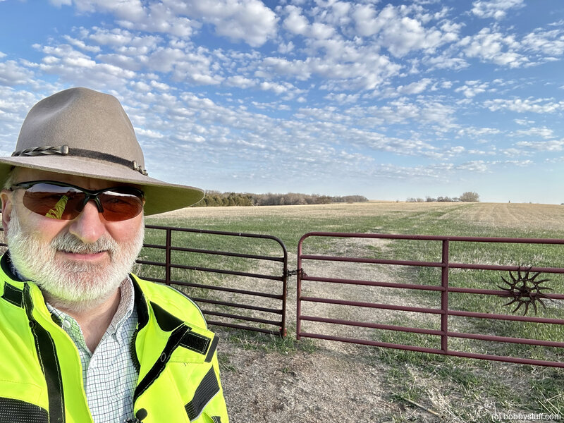
 George Winslow Grave
View a list of places like this or a map.49er George Winslow's trek to California ended here, where he died of cholera. His original gravestone is part of a larger monument that marks his burial place; a nearby interpretive sign tells the story. Multiple wagon ruts and swales of the Oregon and California Trails run southeast-to-northwest across the property, which never has been plowed. The ruts are best viewed in the autumn and winter months, after haying. The site is privately owned, but visitors are welcome and may enter by vehicle when the gate is open, or on foot when it is closed. Be sure to close the gate after entering on foot as livestock may be using the pasture. Open at owner's discretion.
Bobby
Bobby
360 Photo !!!
Click and drag on the photo below to see a 360 view. Pinch to zoom in or out on your mobile device or use your mouse scroll wheel on your desktop. Click the box in the top left of the image to view in full screen.
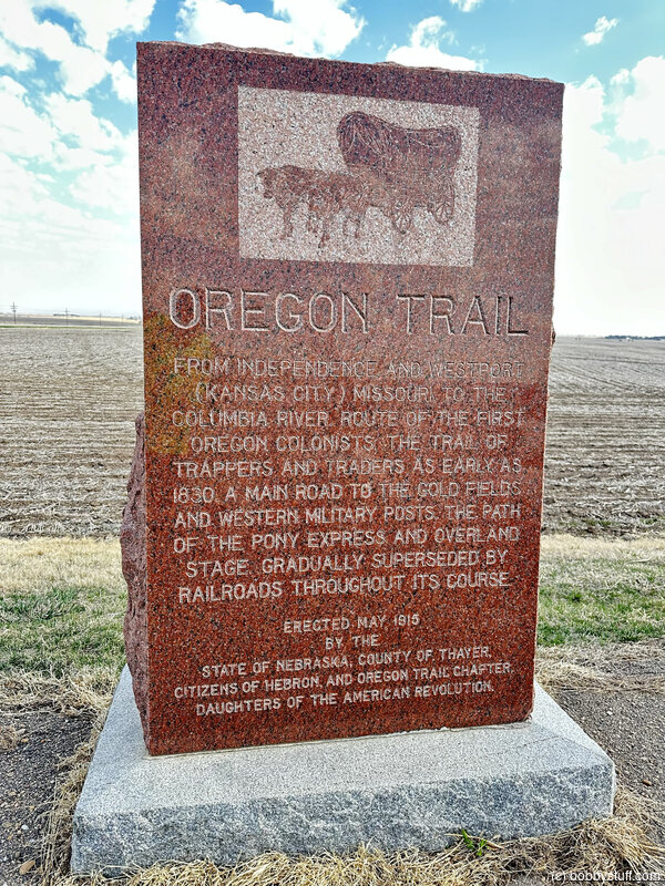
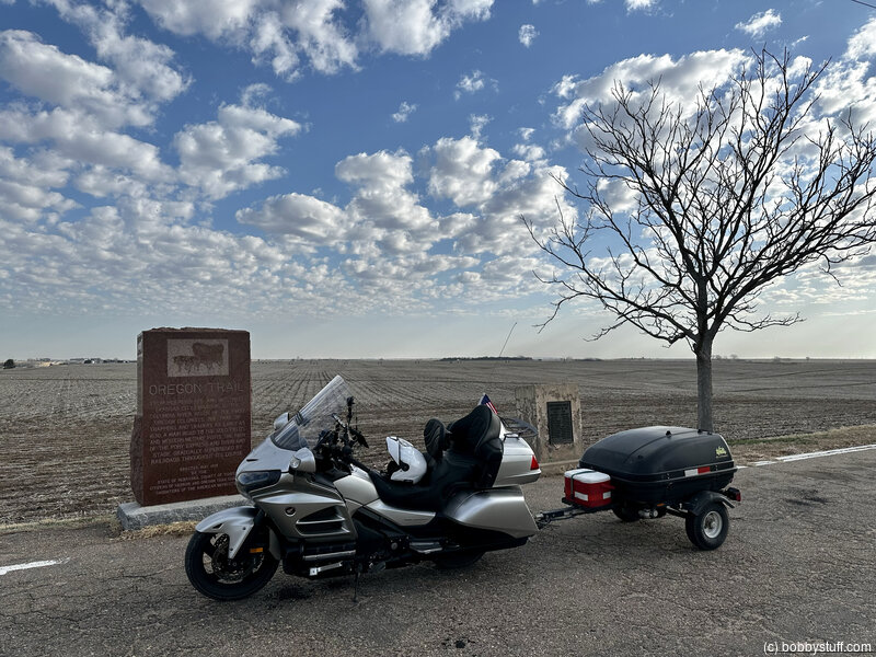
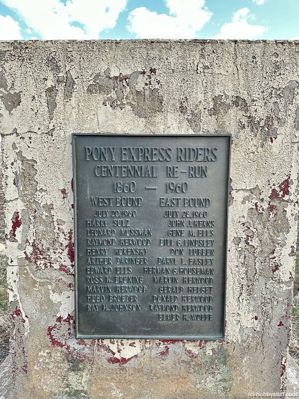
Hebron Roadside Park, Hebron NE
View a list of places like this or a map.Historical Marker
Oregon Trail - From independence and Westport (Kansas City) Missouri to the Columbia river. Route of the first Oregon colonists. The trail of trappers and traders as early as 1830. A main road to the gold fields and western military posts. The path of the Pony Express and overland stage gradually superseded by railroads throughout its course.
Erected May 1915 By the state of Nebraska, county of Thayer, Citizens of Hebron and Oregon Trail chapter. Daughters of the American Revolution.
Bobby
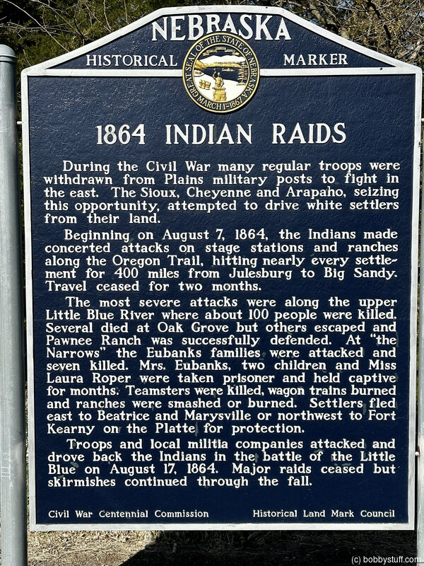
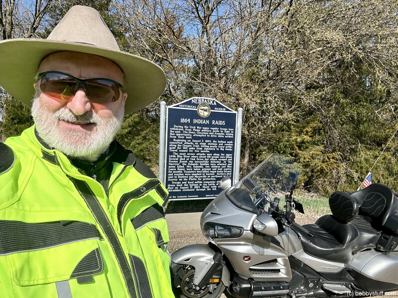
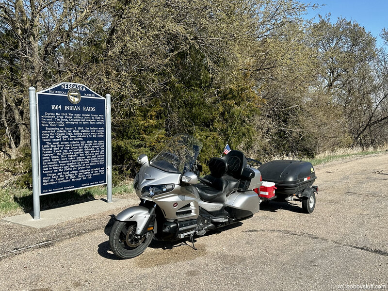
The 1864 Uprising, near Deweese NE
View a list of places like this or a map.nps.gov
A Nebraska State Historical Society interpretive marker provides more information about the 1864 uprising. There is also a granite marker 1/2 mile north across the Little Blue River. From the state marker, look east toward the hillside to see a series of parallel wagon ruts heading toward your location. Note, this is private property.
Historical Marker
1864 Indian Raids
During the Civil War many regular troops were withdrawn from Plains military posts to fight in the east. The Sioux, Cheyenne and Arapaho, seizing this opportunity, attempted to drive white settlers from their lands.
Beginning on August 7, 1864, the Indians made concerted attacks on stage stations and ranches along the Oregon Trail, hitting nearly every settlement for 400 miles from Julesburg to Big Sandy. Travel ceased for two months.
The most severe attacks were along the upper Little Blue River where about 100 people were killed. Several died at Oak Grove but others escaped and Pawnee Ranch was successfully defended. At "the Narrows" the Eubanks families were attacked and seven killed. Mrs. Eubanks, two children and Miss Laura Roper were taken prisoner and held captive for months. Teamsters were killed, wagon trains burned and ranches were smashed or burned. Settlers fled east to Beatrice and Marysville or northwest to Fort Kearney on the Platte for protection.
Troops and local militia companies attacked and drove back the Indians in the battle of the Little Blue on August 17, 1864. Major raids ceased but skirmishes continued through the fall.
Bobby
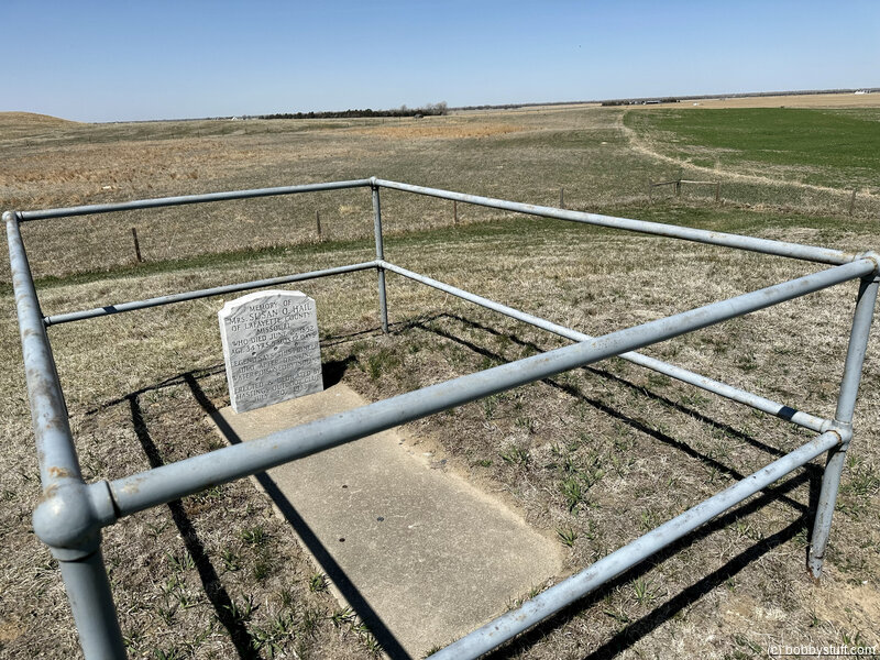
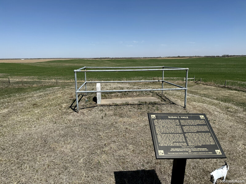
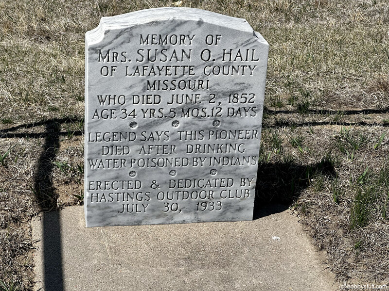
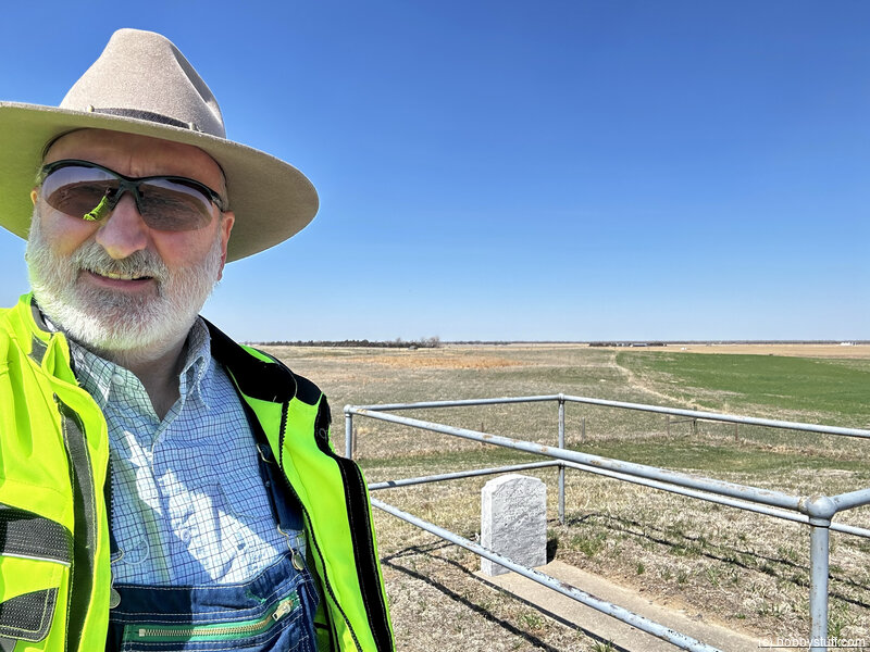
Susan Hail Grave, Kenesaw NE
View a list of places like this or a map.Historical Marker
Memory of Mrs. Susan O. Hail of Lafayette County Missouri who died June 2, 1852
Age 34 yrs. 5 mos. 12 days
Legend says this pioneer died after drinking water poisoned by Indians
Erected & dedicated by Hastings Outdoor Club
July 30, 1933
Historical Marker
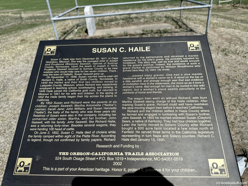
Susan C. Haile was born December 20, 1817, in Cape Girardeau, Missouri. She was the youngest child of Joseph and Prudence (Bledsoe) Seawell, natives of Sumner County, Tennessee. Upon the death of Joseph in 1819, Prudence Seawell returned to Sumner County to be near relatives who would help care for her seven children. There, near the town of Gallatin, Susan Seawell grew up.
On November 17, 1836, Susan married twenty-year-old Richard C. Haile, a native of Smith County, Tennessee. In 1840 the Hailes and their first two children moved to Lafayette County, Missouri, where Richard was respectively employed in teaching school, bookkeeping, and clerking. In 1849 Haile joined the California gold rush, but returned to Missouri in 1851 for his wife and children. In the spring of 1852 the Haile family began their trip across the plains to California.
By 1852 Susan and Richard were the parents of six children: Joseph Seawell; Martha Antoinette ("Nettie"); Leaman; Sarah Jane; John William; and Susan Henrietta ("Hettie"), the baby of the family who was three years old. Relatives of Susan were also in the company, including her unmarried older sister, Martha, and her brother, John Seawell, with his family. John Seawell, like Richard Haile, was a returning forty-niner. Besides several wagons, they were herding 100 head of cattle.
On June 2, 1852, Susan C. Haile died of cholera while the family camped within sight of the Platte River. According to legend, though not confirmed by family papers, Richard returned to the settlements and obtained a marble headstone for his wife's grave. He probably traveled by horseback. This story may well be true and would account for the grave's survival. Indeed, the existence of such a grave marker is confirmed by William Woodhams who arrived here May 10, 1854. He wrote:
....passed many graves. One had a nice marble headstone with a woman's name on it. It stood on the top of a little sandhill, and strange enough was that sad evidence of civilization here in the wilderness, the more so as it bore a woman's name. Bad enough for man to be buried in this wild region, but a woman's place seems peculiarly in the comforts of home and friends.The wagon train went on without Richard, with Aunt Martha Seawell taking charge of the Haile children. After marking Susan's grave, Richard could well have overtaken the slow-moving wagon train before it reached California.
Richard and the children settled in Napa County where he farmed and engaged in lumbering with Susan's brother, John Seawell. In 1853 he married widowed Susan (Clayton) Sears, a native of Kentucky. They had four children together. Later the family moved to Solano County after Richard bought a 500 acre farm located a few miles north of Fairfield. He served three terms in the California legislature representing in turn Napa and Solano counties. Richard C. Haile died January 13, 1890.
Research and Funding by The Oregon-California Trails Association, 2002. This is a part of your American heritage. Honor it, protect it, preserve it for your children.
Bobby
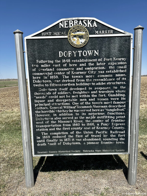
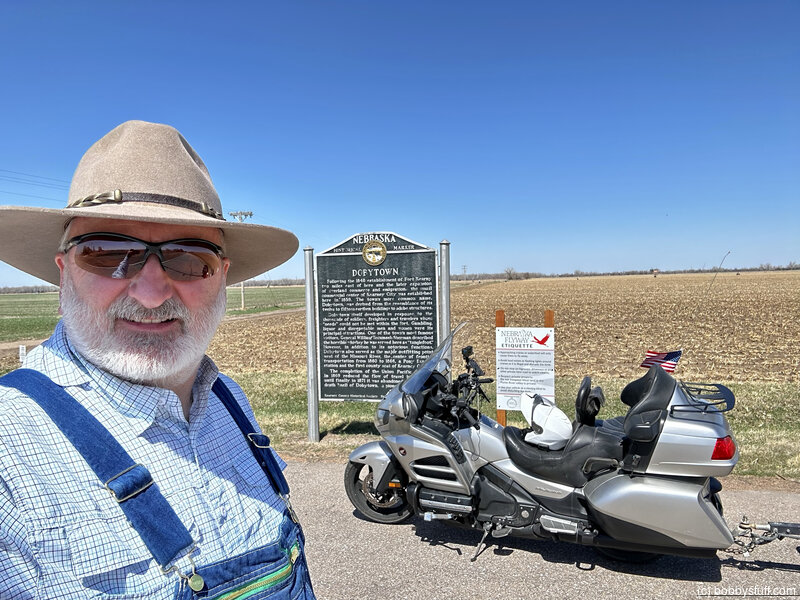
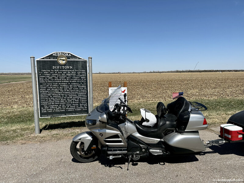
Dobytown Historical Marker, Gibbon NE
View a list of places like this or a map.Historical Marker
Following the 1848 establishment of Fort Kearny two miles east of here and the later expansion of overland commerce and emigration, the small commercial center of Kearney City was established here in 1859. The town's more common name, Dobytown, was derived from the resemblance of its twelve to fifteen earthen buildings to adobe structures.
Dobytown itself developed in response to the thousands of soldiers, freighters and travelers whose "needs" could not be met within the fort. Gambling, liquor and disreputable men and women were its principal attractions. One of the town's most famous visitors, General William Tecumseh Sherman described the horrible whiskey he was served here as "tanglefoot." However, in addition to its notorious functions, Dobytown also served as the major outfitting point west of the Missouri River, the center of frontier transportation from 1860 to 1866, a Pony Express station and the first county seat of Kearney County.
The completion of the Union Pacific Railroad in 1869 reduced the flow of travel by the fort until finally in 1871 it was abandoned, souncing the death knell of Dobytown, a pioneer frontier town.
Bobby
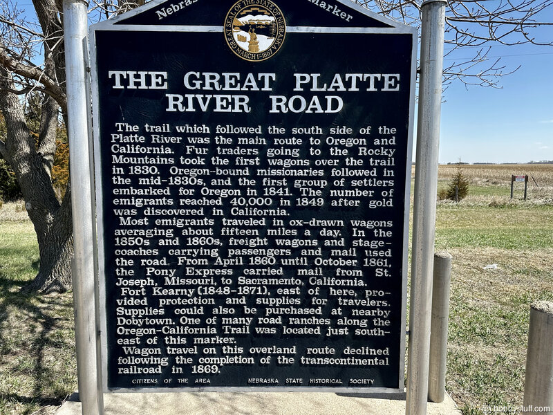
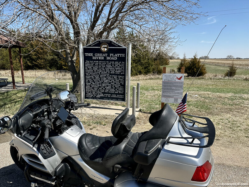
Great Platte River Rd Historical Marker, Kearney NE
View a list of places like this or a map.Historical Marker
The Trail Which followed the south side of the Platte River was the main route to Oregon and California. Fur traders going to the Rocky Mountains took the first wagons over the trail in 1830. Oregon-bound missionaries followed in the mid-1830s, and the first group of settlers embarked for Oregon in 1841. The number of emigrants reached 40,000 in 1849 after gold was discovered in California.
Most emigrants traveled in ox-drawn wagons averaging about fifteen miles a day. In the 1850s and 1860s, freight wagons and stagecoaches carrying passengers and mail used the road. From April 1860 until October 1861, the Pony Express carried mail from St. Joseph, Missouri, to Sacramento, California.
Fort Kearny (1848-1871), east of here, provided protection and supplies for travelers. Supplies could also be purchased at nearby Dobytown. One of many road ranches along the Oregon-California trail was located just southeast of this marker.
Wagon travel on this overland route declined following the completion of the transcontinental railroad in 1869.
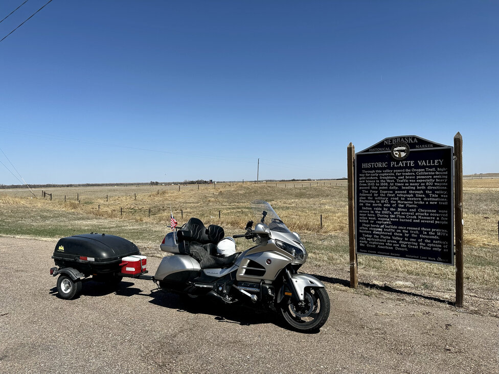
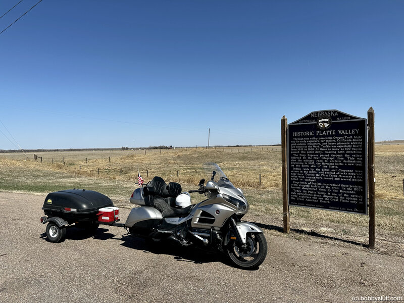
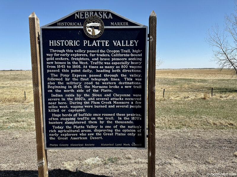
Historic Platte Valley, Holdrege NE
View a list of places like this or a map.Historical Marker
Through this valley passed the Oregon Trail, highway for early explorers, fur traders, California-bound gold seekers, freighters, and brave pioneers seeking new homes in the West. Traffic was especially heavy from 1843 to 1866. At times as many as 800 wagons passed this point daily, heading both directions.
The Pony Express passed through the valley, followed by the first telegraph lines. This was also the military road to western destinations. Beginning in 1847, the Mormons broke a new trail on the north side of the Platte.
Indian raids by the Sioux and Cheyenne were severe in the 1860's, and several attacks occurred near here. During the Plum Creek Massacre a few miles west, wagons were burned and several people killed or captured.
Huge herds of buffalo once roamed these prairies, often stopping traffic on the trail. In the 1870's hunters slaughtered them by the thousands.
Today the Platte Valley is one of the nation's rich agricultural areas, disproving the opinion of early explorers who saw the Great Plains only as the Great American Desert.
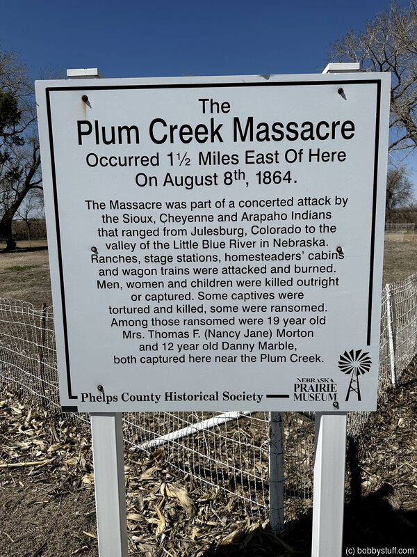
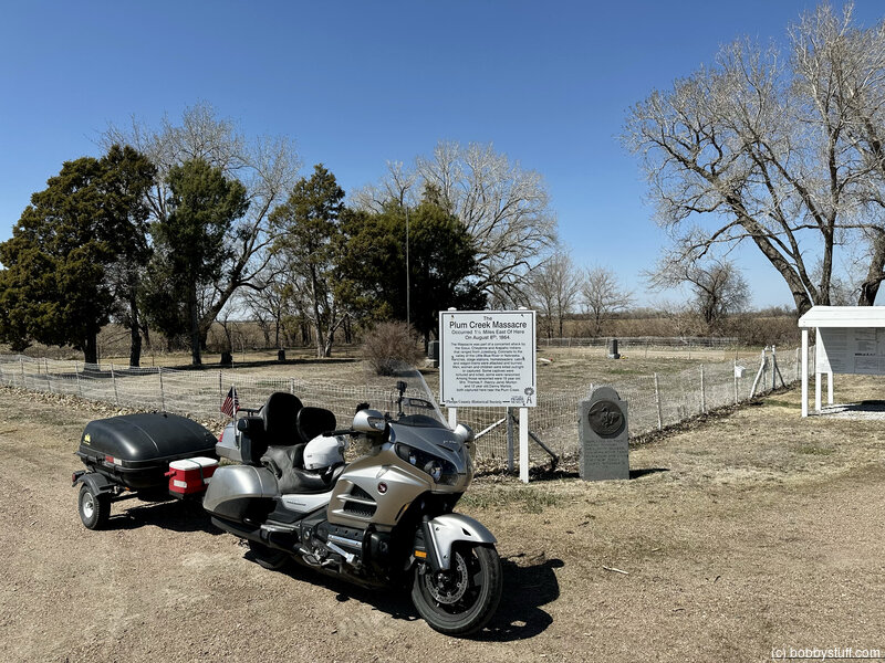
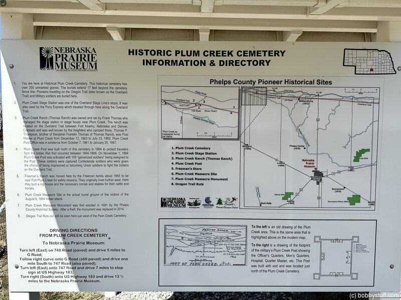
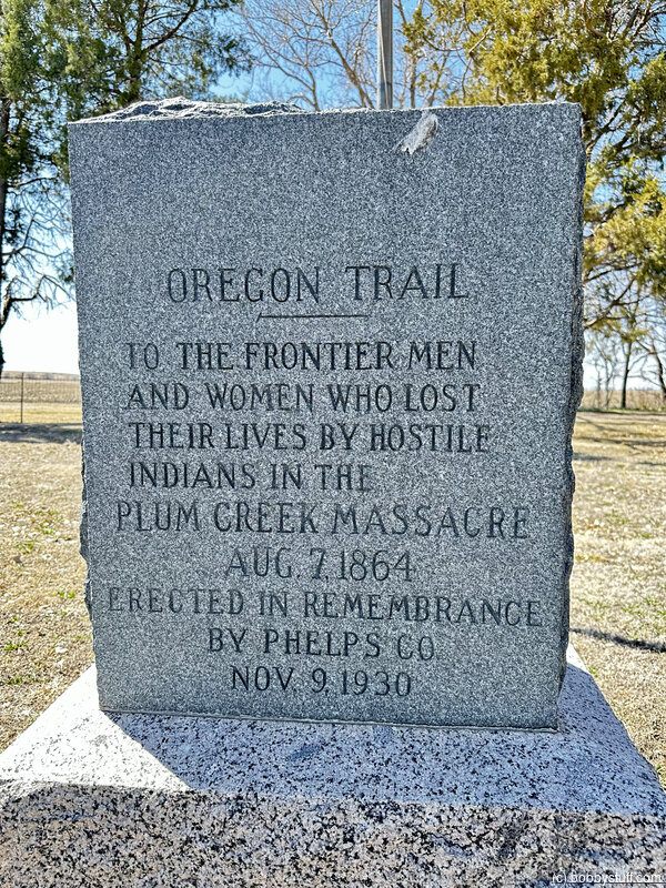
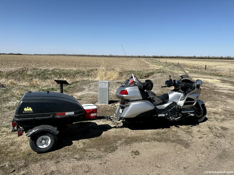
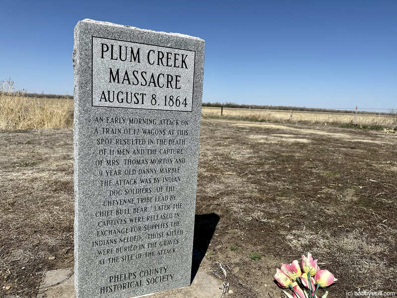
Plum Creek Massacre Site and Cemetery, Bertrand NE
View a list of places like this or a map.Historical Marker
An early morning attack on a train of 12 wagons at this spot resulted in the death of 11 men and the capture of Mrs. Thomas Morton and 9 year old Danny Marble. The attack was by Indian "Dog Soldiers" of the Cheyenne Tribe led by Chief Bull Bear. Later the captives were released in exchange for supplies the Indians needed. Those killed were buried in graves at the site of the attack.
Historical Marker
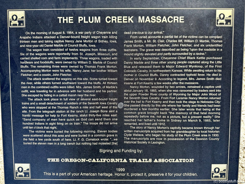
On the morning of August 8, 1864, a war party of Cheyenne and Arapaho Indians attacked a Denver-bound freight wagon train killing thirteen men and taking captive Nancy Jane Morton of Sidney, Iowa, and nine-year old Daniel Marble of Council Bluffs, Iowa.
The wagon train consisted of twelve wagons from three outfits. Six of the wagons were reportedly from St. Joseph, Missouri, and carried shelled corn and farm implements. Three wagons, loaded with hardware and foodstuffs, were owned by William D. Marble of Council Bluffs. The remaining three were owned by Thomas Frank Morton. Accompanying Morton were his wife, Nancy Jane; her brother William Fletcher, and a cousin, John Fletcher.
The attack scattered the wagons on this site. Some turned toward the river, while others turned southward toward the bluffs. All thirteen men in the combined outfits were killed. Mrs. James Smith, of Marble's outfit, was traveling far in advance with her husband and his partner. They escaped by hiding in a cattail marsh near the river.
The attack took place in full view of several east-bound freight trains and a small detachment of soldiers of the Seventh Iowa Cavalry. They were stopped at the Thomas Ranch a mile and half west of this site. From the telegraph station at the ranch Lt. Joseph Bone sent a frantic message for help to Fort Kearny, about thirty-five miles east; "and the company of men here quick as God can send them one hundred Indians in sight firing on ox train." The troops did not arrive until ten o'clock that night.
The victims were buried the following morning. Eleven bodies were scattered about this area and were buried in a common grave in a field a few yards south of here. Lt. F.G. Comstock wrote: "…we buried the men in a long trench but nothing had molested (the) dead previous to our arrival."
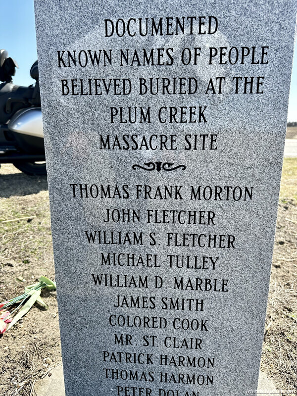
From varied accounts a partial list of the victims can be compiled: James Smith, A Mr. St. Clair, Charles Hiff, William D. Marble, Thomas Frank Morton, William Fletcher, John Fletcher, and six unidentified teamsters. The grave was described as being "upon the roadside in a mound slightly elevated and partly surrounded by a ravine."
In early September, Cheyenne Chief Black Kettle purchased Danny Marble and three other young people captured along the Little Blue and released them to Major Edward Wynkoop, of the First Colorado Cavalry, in northwestern Kansas. While awaiting return to his mother in Council Bluffs, Danny contracted typhoid fever. He died in Denver on November 9. According to legend, Mrs. James Smith died insane at Fort Kearny a few weeks after the massacre.
Nancy Morton, wounded by two arrows, remained a captive until about January 18, 1865, when she was ransomed by traders sent into the upper Powder River country at Wyoming by Major John Wood of the Seventh Iowa Cavalry. From Fort Laramie Nancy Morton returned over the trail to Fort Kearny and then took the stage to Nebraska City. She passed directly by this site where her family and friends had been murdered a few months earlier. She later wrote that being at the common grave brought back "the memory of that fatal morning repeatedly before me, not as a picture, but a present reality." She reached her father's home in Sidney on March 9, 1865, later remarried, and lived until 1912.
The story of Nancy Morton's captivity became known through written manuscripts acquired from her granddaughter by local historian Clyde Wallace, who began his study of the Plum Creek area. The manuscripts are now in possession of the Dawson County Historical Society in Lexington.
Signing and Funding by: The Oregon-California Trials Association
 Elevation Changes During the Day
The day started at 1,467 feet and ended at 2,785 feet. The highest altitude was 2,792 feet and the lowest altitude was 1,333 feet.
| Day 3 - Blue Springs MO to Fairbury NE |
Topics
TagsConfederate Statues (32),Motorcycle (97),National Parks (9),Odd (1),Route 66 (33),Unemployment (6),Zombies (1)