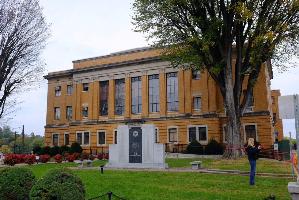
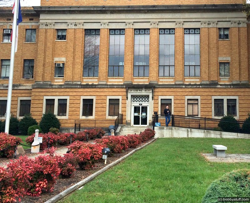
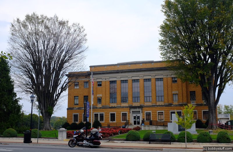
McDowell County Courthouse in Marion, North Carolina
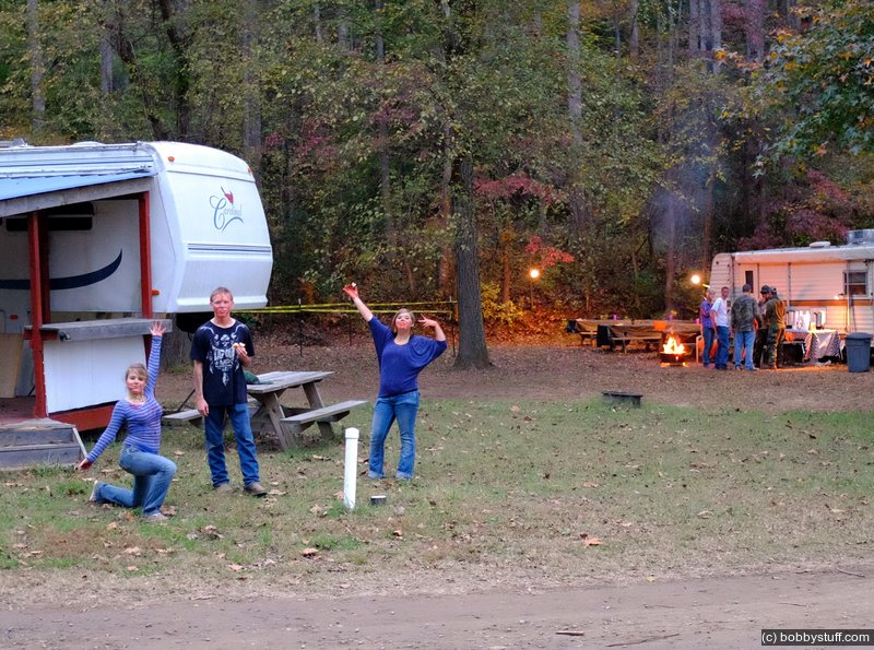
Laurie and I like riding our Gold Wing motorcycle. But it is easy to get into a rut and just ride the same roads. So to force ourselves to ride to places we would not normally visit we made a goal to visit and photograph all 100 North Carolina courthouses within 1 year.
As usual, we got a little behind. We started in July 2015 and finished 99 out of 100 by June 2018. The last courthouse was in our home county of Wake and it took us until Feb 2021 to get that final one. But we made it! This blog is about one of those visits.
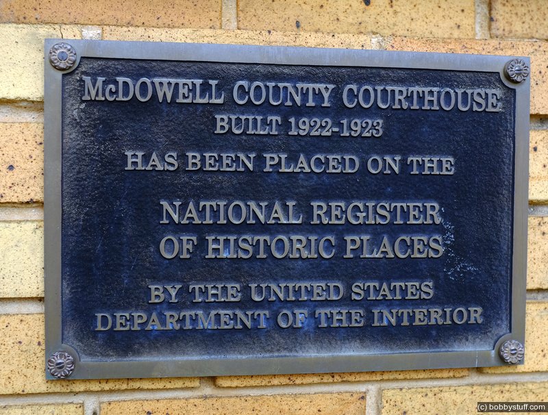
Many NC courthouses were added to the National Register of Historic Places in 1979. The nomination form has some interesting facts about the various courthouse styles over the years.
Courthouse Information
Wikipedia says the following about the courthouse:
McDowell County Courthouse is a historic courthouse building located at Marion, McDowell County, North Carolina. It was designed by noted architect Erle G. Stillwell and built between 1921 and 1923. It is three-story, late Neoclassical building sheathed in yellow brick. The rectangular structure is composed of a central block flanked by slightly recessed, unornamented wings.
It was listed on the National Register of Historic Places in 1979.[1] It is located in the Main Street Historic District.
County Information
The North Carolina History Project lists the following information for this county:
A mountain county in North Carolina, McDowell remains a predominately rural county with forest land covering most of the region. Historian William Powell writes that "roughly 75 percent of the county remains forested and boasts a wide array of wildlife, waterfalls, and scenic vistas." Some natural traits as well as historic commemorations serve as popular attractions in McDowell County. Linville Caverns, located underneath the McDowell-Avery County border, draws in numerous explorers and tourists each year. The Arrowhead Monument, a 15-foot arrowhead, and the Mountain Gateway Museum are both located in Old Fort. Originally sculpted from a large piece of pink granite in 1930, the Arrowhead Monument commends the Catawba and Cherokee, the Indian tribes that first lived in present-McDowell County.
Other important attractions in McDowell County include the Carson House and Andrews Geyser. Built in the late 1700s by politician John Carson, the house once operated as the courthouse of the early county. In addition to its purpose as a courthouse, the Carson House became a gathering place for politicians and other socialites during the 1800s. The Carson lineage continued to add and renovate the Carson House throughout the nineteenth century. Eventually several McDowell County residents purchased the house, and it became a public museum in 1964.
Andrews Geyser, a man-made waterspout finished in 1885, attracted railway passengers who passed through McDowell County. Created from a dam of Mill Creek, Andrews Geyser once spouted water 250 feet into the air every few minutes during the late nineteenth century. However, the original geyser deteriorated in 1903. George Baker, a prominent New York banker, sought to restore the man-made spout, moving it to land owned by the Southern Railway Company. Baker renamed the geyser in recognition of the owner of Southern Railway, Alexander Andrews. However, as the railway transportation service declined with the advent of automobiles Southern Railway let the spout dissipate. Eventually, a renovation fund was started, and the geyser was repaired in 1976.
The county's establishment in 1842 predates the Scotch-Irish settlement of modern day McDowell County in the 1700s. Known as the "Gateway to the Mountains," McDowell became a safe-haven for those traveling and settling the western wilderness in the North Carolina mountains. Various forts and garrisons were constructed throughout the region to protect settlers from the hostile Cherokee. Two prominent forts in McDowell, Cathey's Fort and the Frontier Fort, were used by General Rutherford during his fight against the Cherokee during the 1770s and 1780s. However, these forts no longer exist.
In the early nineteenth century, McDowell County was at the center of the statewide and national gold rush. The deposits of gold found and mined in McDowell County made North Carolina the leading state for gold production before California took the lead beginning in the late 1840s and 1850s.
McDowell County was annexed from the Rutherford and Burke Counties two decades before the start of the Civil War. Named in honor of Colonel Joseph McDowell who served in the Revolutionary War and led a company during the Battle of King's Mountain, the county's communities include Marion (the seat of government), Ashford, Glenwood, Sugar Hill, Nebo, Old Fort, and Little Switzerland. The county seat was established in 1844, and it is named in honor of Francis Marion, the famed "Swamp Fox" hero. Marion was known for his guerilla war tactics in South Carolina during the Revolutionary War.
In 1894, a fire destroyed much of downtown Marion, including the county courthouse in the town. At the time there was no fire department in the town so many citizens had to gather together in bucket lines, saving several historic homes in McDowell County. Many of the houses still stand in Marion and some of the structures are listed as historical significant structures in the McDowell County cultural institution, Main Street Historic District.
Daniel Kanipe (1853-1926) was born in Marion, and he experienced the Battle of Little Bighorn in 1876. Kanipe served in the 7th U.S. cavalry, and he was part of the war between U.S. soldiers and hostile Sioux Indians in the present-day Montana. Ordered by Captain Thomas Custer (George's brother) to carry a message to a reserve battalion, Kanipe escaped the bloodshed, and he witnessed the decimation of Lieutenant Colonel George Custer's regiment. During his years after Bighorn, historians and other Old West aficionados sought Daniel Kanipe's account of the famed "Custer's Last Stand."
Our Experience
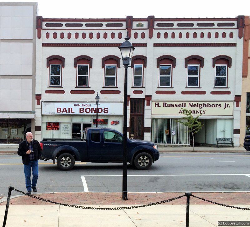
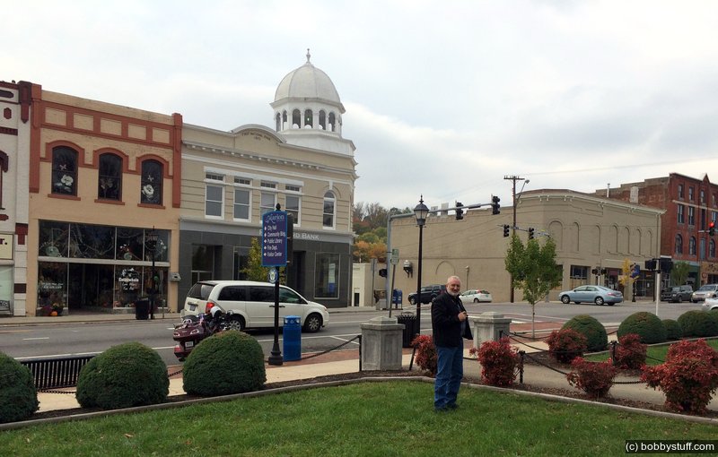
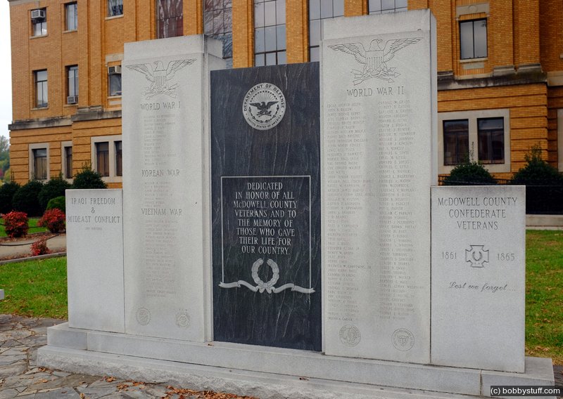
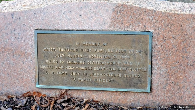
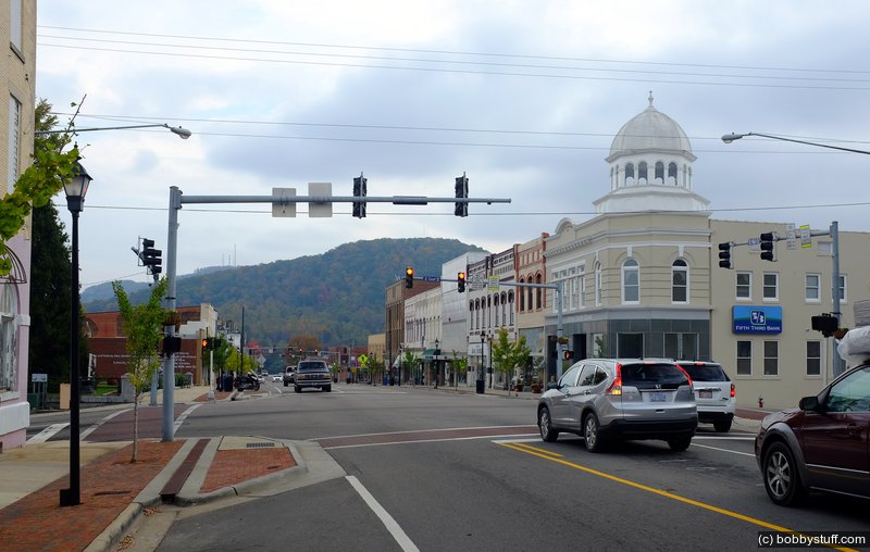
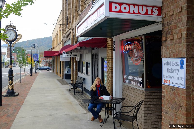
Mario has a very nice downtown. The interesting thing about this courthouse is all the typical monuments are combined into one. From the Civil War through Iraqi Freedom and the Mideast Conflict.
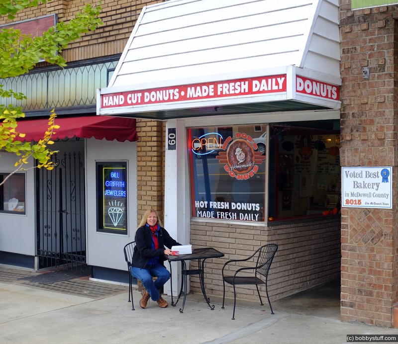
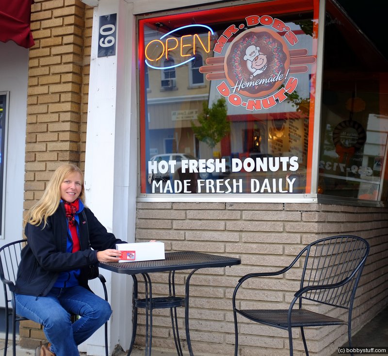
It was time to feed Laurie again so we walked along the street in front of the courthouse and wondered into Mr Bob's Donuts. As we were walking in a local lady entered just ahead of us mumbling about those evil donuts. As she was getting her order I noticed they had something called an "Apple Ugly". I love apple fritters and figured this had to be similar. I mentioned to Laurie that I wanted an "Apple Ugly." Bernice, the owner, said she just sold her last one. I asked "Can I catch him on foot?" She kind of chuckled and said no.
Bernice makes her donuts fresh every day. At the end of the day she gives the left overs to the Fire Department, EMS, etc. She also does a little bartering with a local guy who cuts her grass and she gives him left over dough and donuts for his pigs.
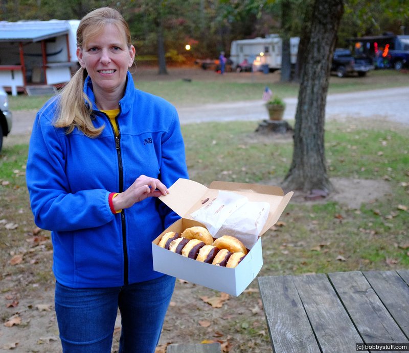
I had a great raspberry filled donut and Laurie had a Bavarian Cream which she said was wonderful. As we were leaving Bernice asked if we wanted some free donuts since she was about to close up. I remembered the teenagers that were working at a haunted trail back at the campground and said I would take the donuts to them. She gave us a box full of donuts and the teenagers loved them.
McDowell County Courthouse in Marion, North Carolina
McDowell County Courthouse in Marion, North Carolina
Bobby
McDowell County Courthouse in Marion, North Carolina
Bobby
McDowell County Courthouse in Marion, North Carolina
McDowell County Courthouse in Marion, North Carolina
Bobby
McDowell County Courthouse in Marion, North Carolina
McDowell County Courthouse in Marion, North Carolina
McDowell County Courthouse in Marion, North Carolina
McDowell County Courthouse in Marion, North Carolina
McDowell County Courthouse in Marion, North Carolina
Laurie
McDowell County Courthouse in Marion, North Carolina
Laurie
McDowell County Courthouse in Marion, North Carolina
Laurie
Laurie