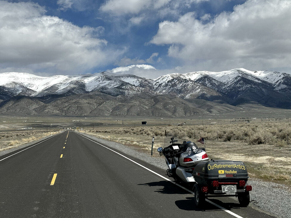
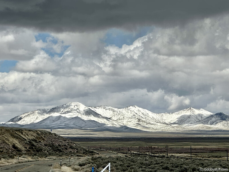
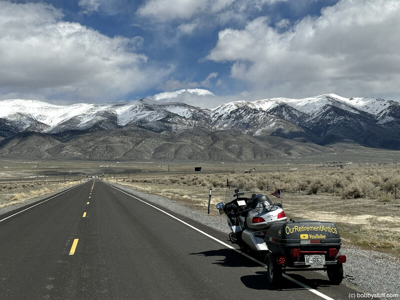
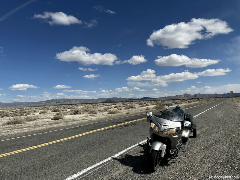
Day 12 - Elko NV to Carson City NV
| Miles for the Day: | 360 |
| Total Trip Miles: | 3560 |
| Start Point: | Elko, NV |
| Sun Rise: | 5:59 AM PDT |
| Start Altitude: | 5051 feet |
| Start Weather: | At 6:00 AM PDT, the temperature was 34.1 degrees with 51 percent humidity. The conditions were partially cloudy. |
| End Point: | Carson City, NV |
| Sun Set: | 7:39 PM PDT |
| End Altitude: | 4764 feet |
| End Weather: | At 6:00 PM PDT, the temperature was 37.9 degrees with 42 percent humidity. The conditions were partially cloudy with a wind speed of 10.7 and wind gusts of 19.7. |
Table of Contents
 Google Map Track Log
 YouTube Video
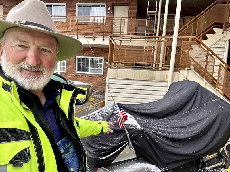
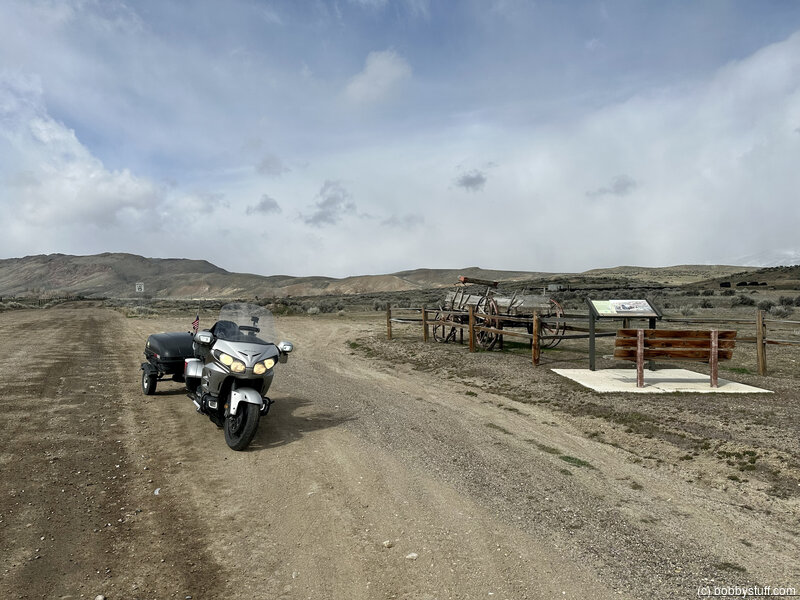
Bobby
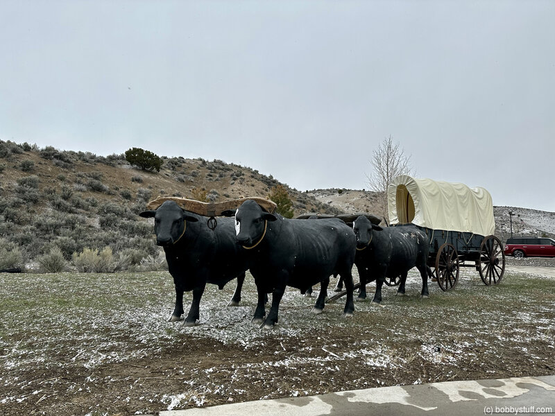
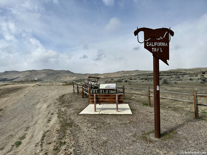
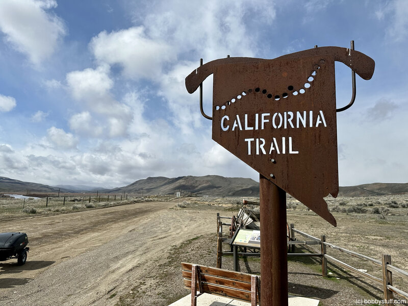
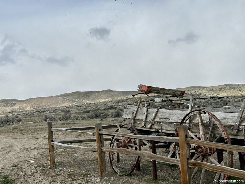
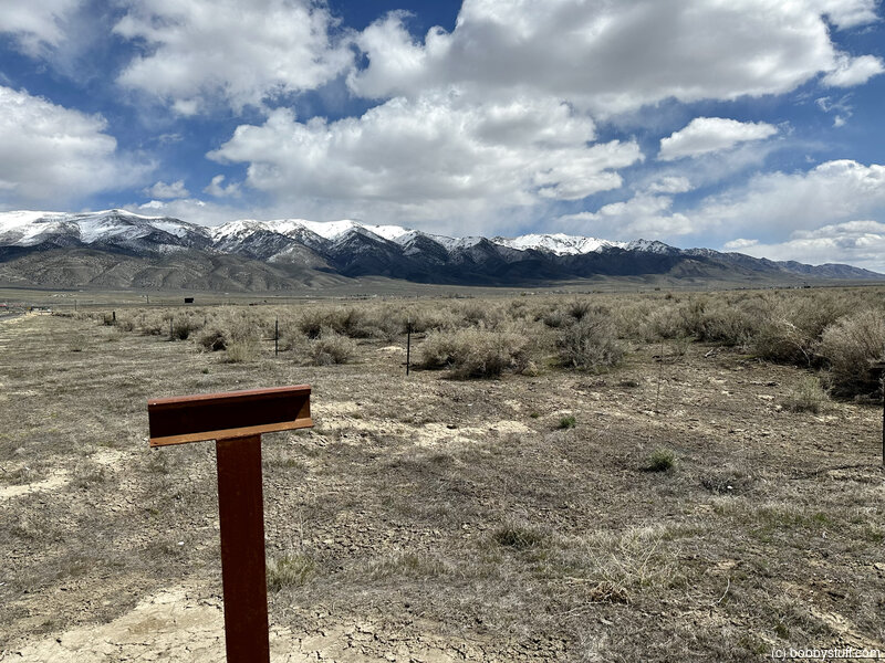
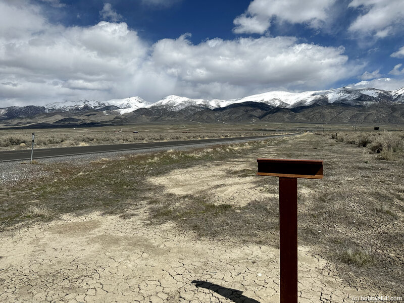
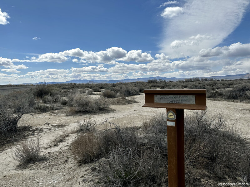
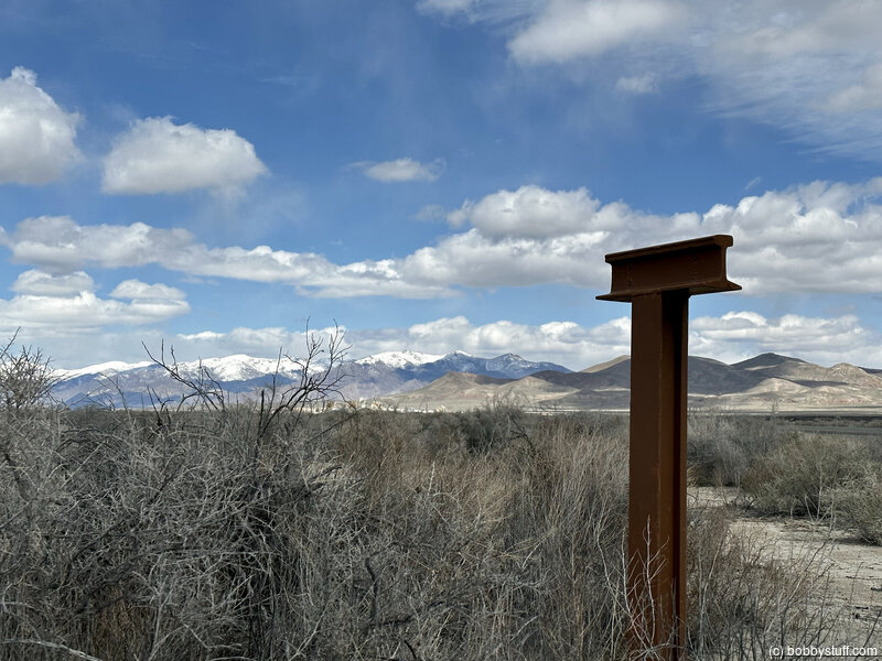
 California Trail Markers, Elko NV
View a list of places like this or a map.Historical Marker
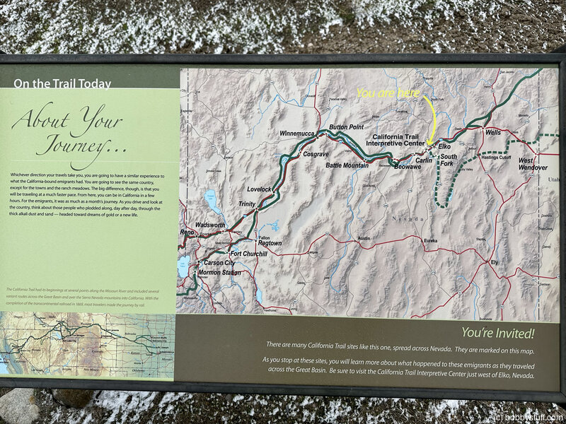
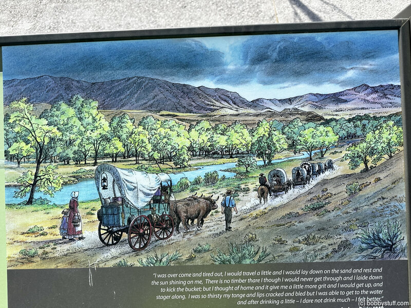
About Your Journey ...Whichever direction your travels take you, you're going to have a similar experience to what the California-bound emigrants had. You're going to see the same country, except for the towns and the ranch meadows. The big difference, though, is that you'll be traveling at a much faster pace. From here, you can be in California in a few hours. For the emigrants, it was as much as a month's journey. As you drive and look back at the country, think about those people who plodded along day after day through the thick alkali dust and sand--headed toward dreams of gold or a new life.
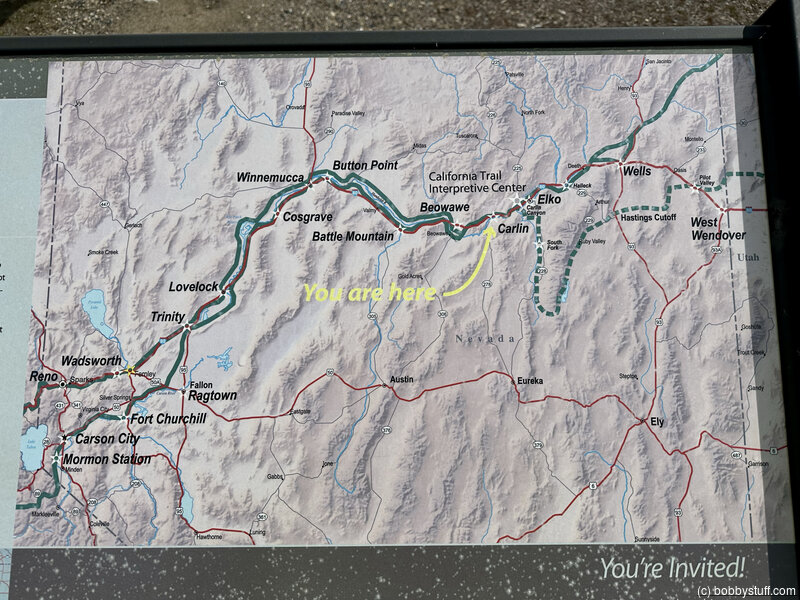
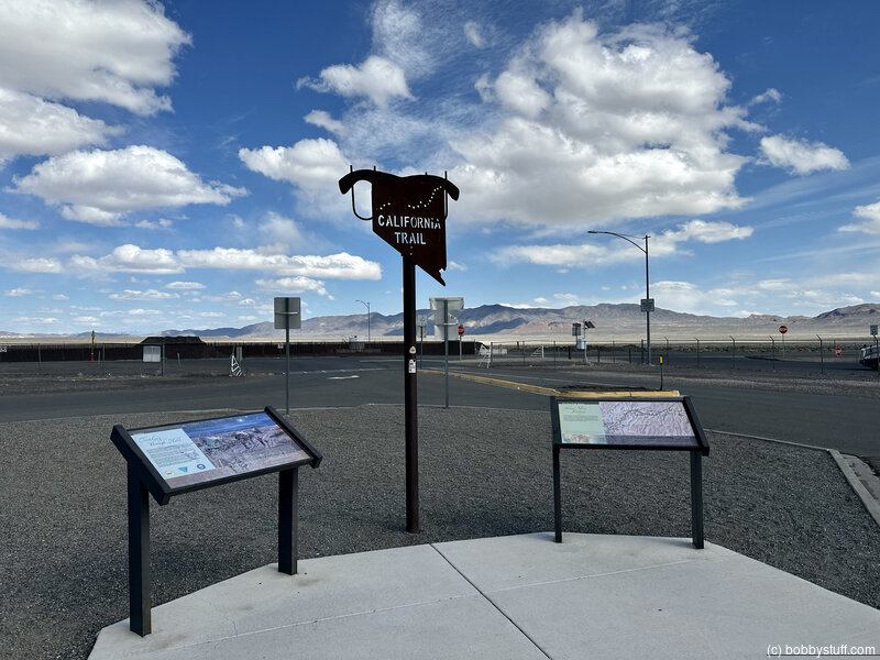
The California Trail had its beginnings at several points along the Missouri River, and included several variant routes across the Great Basin and over the Sierra Nevada mountains into California. With the completion of the transcontinental railroad in 1869, most travelers made the journey by rail.
Historical Marker
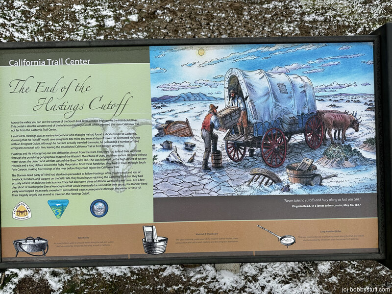
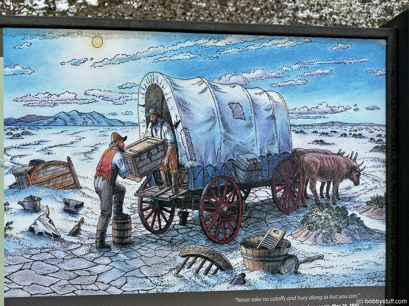
The End of the Hastings Cutoff
Across the valley you can see the canyon of the South Fork River, a major tributary to the Humboldt River. This portal is also the western end of the infamous Hastings Cutoff, which rejoined the main California Trail not far from the California Trail Center.
Lansford W. Hastings was an early entrepreneur who thought he had found a shorter route to California, claiming that his "cutoff" would save emigrants 400 miles and several days of travel. He promoted this route with an Emigrant Guide. Although he had not actually traveled the route, he persuaded a number of 1846 emigrants to travel with him, leaving the established California Trail at Fort Bridger, Wyoming.
Hastings and his initial group ran into difficulties almost from the start. First, they had to find their way west through the punishing geographical maze of the Wasatch Mountains of Utah, and then endure 80 miles without water across the desert and salt flats west of the Great Salt Lake. This was followed by the high desert of eastern Nevada and a long detour around the Ruby Mountains. After these hardships, they had to travel through South Fork Canyon, making 14 crossings of the river before they could rejoin the California Trail.
The Donner-Reed party of 1846 had also been persuaded to follow Hastings. After much travel and loss of livestock, furniture, and wagons on the Salt Flats, they found upon rejoining the California Trail that they had actually added 125 miles to their journey. They also spent three additional weeks of travel time. Just a few days short of reaching the Sierra Nevada pass that would eventually be named for their group, the Donner-Reed party was trapped by an early snowstorm and suffered tragic consequences through the winter of 1846-47. Their tragedy put an end to travel on the Hastings Cutoff.
Historical Marker
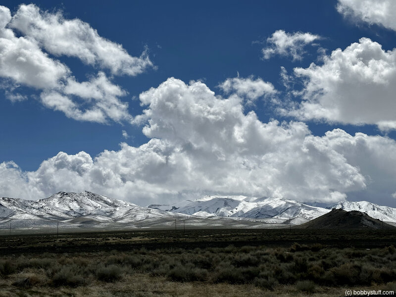
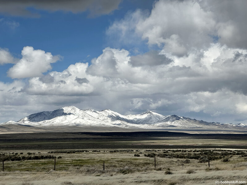
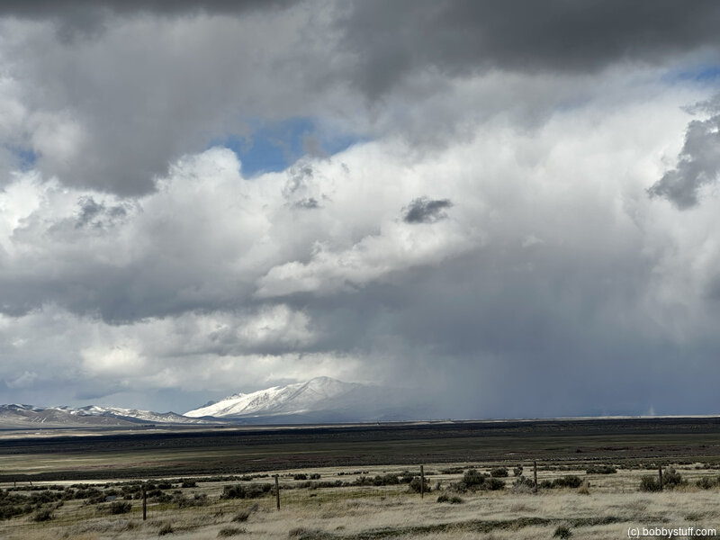
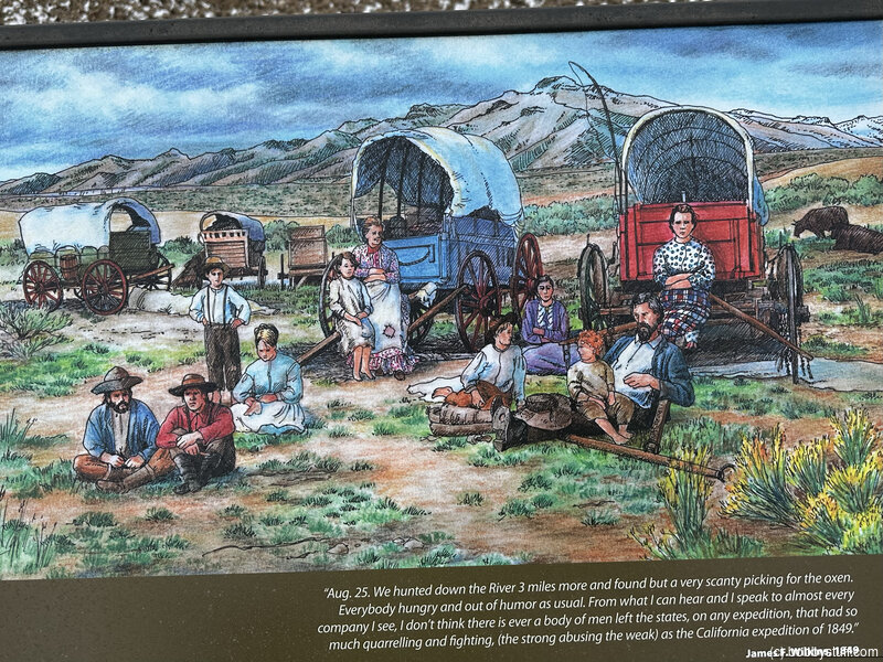
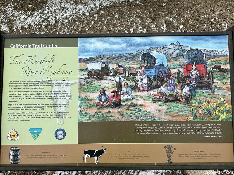
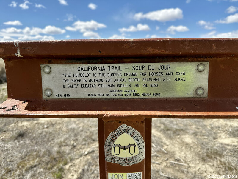
The Humboldt River HighwayThe California Emigrant Trail extended approximately 2,000 miles from the Missouri River to California. Today you are standing on a segment of the trail that followed the Humboldt River for about 280 miles across northern Nevada. It was the only water course across the high desert of the Great Basin.
The Humboldt River begins at Humboldt Wells, springs near present-day Wells, Nevada, and flows west and southwest to the Humboldt Sink. It generally took 16 days for emigrants to make the journey along the river. Most travelers crossed Nevada in the heat of August, when the trail was very dusty, the river was nearly dry, and the water alkaline.
From 1849 to 1853, at the height of the California Gold Rush, approximately 200,000 emigrants passed by this location, with 50,000 more making the trek before the Transcontinental Railroad was completed in 1869.
When they reached this point, the emigrants had been on the trail for three months, had traveled about 1,600 miles, and were 400 miles from their destination. Still ahead of them lay the crossing of the dreaded and waterless Forty-Mile Desert and the climb over the Sierra Nevada Range.
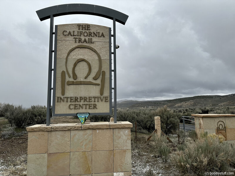
The California Trail Interpretive Center, Elko NV
View a list of places like this or a map.nps.gov
The California Trail Interpretive Center is a Bureau of Land Management facility featuring trail art, excellent interpretive exhibits, and programs, special events, and meeting space.
Trail etiquette information and interpretive exhibits are provided at the interpretive kiosk.
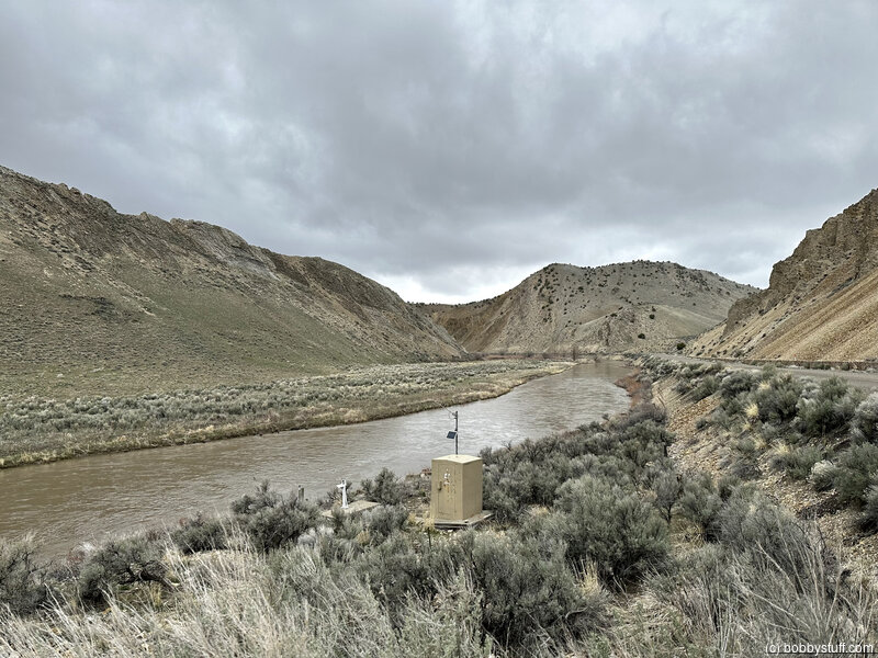
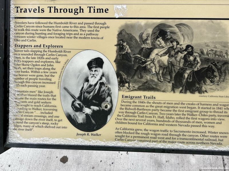
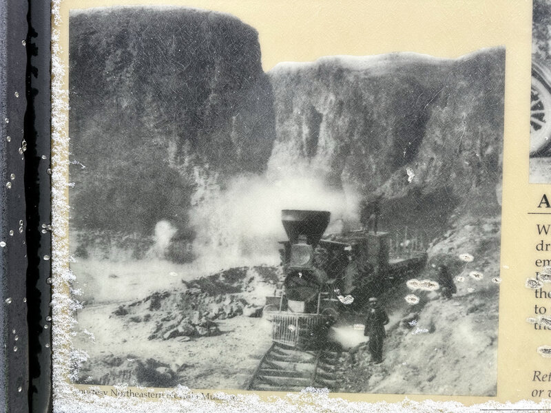
California Trail - Carlin Canyon, Carlin NV
View a list of places like this or a map.Historical Marker
California Trail - Carlin Canyon"We have to cross the river four times... on each side of you there is a perpendicular wall of vast rock... overhanging the road so one has a feeling very near bordering on fear as he passes under those precipices" -- Lewis Beers, Aug 3, 1852
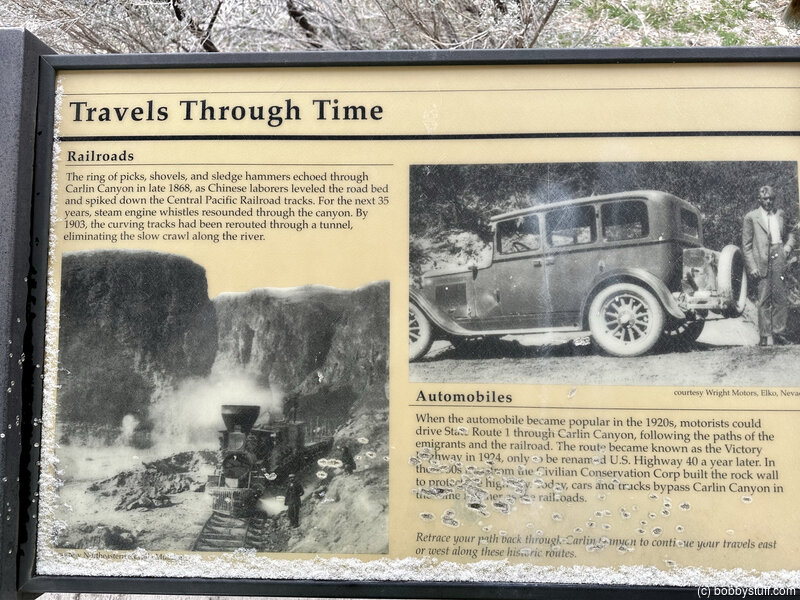
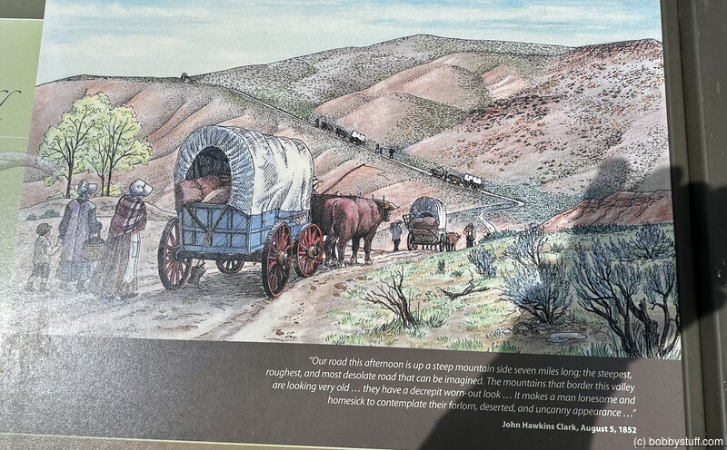
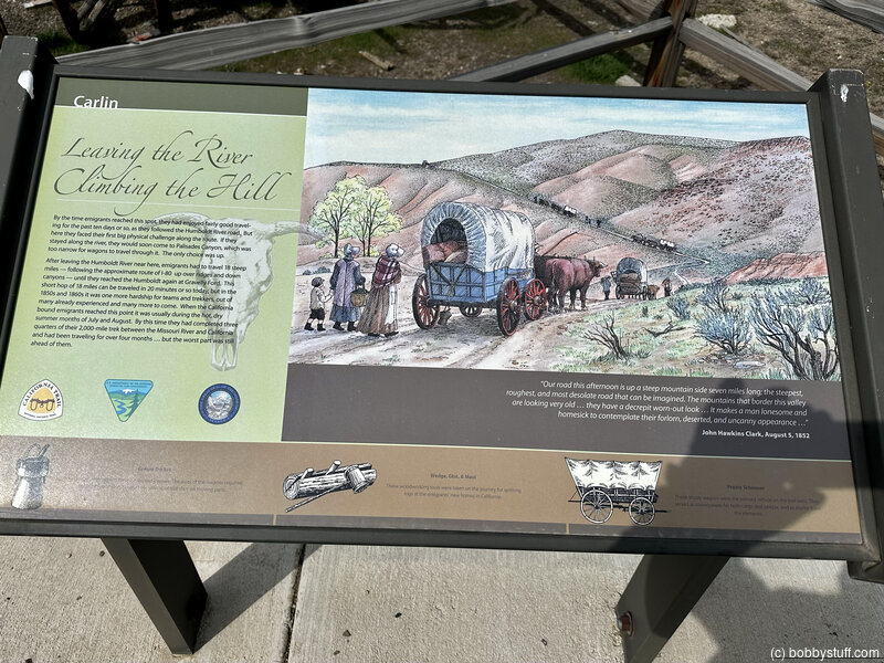
Leaving the River, Climbing the Hill Marker, Carlin NV
View a list of places like this or a map.Historical Marker
Leaving the River, Climbing the HillBy the time emigrants reached this spot, they had enjoyed fairly good traveling for the past ten days or so, as they followed the Humboldt River road. But here they faced their first big physical challenge along the route. If they stayed along the river, they would soon come to Palisades Canyon, which was too narrow for wagons to travel through it. The only choice was up.
After leaving the Humboldt River near here, emigrants had to travel 18 steep miles — following the approximate route of I-80 up over ridges and down canyons — until they reached the Humboldt again at Gravelly Ford. This short hop of 18 miles can be traveled in 20 minutes or so today, but it the 1850s and 1860s it was one more hardship for teams and trekkers, out of many already experienced and many more to come. When the California bound emigrants reached this point it was usually during the hot, dry summer months of July and August. By this time they had completed three quarters of their 2,000-mile trek between the Missouri River and California and had been traveling for over four months… but the worst part was still ahead of them.
Button Point, Midas NV
View a list of places like this or a map.nps.gov
Button Point offers a good view of the lush meadows in the Humboldt River Valley, where native people collected grass seed and emigrants cut wild hay for their livestock.
Nevada historical signs and wayside exhibits at the roadside rest area tell about the Humboldt River and 19th-century international politics along the watercourse. A T-rail marker is located near the restroom.
On leaving the rest area, turn right and continue one mile on the frontage road, past the interstate entrance/exit, to the end of the pavement. Continue ahead a half-mile on the dirt road to a T-rail marker on the right, where the trail drops into a gully.
Historical Marker
International Intrigue and the Humboldt RiverBefore nearly quarter of a million California-bound emigrants followed the path of the Humboldt River from 1841 to 1869, someone had to have first explored the Humboldt and figured out where it went. That someone was Peter Skene Ogden, who traveled south from Oregon and first arrived on the Humboldt near here in late 1828.
Ogden worked for the Hudson's Bay Company, an early 19th century fur-trade enterprise that also furthered the interests of its home country—Great Britain. Having fur traders active in the West was a way to "check" or "counter" American expansionism. Ogden and his men tried to trap all the beaver out of this valley twice so that Great Britain could claim the land, but it didn't work. Under the pretense of "exploring new country" they were actually violating the sovereign territory of another nation—Mexico.
With the treaty that ended the Mexican-American War in 1848, the Great Basin became part of the United States. In 1850 this area became part of Utah Territory, established after the State of Deseret that was proposed by the Mormons in Salt Lake City in 1849 was rejected by Congress. In 1864, the Humboldt River Valley then became part of the new State of Nevada.
Historical Marker
California Trail - Humboldt Sloughs"The water is warm and tastes but little better than soap suds. We use acid in all the water we drink, by that means we manage to get along, although we are all anxious to get off this river" - Ephriam Brandiff, Aug. 16, 1852
The California Trail along the Humboldt River, Lovelock NV
View a list of places like this or a map.nps.gov
The California Trail along the Humboldt River was littered with the carcasses of livestock that had become mired and drowned in alkaline sloughs while trying desperately to drink from the river. A T-rail marker along the highway relates one traveler's description, and wagon swales are located there. Please do not trespass on adjacent private property.
The trail along the south side of the Humboldt River converges with the freeway south of the marker.
The T-rail marker is on the left side of the road about a half-mile from the freeway.
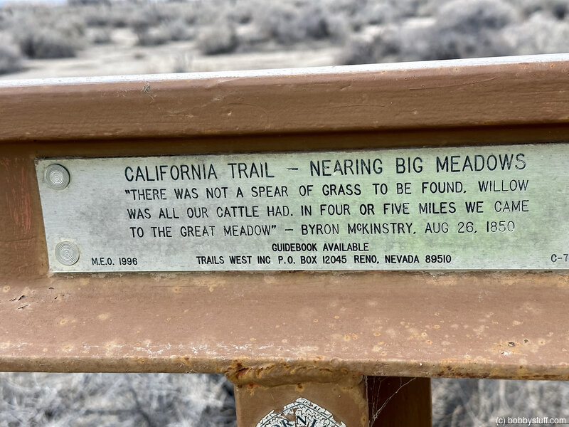
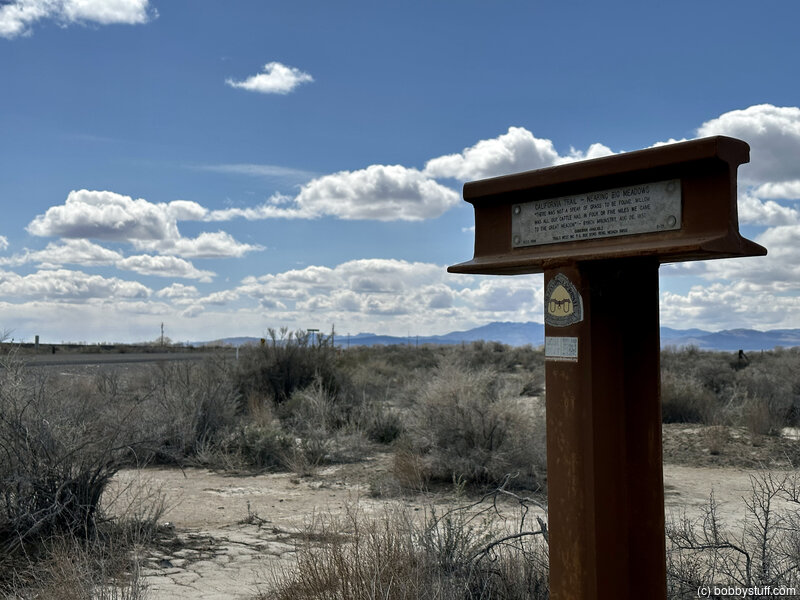
Approaching Big Meadows, Lovelock NV
View a list of places like this or a map.nps.gov
Approaching Big Meadows starving livestock and exhausted travelers lifted their heads and picked up their feet, for they knew that relief lay just head. A T-rail marker is located at this stop on the approach to Big Meadows, and faint trail trace is visible there.
The T-rail marker is to the right about eight yards off the road, just before the junction with Old Pitt Dam Road.
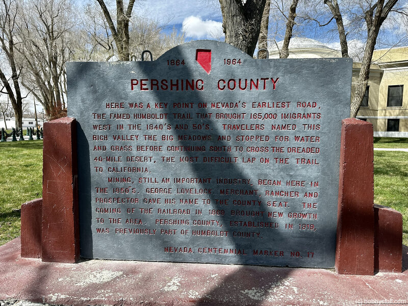
Big Meadows, Lovelock NV
View a list of places like this or a map.nps.gov
Big Meadows was large and lush, absorbing much of the dwindling river as it approached the Humboldt Sink. Here travelers stopped to rest their livestock and cut meadow hay in preparation for the crossing of the Forty Mile Desert just ahead.
Several commemorative and interpretive monuments are located near the Pershing County Courthouse. Most of the meadows are now agricultural fields; they can be viewed along the Lovelock Cave BackCountry Byway.
A T-rail marker commemorating Big Meadows is located at the flagpole in front of the library, north of the courthouse parking lot.
Other historical signs and trail monuments are located on the grounds, as well.
The Humboldt Sink, Lovelock NV
View a list of places like this or a map.nps.gov
The Humboldt Sink is a shallow basin that collects the last of the Humboldt River. A T-rail marker on the playa summarizes one traveler's opinion of the place. The river's official end is marked by Humboldt Lake.
Look on the right, south of the tracks, for a T-rail marker denoting Granite Point.
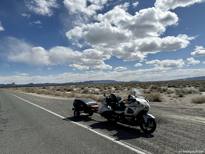
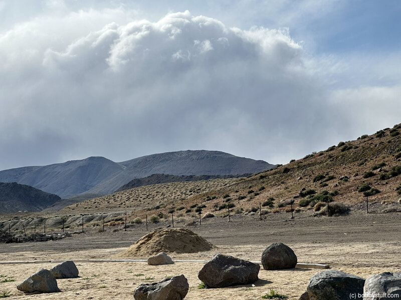
The Forty Mile Desert, Fallon NV
View a list of places like this or a map.nps.gov
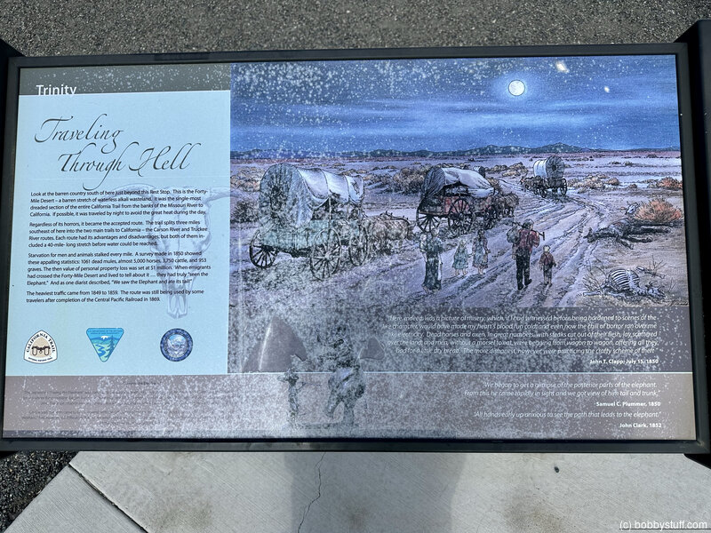
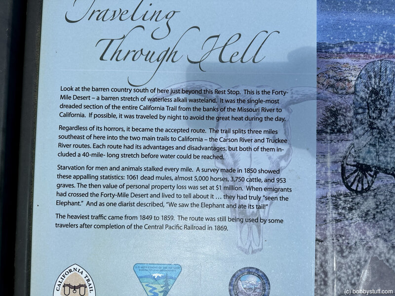
The Forty Mile Desert was a 2000 square-mile cauldron of heat and thirst. Here the trails were literally paved with dead livestock. Researchers have determined that the Truckee and Carson routes diverge two miles east of the rest area rather than five miles southwest of it, as the historical sign at the rest area states.
Historical Marker
Forty Mile DesertThe 40 Mile Desert, beginning here, is a barren stretch of waterless alkali wasteland. It was the most dreaded section of the California Emigrant Trail. If possible, it was traveled by night because of the great heat.
The route was first traveled by the Walker-Chiles Party in 1843, with the first wagon train, regardless of its horrors, it became the accepted route, as it split five miles southwest of here into the two main trails to California—the Carson River and Truckee River routes.
Starvation for men and animals stalked every mile. A survey made in 1850 showed these appalling statistics---1,061 dead mules, almost 5,000 horses, 3,750 cattle, and 953 graves. The then value of personal property loss was set at $1,000,000.
The heaviest traffic came from 1849 to 1869. It was still used after completion of the Central Pacific Railroad in 1869.
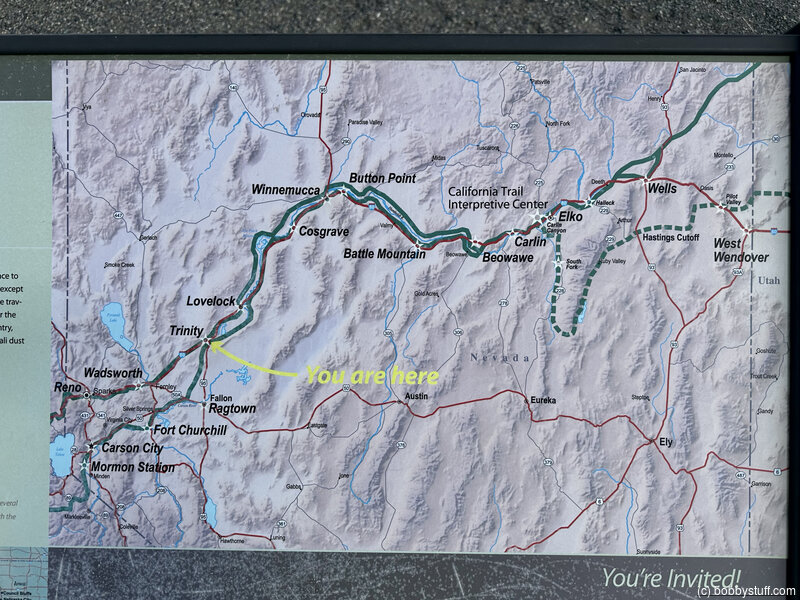
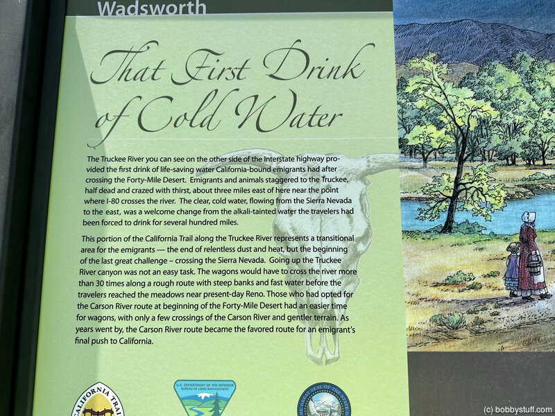
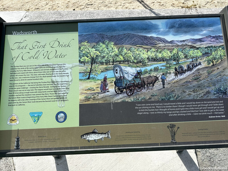
Wadsworth Rest Area Historical Marker, Reno NV
View a list of places like this or a map.Historical Marker
The First Drink of Cold WaterThe Truckee River you can see on the other side of the Interstate highway provided the first drink of life-saving water California-bound emigrants had after crossing the Forty-Mile Desert. Emigrants and animals staggered to the Truckee, half dead and crazed with thirst, about three miles east of here near the point where I-80 crosses the river. The clear, cold water, flowing from the Sierra Nevada to the east, was a welcome change from the alkali-tainted water the travelers had been forced to drink for several hundred miles.
This portion of the California Trail along the Truckee River represents a transitional area for the emigrants - the end of relentless dust and heat, but the beginning of the last great challenge - crossing the Sierra Nevada. Going up the Truckee River canyon was not an easy task. The wagons would have to cross the river more than 30 times along a rough route with steep banks and fast water before the travelers reached the meadows near present-day Reno. Those who had opted for the Carson River route at beginning of the Forty-Mile Desert had an easier time for wagons, with only a few crossings of the Carson River and gentler terrain. As years went by, the Carson River route became the favored route for an emigrant's final push to California.
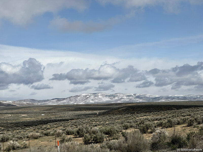
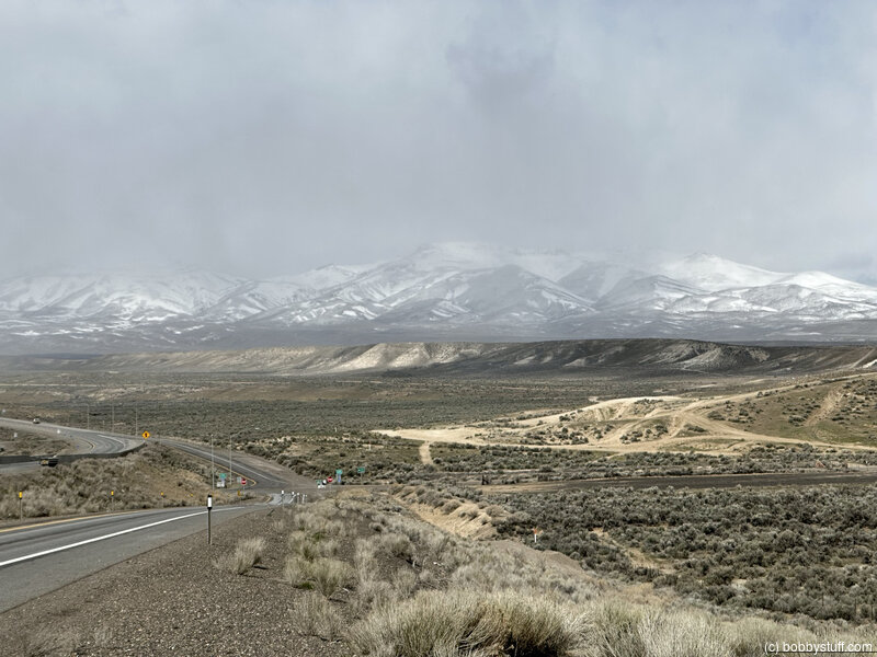
 Elevation Changes During the Day
The day started at 5,051 feet and ended at 4,764 feet. The highest altitude was 5,673 feet and the lowest altitude was 3,892 feet.
| Day 11 - Logan UT to Elko NV |
Topics
TagsConfederate Statues (32),Motorcycle (97),National Parks (9),Odd (1),Route 66 (33),Unemployment (6),Zombies (1)