Day 18 - Amarillo TX to El Reno OK
| Miles for the Day: | 287 |
| Total Trip Miles: | 5786 |
| Start Point: | Amarillo, TX |
| Start Weather: | At 6:00 AM CDT, the temperature was 48.8 degrees with 31 percent humidity. The conditions were overcast. |
| End Point: | El Reno, OK |
| End Weather: | At 6:00 PM CDT, the temperature was 58.8 degrees with 23 percent humidity. The conditions were clear with a wind speed of 11.8 and wind gusts of 19.8. |
| Sun Rise: | 7:17 AM CDT |
| Sun Set: | 8:03 PM CDT |
Table of Contents
 Google Map Track Log
 YouTube Video
YouTube Video
 The intersection of the last scene in Castaway with Tom Hanks
View a list of places like this or a map.
360 Photo !!!
Click and drag on the photo below to see a 360 view. Pinch to zoom in or out on your mobile device or use your mouse scroll wheel on your desktop. Click the box in the top left of the image to view in full screen.
The Intersection of the last scene in the movie Castaway, Mobeetie, TX
Bobby
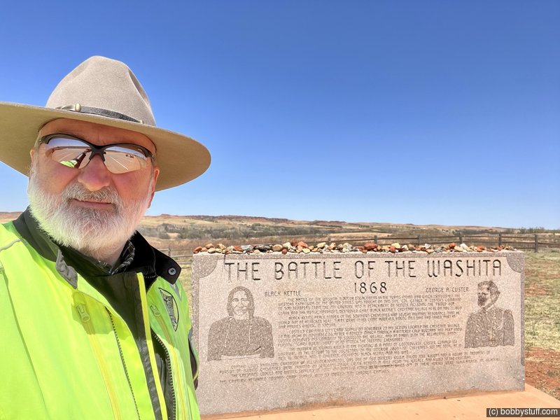
 Washita Battlefield National Historic Site
View a list of places like this or a map.nationalparks.org
Washita Battlefield National Historic Site protects the site of the Cheyenne village of Peace Chief Black Kettle, who was attacked by the 7th U.S. Cavalry.
Attacked by the 7th U.S. Cavalry under Lt. Col. George A. Custer just before dawn on November 27, 1868, The controversial strike was hailed at the time by the military and many civilians as a significant victory aimed at reducing Native American raids on frontier settlements. Washita remains controversial because many Cheyenne and whites labeled Custer's attack a massacre. Black Kettle is still honored as a prominent leader who never ceased striving for peace even though it cost him his life.
Lots of info can be found on the nps.gov
Bobby
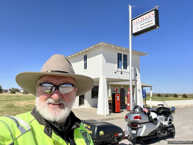
 Lucille's, Hydro OK
View a list of places like this or a map.nps.gov
theroute66.com
The stretch of Route 66 from the Camelback bridge to Hydro is listed on the National Register of Historic Places. It is one of the longest intact segments of Route 66 in western Oklahoma and is 19.5 miles long. It was paved in Portland Concrete in 1931, 33 and 34. Some patches of asphalt have resurfaced it west of the Canadian River, but the rest is unaltered. It has the original integral curbs and drains to help discharge rain water.
It remained operational until 1962 when I-40 replaced it.
This service station is officially named the Provine Service Station but is commonly known as Lucille's Place. This station was built in 1929 and other stations like it were springing up across the country. This style of rural station was convenient for the traveler to get gasoline, pay the attendant, and be on his way. Like other rural, mom and pop-built stations of the time, this one was built with the owner's living quarters located on the second story.
In 1941, the Hamons family took over its operation. Lucille Hamons ran the business and lived there for nearly 60 years. She quickly became one of the highway's legendary characters. Her self-reliance and generous assistance to motorists earned her the nickname "Mother of the Mother Road."
In 1971, the completed section of Interstate 40 a few miles to the south cut the station off from direct access to the new highway, but Lucille found a way to survive. She kept the station open until the day she died, August 18, 2000.
Bobby
 Elevation Changes During the Day
The day started at 3,538 feet and ended at 1,393 feet. The highest altitude was 3,768 feet and the lowest altitude was 1,393 feet.
| Day 17 - Santa Fe NM to Amarillo TX |
Topics
TagsConfederate Statues (32),Motorcycle (101),National Parks (9),Odd (1),Route 66 (33),Unemployment (6),Zombies (1)