Day 12, More Route 66 and Final Blog
| Miles: | 295 |
| Start Point: | El Reno, OK |
| Start Weather: | At 6:00 AM CDT, the temperature was 42.8 degrees with 80 percent humidity. The conditions were partially cloudy. |
| End Point: | Silver Creek, MO |
| End Weather: | At 6:00 PM CDT, the temperature was 53.3 degrees with 66 percent humidity. The conditions were partially cloudy. |
| Sun Rise: | 7:29 AM CDT |
| Sun Set: | 7:33 PM CDT |
Table of Contents

Intro
Rushing to El Reno, OK last night and skipping some things I wanted to see was the right choice. This morning there is snow in Santa Rosa and Moriarty. There seems to be ice or snow in Amarillo. I guess they knew what they were doing with the brine on the bridges.
This is also my last blog for the trip. I will take a couple of days to get to eastern KY to see my Dad, then return to home and wife in NC on Saturday.
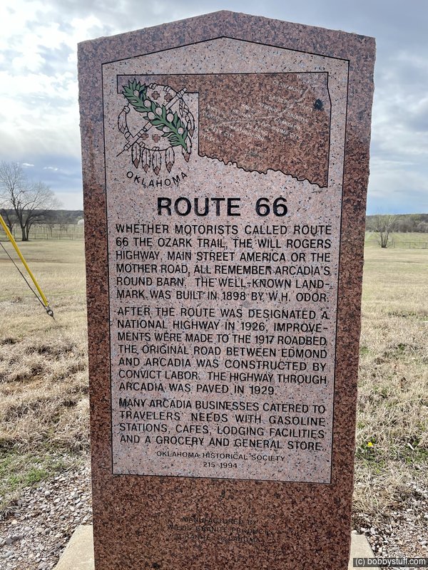
Today was all Route 66. I have visited most of the major sites along this route but still had a few to visit. I did that today as well as stopping at a couple I just could not pass up even if I had been there before.
I think the video today is actually pretty good, check it out.
I want to thank everyone for all the kind comments on social media and my website. I can't wait for my next trip.
 Video
Video
Bobby
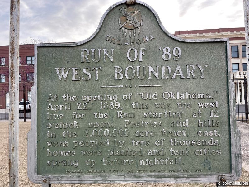
 End Line of 1889 Oklahoma Land Rush
View a list of places like this or a map.blogoklahoma.us
At the opening of "Old Oklahoma" April 22, 1889, this was the west line for the Run starting at 12 O'clock noon. Prairies and hills in the 2,000,000 acre tract, east were peopled by tens of thousands of homes where planted and tent cities sprang up before nightfall.
There is also a lot of info here.
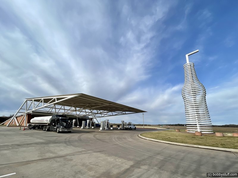
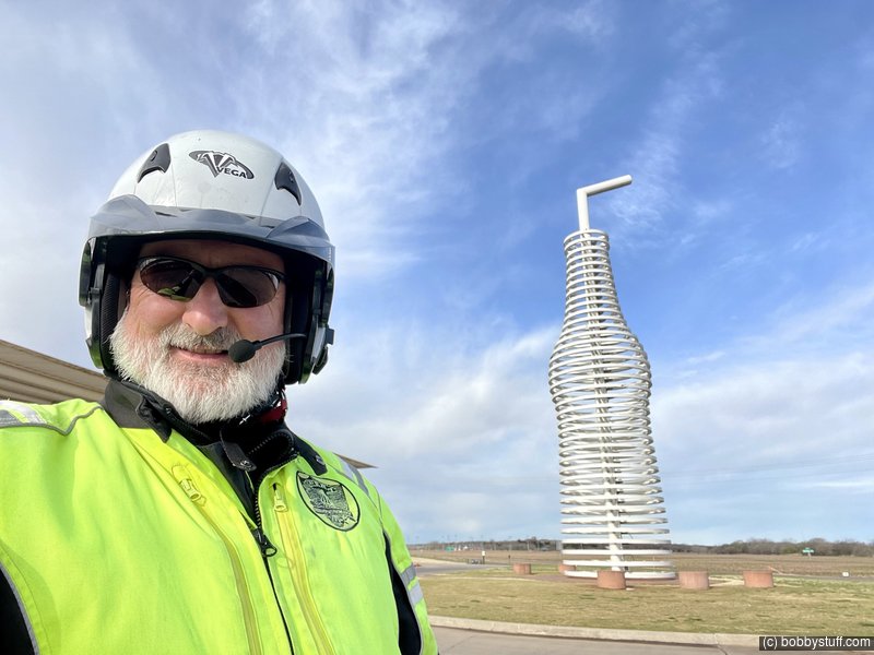
 Pops Soda Ranch, Arcadia OK
View a list of places like this or a map.wikipedia.org
Pops restaurant in Arcadia, Oklahoma is a modern roadside attraction on Route 66. Using a theme of soda pop, it is marked by a giant neon sign in the shape of a soda pop bottle. The glass walls of the restaurant are decorated with shelves of soda pop bottles, arranged by beverage color. These bottles are for sale as-is, or may be purchased cold from the huge refrigerator at the western end.
Opened in 2007, the restaurant's structure incorporates a cantilevered truss extending 100 feet over the gas pumps and parking area in the forecourt.
The roadside sign is 66 feet tall and weighs 4 tons. The height is a reference to the historic highway beside which it is situated. Although apparently constructed from neon tubes, it is actually lit by LEDs, which provide a spectacular light show each night.
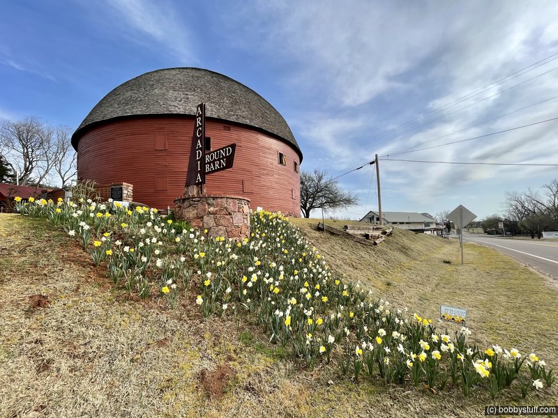
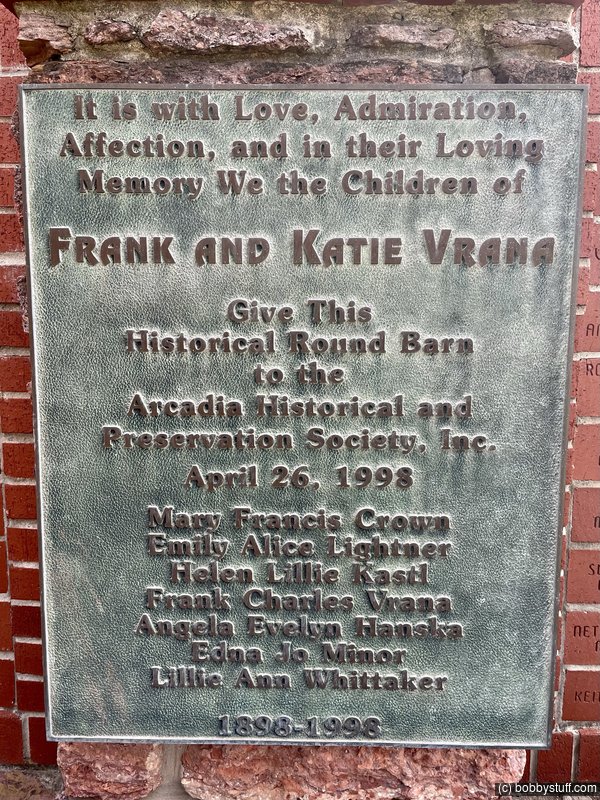
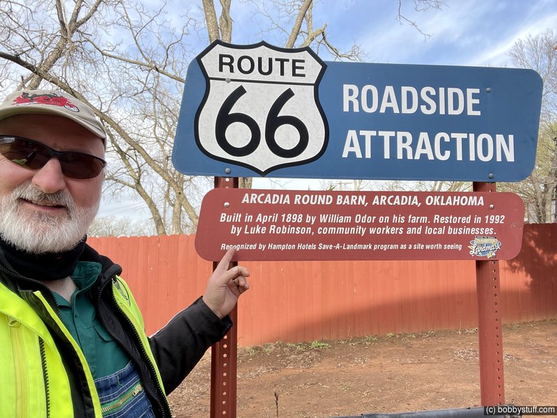
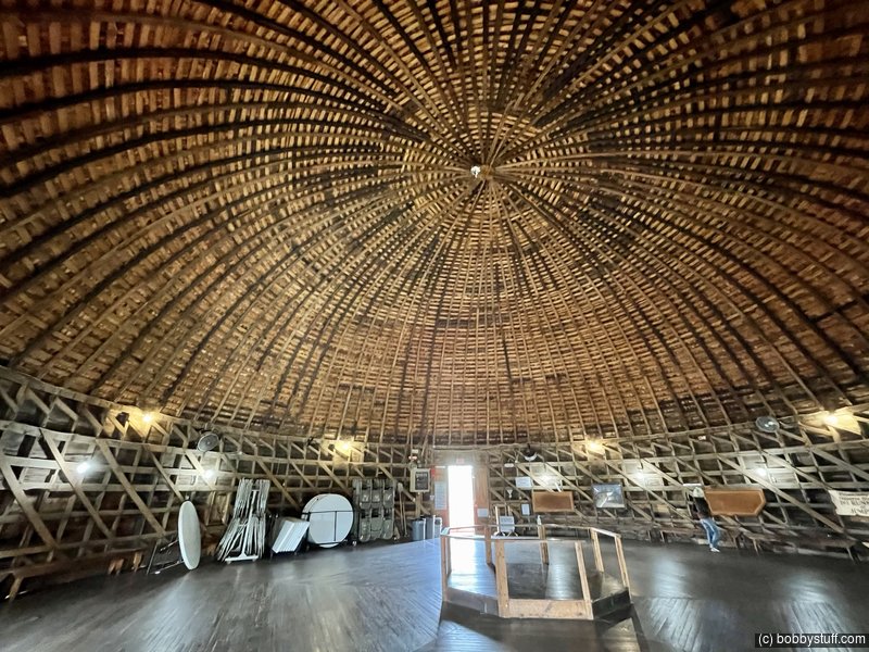
Arcadia Round Barn, Arcadia OK
View a list of places like this or a map.nps.gov
Sitting atop a low terrace overlooking the Deep Fork River, the Round Barn in Arcadia has been a center of community activity and curiosity for over a century. William Harrison "Big Bill" Odor arrived in Oklahoma County in 1892, and shortly after, in 1898, oxen cleared the ground for construction of his barn. He built a barn 60 feet in diameter and 43 feet high with a local red Permian rock foundation. Local burr oak timbers were soaked in water until soft and then banded into the mold to create the rafters. Mr. Odor apparently designed the barn himself, though no one knows how he chose the round design.
After its construction was completed in 1898, the barn housed hay, grain, and livestock, but almost from the start, it served as a community center. During the barn's construction, three young workers, realizing what a fine place it would be for dances, persuaded Mr. Odor to let them pay the difference between planed rough flooring and hardwood, which was more suitable for dancing. From time to time for the next 25 years, barn dances drew crowds and musicians to Arcadia from a wide area. Mr. Odor compared the barn's acoustics with those of the Mormon Tabernacle in Salt Lake City, and it became a popular rallying point while Arcadia flourished.

360 Photo !!!
Click and drag on the photo below to see a 360 view. Pinch to zoom in or out on your mobile device or use your mouse scroll wheel on your desktop. Click the box in the top left of the image to view in full screen.
Round Barn, Arcadia OK
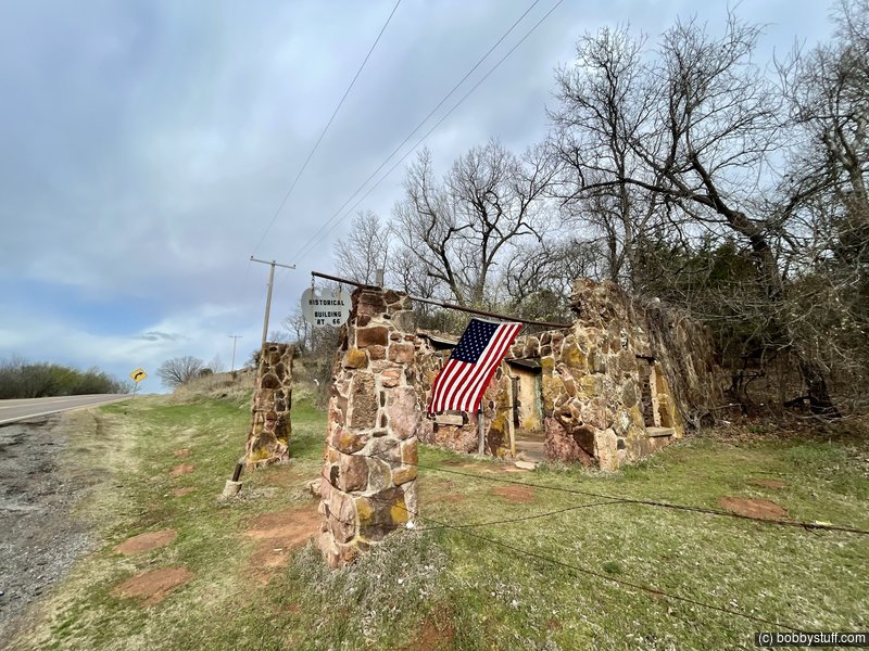
Ruins of Conoco Service Station, Luther MO
View a list of places like this or a map.theroute-66.com
The limestone blocks of a roofless shell correspond to a Conoco filling station built sometime between 1915 and 1920. There is a sign telling its story, which involves counterfeiting and gangsters.
Apparently the owner printed fake $10 bills in the back of the shop. Eventually he was caught and jailed. The station closed and fell into ruin. Later in the 1940's a body was found there, a murder victim, who was never identified.
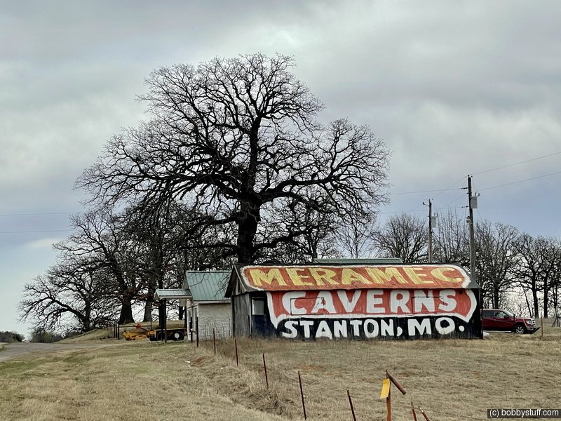
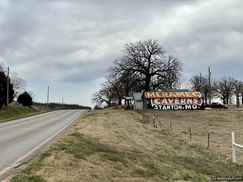
Meramec Caverns Barn Sign, Warwick OK
View a list of places like this or a map.You must be traveling east to see this sign so I missed it in 2018. It is the last one in Oklahoma.
Meramec Caverns were actively promoted by Lester B. Dill, who actually invented the bumper sticker as a means of advertising them. He erected billboards along Route 66, and also, the painted barns.
This Meramec barn is over 400 miles away from the Caverns.
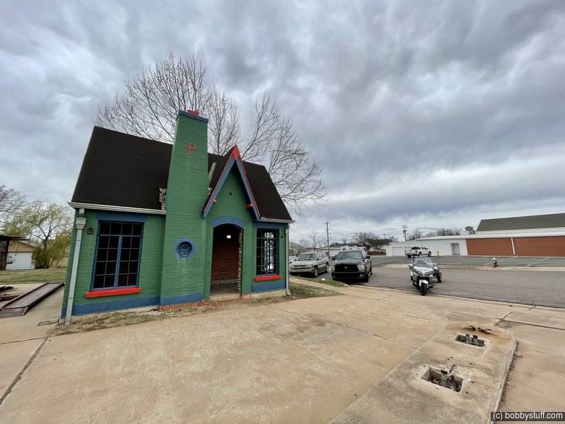
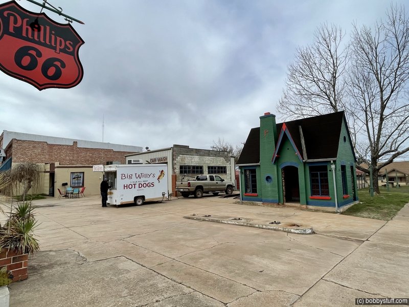
Phillips 66 Station, Chandler OK
View a list of places like this or a map.theroute-66.com
A cottage style Phillips 66 gasoline station built in the early 1930s.
Like many Phillips 66 Stations of the early 1930s, it was built in a Tudor Revival cottage style. The steep gabled roof, tall windows and chimneys conveyed a home-like look to reassure the travelers and make them feel at home.
Over 300 buildings like this were built by Phillips between 1928 and 1945.
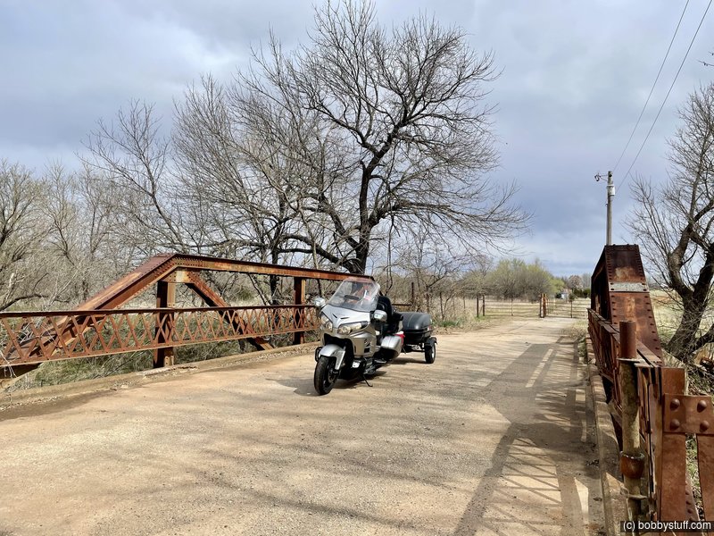
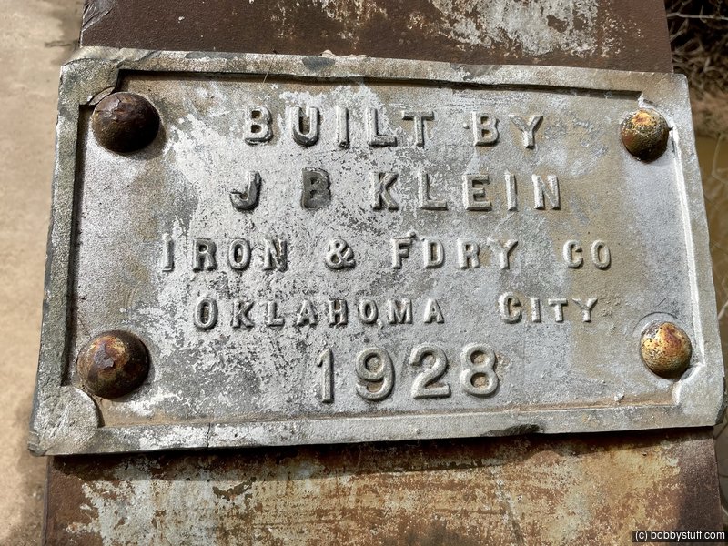
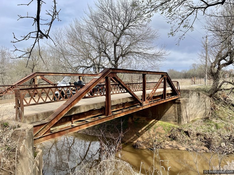
Route 66 Abandoned Road and Bridge, Stroud OK
View a list of places like this or a map.I don't have any info on this bridge. But it is definitely early Route 66.
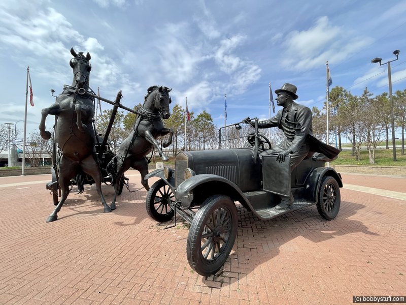
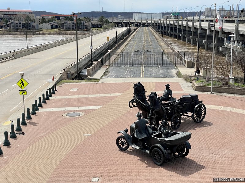
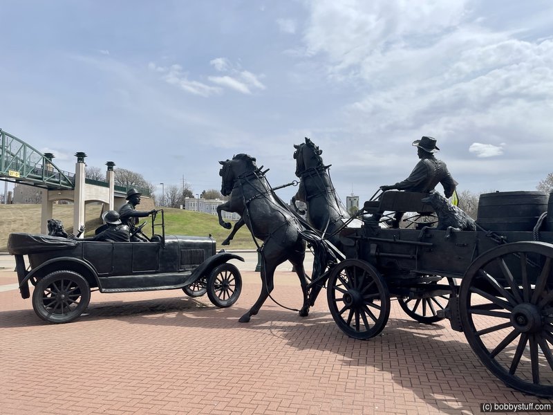
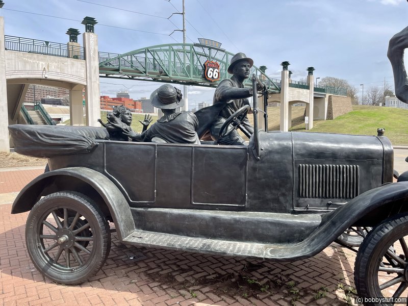
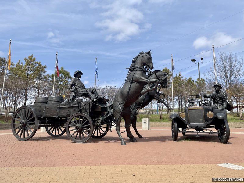
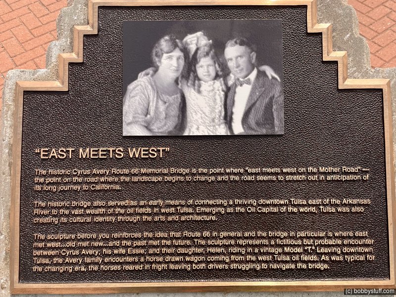
Cyrus Avery Centennial Plaza, Tulsa OK
View a list of places like this or a map.nps.gov
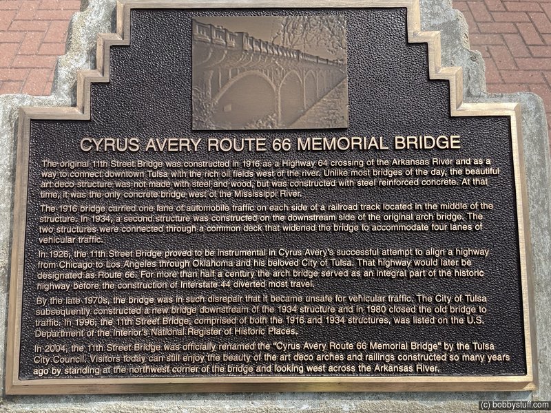
Built in 1916-1917 over the Arkansas River in Tulsa, the 11th Street Arkansas River Bridge is significant as the first major multi-span concrete bridge in Oklahoma. The bridge became a critical link between downtown Tulsa and the oil fields to the west. The mid-1910s was a period of great activity for Tulsa because of the booming oil economy. Across the Arkansas River, West Tulsa expanded rapidly to become a busy area for refining oil. The increase in traffic and trucking associated with the oil business made replacing the earlier wooden bridge a necessity.
Built by the Missouri Valley Bridge and Iron Company for $180,000, the 11th Street Arkansas River Bridge is a multi-span concrete arch bridge with 18 spans set on piers sunk into bedrock. Harrington, Howard and Ash of Kansas City, a firm that designed many bridges in the Midwest, engineered the bridge. Completed in 1917 and regarded as an architectural beauty with all modern features, the bridge, at 1,470 feet long and 34 feet wide, was one of the longest concrete structures in the Midwest. It supported a railroad track in the center and single lane of vehicular traffic on each side with sidewalks adjacent to the exterior lanes. The original design included a classical balustrade and Victorian-era lighting. In 1929, the installation of new Art Deco style guardrails and lighting fixtures updated the bridge. These lights are no longer extant.
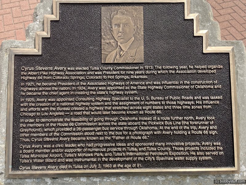
Tulsan Cyrus Avery served as County Commissioner from 1913 to 1916, and was involved with construction of the bridge. In 1924, the Federal Government appointed Avery as a consulting highway specialist and assigned him the task of creating a U.S. highway system. Recognizing the economic impacts of these highways, Avery became a strong proponent of a route from Chicago to Los Angeles that would pass through his hometown of Tulsa. Already in existence as the primary crossing over the Arkansas River, the 11th Street Bridge became a major determining factor in defining the path of Route 66 to and through Tulsa.
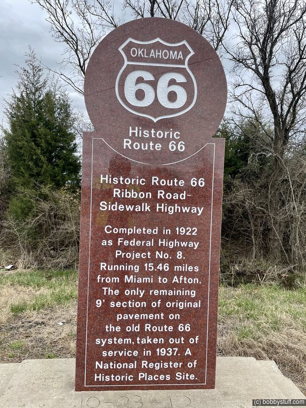
Route 66 Ribbon Road/Sidewalk Highway Landmark, Narcissa MO
View a list of places like this or a map.theroute-66.com
The famous nine-foot wide "Ribbon Road" paved between 1921 and 1922, that would become part of Route 66 in 1926 has an interesting history:
The state of Oklahoma was admitted into the United States in 1907. Its main routes of communication were the railroads. There were few roads and most of them were in poor condition.
With help and subsidies from the Federal government, Oklahoma improved its roads. Among the road building projects was one which resulted in the "Nine Foot wide Road", which originally was Oklahoma State Highway 7
It had been approved on December 8, 1918 and divided into two stages. The first one linked Miami and Narcissa, and work began in July 1919 and was completed in March 1921.
The second stage linked Narcissa to Afton and work on the roadbed began in July 1921 and was completed in February 1922.
The Committee that was organized to define the National Highway system proposed an alignment for Route 66 that incorporated pre-existing roads. The Ottawa County segment of Route66 incorporated Oklahoma State Highway 7. This was approved by the Associated Highways Association of America (AASHO) and that is how the "Sidewalk Road" became part of the brand new U.S. Highway 66 in 1926.
Only in 1935 would construction begin on a shorter and wider road between Afton and Miami. It would have gentler curves (the Ribbon-Road has six 90 ° curves) and widened shoulders. This new alignment was opened in 1937 and is still used as U.S. 60 - 59.
Legend has it that the funds were insufficient and that the engineers chose to build only one lane, nine-feet wide and pave the whole length between Miami and Afton rather than pave half the distance with a regular width road.
Actually the reasons for the unique width of this road are not clear.
 Elevation Changes During the Day
The day started at 1,511 feet and ended at 988 feet. The highest altitude was 1,511 feet and the lowest altitude was 546 feet.